‘Severe storms’: Twin weather alarm for Sydney, Melbourne

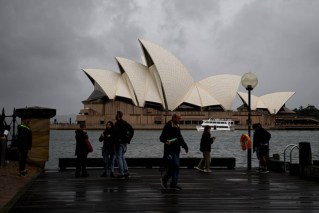
Millions of Australians face the imminent threat of dangerous storms, with severe storm warnings issued for Sydney and Melbourne on Tuesday afternoon.
The Bureau of Meteorology said a storm bringing damaging winds and hail was forecast to hit the harbour city, as well as the Hunter and Illawarra regions.
In Victoria, there was a similar warning for Melbourne for a “cell-based severe thunderstorm” for parts of the city and Port Phillip Bay.
Tweet from @BOM_NSW
Tweet from @BOM_Vic
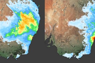
The wild storm forecasts followed images of a hybrid cyclone spinning across Australia’s eastern seaboard, bringing more relentless heavy rain to many areas that are already soaking.
In satellite images released by forecaster Weatherzone on Monday, a cold-core low could be seen passing over south-eastern Australia, with another warm-core low off the NSW coast.
“As the name suggests, a hybrid cyclone refers to a low-pressure system that has both warm and cold air in its core,” Weatherzone said.
“This mix of air leads to a mix of energy sources, which can allow hybrid cyclones to intensify quite rapidly.”
Such systems are renowned for bringing severe weather.
Before the cold-core low and the warm-core low met, both systems brought heavy rain across Australia, leading to flooding in several states.
Weatherzone expected the system to bring heavy rain to parts of the NSW south coast, Victoria’s Gippsland region and Tasmania’s east coast until Thursday.
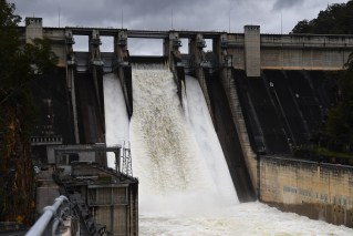
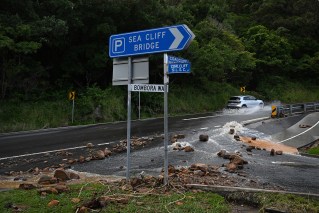
Bega was a focus for NSW authorities on Tuesday, after up to 100 millimetres of rain on parts of the south coast overnight. NSW SES Commissioner Carlene York said the agency was also dealing with major flooding in the NSW western plains, south-west slopes and the Riverina regions.
More rain expected for Australia’s east
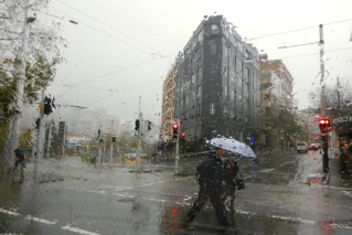
The Bureau of Meteorology said the low-pressure system that brought south-east Queensland and eastern NSW widespread rain would direct more downpours to coastal areas in the next 24 hours.
South-east and eastern Australia can expect showers and thunderstorms from Tuesday night. There’s a chance the weather could become quite severe between Townsville and Wollongong.
“Heavy rainfall will be the primary risk; however, more intense cells could produce damaging winds and large hail,” the BOM said.
However, there will be some relief for north-east NSW and south-east Queensland, both of which have been deluged this week.
Sydney is likely get sunshine right through to the weekend, but it won’t last long.

More rain is expected to fall in coming days across eastern Australia. Photo: Weatherzone
“There will be drier and warmer conditions across eastern Queensland and eastern NSW this weekend, before another band of rain and storms move in from central Australia on Sunday, reaching the eastern states on Monday,” the bureau said.
Southern NSW, Victoria and south-east South Australia won’t be as lucky.
Showers are expected to continue in southern NSW, Victoria and south-east South Australia and persist right through to Friday.
There are several active flood warnings across NSW, Victoria, Queensland and Tasmania.
BOM senior meteorologist Kevin Parkyn said up to 50 millimetres of rain could fall over several days in flood-hit north-eastern Victoria when wild weather returns from Sunday.
“There’s no doubt that October will smash the rainfall record across the northern plains,” Mr Parkyn said.
“There will never have been a wetter October in our record books.”
Sydney has already recorded its wettest October on record – the third month this year it has smashed rainfall records.