Downpours to bring a month’s rain for millions of Australians
Source: Bureau of Meteorology
Millions of Australians face a wet weekend, with potentially hundreds of millimetres of rain forecast in the east and a “400-kilometre line of storms” in the west.
Forecaster Weatherzone said a coastal trough lingering off New South Wales meant rain would intensify heading into the weekend and early next week, with downpours likely in some areas.
“While rainfall is expected to fall each day from now until the weekend, the heaviest falls are expected between Saturday and Tuesday as an upper-level low approaches NSW,” it wrote on Thursday.
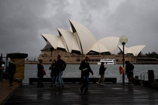
“During this period the central and northern NSW coasts, including Sydney, are forecast to see widespread falls of 60-120 millimetres, with isolated falls exceeding 200 millimetres in some areas.”
With Sydney’s average May rainfall coming in at 117 millimetres, that means some areas may get more than a month’s rain in just a couple of days this weekend.
Tweet from @BOM_Qld
The Bureau of Meteorology has issued marine weather warnings for the Macquarie, Hunter, Illawarra and Sydney coasts for Friday and Saturday. It said people should stay out of the water and away from exposed areas.
“Surf and swell conditions are expected to be hazardous for coastal activities such as rock fishing, boating, and swimming in the following areas,” the weather bureau said in a warning early on Thursday.
Weatherzone said the highest daily rainfall totals were expected in central and north-eastern NSW and southern Queensland on Saturday, including some high totals in NSW’s west.
“The rainfall will then focus on eastern NSW and south-eastern Queensland on Sunday and Monday, with the heaviest falls along the central and northern NSW coastline on Sunday,” it said.
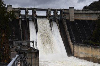
“This rainfall could cause flooding in NSW and southern Queensland during this period as it falls on a sodden landscape from the wet days preceding it.”
Tweet from @weatherzone
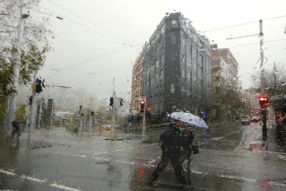
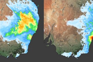
Meanwhile, on the other side of the country, a massive 400-kilometre-long line of thunderstorms” was moving towards south-western Western Australia “in a ‘train-like’ fashion” early on Thursday.
It was expected to bring heavy rain and large hail.
“This movement of thunderstorms is commonly known as the ‘train effect’, which is when thunderstorms and the associated heavy rainfall repetitively impact the same location,” Weatherzone said.
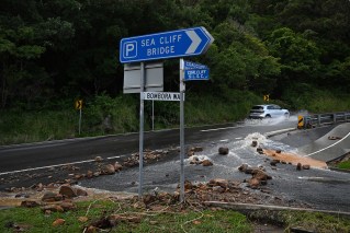
“This train effect could cause flash flooding in the region over the next few hours. These thunderstorms are also moving over a very dry landscape, which could increase this risk of flash flooding further.”
Cape Naturaliste had 12.2 millimetres in half an hour just before 8am on Thursday (local time). Earlier, the weather station at Wilydowns recorded 40.2 millimetres of rain in an hour.
BoM issued a thunderstorm warning on Thursday for Bunbury, Busselton, Manjimup, Margaret River, Dunsborough and Pemberton.
“Severe thunderstorms are likely to produce heavy rainfall that may lead to flash flooding, large hailstones and damaging winds in the warning area over the next several hours,” it said.
Rainfall is forecast to ease across WA on Friday and Saturday. However, an incoming low-pressure system in the state’s south is likely to bring more rain on Sunday and into next week.