‘Prepare for flooding’: Another week, another dire forecast for Australia’s east
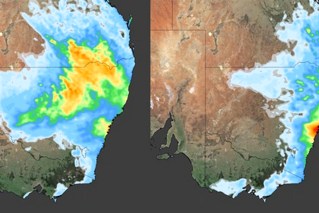
Source: Bureau of Meteorology
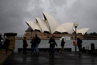
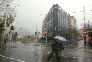
Millions of people across Australia’s east coast can expect another week of wet and wild weather, including those in already flooded regions.
The Bureau of Meteorology warned on Monday that widespread rain was expected across eastern Australia in coming days, with heavy falls and lower than average temperatures forecast from the country’s north to Tasmania.
The next five days will bring rain from the Top End through to the eastern interior, with peak falls predicted on Wednesday, and falls continuing in large parts of NSW and southern Queensland across next weekend.
“For many communities, this does mean an increased flood risk – not just for those who have recently experienced flooding, but for those currently in flood,” meteorologist Jonathan How said.
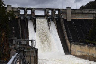
Widespread falls of more than 50 millimetres are likely for southern Queensland, much of NSW, northern Victoria and northern Tasmania by Friday night.
Mr How said the latest rain forecast came as many rivers were already subject to minor and moderate flood warnings.
“With the upcoming rainfall, we are anticipating issuing further flood watches and warnings right across the south-east,” he said.
“Catchments are wet and rivers will respond very quickly.”
Showers and thunderstorms would extend from the Northern Territory to Adelaide and South Australia on Monday into Tuesday, with rain and storms also hitting western Queensland, western NSW and and northwest Victoria by Tuesday, Mr How said.
The worst of the heavy falls is forecast for Wednesday, with showers from north-east Queensland extending west to inland NSW and northern Victoria along with gusty easterly winds on the southern coast.
Showers, storms and strong winds will increase on Wednesday night and Thursday in northern Tasmania, while easing elsewhere.
By the weekend, a low pressure system will drag further showers onshore across the east coast, bringing more rain to much of NSW and southern Queensland.
In South Australia, the SES has already issued a flood advice, warning of the “potential for flash flooding in the Flinders district over the next two days, due to isolated heavy rain falls”.
“This might lead to flash flooding within the creek systems, causing flowing water across roads at short notice. Even if it is not raining, there is still the potential for creeks to flood,” the advice issued on Monday said.
Tweet from @SA_SES
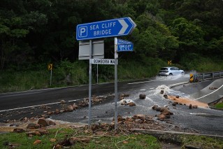
The forecast comes as communities in southern Queensland, inland NSW and northern Victoria deal with flooding after heavy falls last month.
Temperatures will also dip below average for spring, as cloud cover and persistent rain combine to push the mercury into the low 20s on the east coast, and below 20 degrees on the southern coast.
Winds of up to 90km/h are predicted for Tasmania, including over King Island, which was unusual for the area and could lead to trees falling, Tasmania SES acting director Leon Smith said.
He said the heavy rainfall could also lead to river rises, and urged Tasmanians to prepare their properties before the severe weather arrived.
Last Friday, the NSW SES moved to the Australian Warning System, a nationally consistent three-tier alert already used by the NSW Rural Fire Service.
It hoped the advice, watch and act, and emergency warning alerts would provide clearer, more useful information when it was needed.
The change followed a review of flooding in NSW earlier this year by chief scientist Mary O’Kane and former police commissioner Mick Fuller, which found the old system needed an overhaul.
“Many people said that the weather and rainfall information received was inaccurate and that warnings and orders from the SES were inadequate,” the report noted.
Storm season officially began in NSW on Saturday. Emergency Services Minister Steph Cooke has warned it will be wetter than usual.
“The annual increased frequency of storms, strong winds and rain will coincide with a third consecutive La Nina, which means communities right across the state will remain on high alert,” Ms Cooke said last week.
“But it’s important that we’re not complacent.”
The BOM confirmed last week that Australians could expect a wet summer, with cooler temperatures between October and December.
The rare, third consecutive La Nina and reverse Indian Ocean Dipole events had created conditions for increased rainfall, the bureau said.
-with AAP