Cyclone Kimi approaches far north Queensland, while WA coast feels the effects of another cyclone
A severe cyclone is just hours away from making landfall in Queensland, with residents told to brace for destructive winds, heavy rainfall and abnormally high tides.
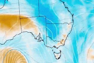
The Bureau of Meteorology expects tropical cyclone Kimi may intensity to a category two storm before hitting the state’s north coast on Monday afternoon.
Meanwhile, residents on the other side of the country are bracing for wild weather as a second cyclone moves over the Indian Ocean.
Early on Monday morning, the Bureau said cyclone Kimi was continuing to move slowly south at about 7km/h.
Residents from Cape Melville to Cardwell, along with State Emergency Services crews, have been sandbagging and tarping properties in preparation for destructive winds of up to 130km/h.
“These winds are strong enough to bring down numerous trees and powerlines and cause power outages and even cause damage to property,” meteorologist Dean Narramore said on Sunday.
The category one storm is forecast to turn southwest before crossing the state’s north coast between Port Douglas and Innisfail where it is expected to make landfall.
Rainfall totals of 100 to 300mm are likely near and to the south of the cyclone’s path, although isolated falls could exceed that.
A flood watch has been activated, with Mr Narramore saying soil and catchments were saturated after weeks of rain.
“Flash and riverine flooding is likely across numerous rivers on the north tropical coast of Queensland on Monday and Tuesday,” he said.
“Roads will become impassable and residents may be cut off as rivers and creeks rise up and over roads and bridges.”
Tweet from @BOM_Qld
The Bureau of Meteorology on Sunday declared tropical cyclone Kimi had quickly developed about 200km north to northeast of Cooktown.
It was moving south at 6km/h late in the evening.
In preparation for the cyclone, the Cairns Botanic Gardens were closed on Sunday afternoon while the Daintree Ferry expects to operate in the early morning before reviewing operations later on Monday.
The latest warning zone includes Cooktown to Lucinda, inland to Mareeba and Chillagoe, and taking in Cairns, Port Douglas, Cardwell and Atherton.
WA’s coast braces for cyclone Joshua
A second cyclone is causing wild weather for Australia’s west coast.
Tropical Cyclone Joshua, which is moving south west over the Indian Ocean, is forecast to deliver gale-force winds to Leeuwin, Albany and Esperance coasts.
Tweet from @BOM_WA
High temperatures and strong winds have resulted in warnings of severe fire danger for communities that are further inland.
A bushfire warning has been issued for parts of Oakford, Casuarina, Wandi, Wellard, Anketell and Oldbury and Kwinana.
A total fire ban has also been declared for these areas due to the weather conditions.
-with AAP
Want to see more stories from The New Daily in your Google search results?
- Click here to set The New Daily as a preferred source.
- Tick the box next to "The New Daily". That's it.