Cyclones Veronica and Trevor continue to wreak havoc across northern Australia
Western Australian residents are bracing for more destructive winds and flooding from Tropical Cyclone Veronica as Cyclone Trevor barrels inland back toward Queensland.
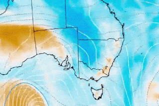
Veronica made landfall on the Western Australian coast between Karratha and Port Hedland on Sunday afternoon, brining lashing rain and destructive gusts of more than 200 k/ph.
Flood warnings have been issued for the Pilbara Coast for Monday as the system, downgraded to a category three moves west, the Bureau of Meteorology said.
WA Premier Mark McGowan urged people to stay indoors as the vicious storm moves slowly, with forecasters saying the damaging systemt is expected to remain for some time.
“People in that part of the world are used to cyclones but this one is different,” he said on Sunday.
“This is a very, very serious situation,” WA Premier Mark McGowan told reporters on Sunday, after a red alert was issued for residents along the Pilbara coast to prepare for destructive winds of up to 155km/h and wind gusts up to 220km/h.
Rivers are rising and roads and communities could be cut off and isolated.
A dangerous storm tide was also predicted to hit the region in the early hours of Monday morning and damaging waves are predicted to bring inundation.
I went to the middle of the road this morning and captured this video down my street. I got caught in a gust and nearly went over.
PS: Neighbours tree is no longer there.#CycloneVeronica #Pilbara #Wickham #WesternAustralia pic.twitter.com/XlUmVO0zQW— Wendy (@WendyBirdOZ) March 24, 2019
Veronica is part of a one-two strike of tropical cyclones on Australia, according to AccuWeather senior meteorologists Kristina Pydynowski and Adam Douty.
After causing havoc in the Northern Territory, Cyclone Trevor is tracking back over the border to western Queensland just south of Mt Isa, where forecasters say it will dump heavy rain for a number of days from Monday.
There is a potential for flooding south of the cattle farming region devastated by floodwaters last month, but meteorologists are watching closely.
“Those areas could get some rain, and heavy rainfall is hard to rule out at this point,” the Bureau of Meteorology’s Lachlan Stoney said.
“(We are) not necessarily forecasting there to be widespread floods, but flooding would be something that we are monitoring closely for areas south of Mt Isa.”
Disaster assistance has been made available for communities in Aurukun Shire Council and the Lockhart River Aboriginal Shire Council to help in the clean up and to restore infrastructure.
Meanwhile people pulled from the path of ex-tropical cyclone Trevor in the Northern Territory are being returned home as assessors clear houses in communities up and down the coast.
-With AAP
Want to see more stories from The New Daily in your Google search results?
- Click here to set The New Daily as a preferred source.
- Tick the box next to "The New Daily". That's it.