Sydney hailstorm racks up massive damage bill as wild weather continues


Ferry passengers got a birdseye view of the hailstorm on Sydney Harbour. Photo: Twitter
Severe thunderstorms are expected to bring gale force winds, “giant” hail, heavy rain and flash flooding for north-east NSW and south-east Queensland on Friday and during the weekend.
Insurance Council of Australia said insurers had receiving more than 25,000 claims with losses of more than $125,000 after the “catastrophic” hailstorm that pummelled Sydney on Thursday night, while the Bureau of Meteorology is warning of more wild weather to come from Friday afternoon.
The bureau issued a strong wind warning for the NSW coast from Byron Bay to Coffs Harbour on Friday, moving into Saturday.
#Thunderstorms expected across parts of #NSW today with the possibility of #severe storms in the north east. Any severe storm warnings issued will be available at https://t.co/6SOB8bQmvE pic.twitter.com/THlmo0HdYA
— Bureau of Meteorology, New South Wales (@BOM_NSW) December 20, 2018
“Tomorrow [Saturday] could be a big storm day for south-east Queensland, heavy thunderstorms including Brisbane and the Gold Coast,” BoM extreme weather desk forecaster Jonathan How said.
“The trough moves through – and there will be nothing left for Sydney –but the storm risk is there for north-east New South Wales and into south-east Queensland,” he said.
The final damage bill for Thursday’s monster storm is expected to rise in the coming days as more insurance claims are reported.
https://twitter.com/AlexDruuuce/status/1075925705899237376
Tennis ball-sized hailstones – up to eight centimetres in diameter – smashed windscreens and collapsed home roofs in Sydney’s west from about 5pm on Thursday. Less than an hour later, the city’s inner suburbs were pummelled by golf ball-sized stones.
Insurance Australia Group’s (IAG) share price dropped more than 4.5 per cent on Friday after it said it had already received 6500 claims.
IAG shares fell 4.5 per cent to $6.64 when the company resumed from a pause in trade at the open.
Insurance rivals QBE and Queensland-based Suncorp were also subdued in early trade, with the latter’s stock dropping more than 4 per cent.
Suncorp said it was too early to accurately estimate the number of claims it is likely to receive, or the final costs. By 12.30pm on Friday, it had received 7800 claims.
Insurance Council of Australia spokesperson Campbell Fuller said about three-quarters of the claims received were for damaged cars and other vehicles, typically smashed windscreens and dented panels.
“The ‘catastrophe’ declaration means insurers will make claims from this storm their priority,” Mr Fuller said.
“They will triage claims to ensure the worst-affected policyholders receive urgent attention.”
Massive hailstorm in Sydney yesterday.
Those stones are getting some serious height, post-bounce.https://t.co/mU1MnAoNYu
— Dakota Smith (@weatherdak) December 20, 2018
@9NewsSyd hail the size of tennis balls in western Sydney. #hailstorm #hail #SydneyStorm #Sydney pic.twitter.com/51OwbGjAbF
— Alicia (@unleishd) December 20, 2018
Some surfers at Bondi Beach took cover under their surf boards to escape the hail on Thursday.
Sydney storm forces Bondi surfers to take cover under boards to escape hail https://t.co/vF7nBNNrka pic.twitter.com/aJ8UAHohhG
— ABC Sydney (@abcsydney) December 21, 2018
Endeavour Energy reported 25,500 homes and businesses in its network were without power from the Blue Mountains, through Sydney’s west and up to the Hawkesbury.
IAG estimates year-to-date net natural peril claim costs were about $410-$430 million pre-tax. Major storms that have led to big numbers of claims include the southern low that affected parts of NSW, Victoria and Queensland in mid-December.
Sydney summer hailstorm craziness! #sydneyhailstorm pic.twitter.com/QFBm0Qw7cc
— Seth (@sethdarby) December 20, 2018
Meanwhile, a heat wave across Queensland that has broken December records – with maximum temperatures of 48 degrees in Birdsville in the state’s west – will move to east in coming days. Brisbane was forecast to hit 37 degrees on Friday, with the western suburbs getting into the low 40s.
Northern NSW will also swelter, with Lismore reaching 38 degrees and Moree reaching 41.

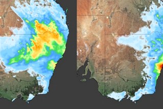
The heatwave forecast for Friday, Saturday and Sunday. Photo: Bureau of Meteorology
On Saturday, the heat will contract in south-east Queensland. It will move into the Northern Territory and Western Australia, particularly the Kimberley and the Pilbara into the weekend, according to the weather bureau.
“Gradually that heat will spread into the south-east of the country and by Monday the heat will move through South Australia and northern parts of Victoria,” Mr How said.
Perth reached 36 degrees on Friday and is expected to rise to 39 on Saturday in the central business district.
In the south-east of the country, it’s significantly cooler. Melbourne hit just 19 degrees on Friday, while Hobart reached only 17.
But the heat will be back for Christmas and for the beginning of 2019, with highs in the 30s.
“The high pressure system will move over the south of the country and bring clear, dry and warmer conditions into Christmas and New Year’s,” Mr How said.
-with AAP