Blizzards forecast for NSW
Damaging winds and blizzard conditions are forecast for parts of NSW as a strong frontal system crosses the state.
The Bureau of Meteorology is predicting strong northwesterly winds, affecting the Snowy Mountains, Southern Tablelands, South West Slopes and the ACT on Monday.
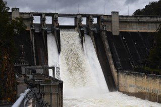
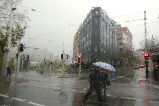
Thousands of properties are without power and the State Emergency Service crews are out in force as strong winds and rain affect southern parts of South Australia and Victoria.
The wild weather does not look likely to stop soon, with the SES warning more severe weather was expected later today and tomorrow, potentially brining more damage.
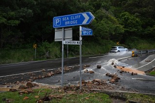
The SES has responded to more than 100 calls for help in Adelaide, and dozens more in Victoria, after the winds overnight and this morning brought down trees and power lines and caused other damage.
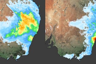
The weather bureau has reissued a severe weather warning in South Australia and parts of Victoria, predicting wind gusts of more than 100 km/h.
Authorities say thousands of properties in Adelaide and in the state’s southeast have lost power.
The usual clamour for Outside Time strangely not a thing this morning. #Adelaide #Weather pic.twitter.com/BgSCzdh5xa
— Samantha Regione (@SamanthaRegione) June 22, 2014
Winds lash Victoria
Strong wind gusts have also swept across Victoria, bringing down trees, ahead of colder conditions this week that will bring the first real dump of snow.
The SES received about 30 requests for help overnight, mainly for trees that had fallen on roads.
The weather bureau issued a severe weather warning for damaging winds and blizzard conditions for the Wimmera, North Central, North East, South West, Central, West and South Gippsland and East Gippsland areas for Monday.
The highest wind gust recorded so far has been 128km/h at Mt William, near the Grampians in the state’s southwest, just after midnight, the Bureau of Meteorology says. Gusts reaching 104km/h were also recorded at Mt Buller about 7am on Monday.
Walking in the wind 33mph #melbourne is a challenge for sure,it’s so so cold!! Lucky I managed to drag myself to reach before the bus left..
— Natalie Tang (@natalietangty) June 23, 2014
In Melbourne, South Channel Island in Port Phillip Bay recorded 95km/h wind gusts at about 4.20am while Tullamarine Airport had gusts of 91km/h gusts at about 2.30am.
“As far as today goes, the worst of the conditions is likely to be this morning and then we’ll have an easing trend this afternoon,” bureau forecaster Andrea Peace said.
“It’s been right through since midnight we’ve been seeing these gusts and we do expect the stronger winds to contract eastwards throughout today.
“It’s still going to be quite windy but probably not quite as windy as what we’ll see this morning.”
As colder air moves through the state later on Monday, there is a possibility of hail and thunderstorms.
But strong winds, along with cold air, will develop again on Tuesday with the squally conditions possibly bringing hail early in the day.
But it is good news for the snow fields
The colder weather could also bring the first real cold outbreak and a decent dusting of snow to the Alpine areas and Mt Dandenong, Ms Peace said.
“We’re expecting up to maybe 20-30cm of snow over the next few days,” she said.