Fresh cyclone threats emerge for northern Australia
Cyclone Anggrek has formed off the Cocos Islands and is gaining strength as it approaches Australia. Image: Bureau of Meteorology
Another cyclone threat is looming, with rain forecast to lash flood-hit regions for days.
Tropical Cyclone Anggrek has formed 500 kilometres off the Cocos Islands in the Indian Ocean and is expected to gain strength as it approaches Australian waters in coming days.
The system is set to become a category two cyclone by Wednesday.
A cyclone watch has been issued for the Cocos Islands, about 4000 kilometres off Western Australia’s coast, with wind gusts of up to 120km/h expected.
It will mark the second cyclone off Australia this season following Jasper’s devastating impact on far north Queensland last month.
Tweet from @BOM_WA
Another cyclone threat may soon emerge up north.
A monsoon trough that has brought more rain for the far north as it recovers from record flooding caused by Jasper may strengthen into a tropical cyclone next week.
Showers continue to test the far north weeks after Jasper struck, with Palmerville and Laura copping more than 100 millimetres overnight.
Rain is forecast to continue with a flood watch for Cape York and parts of the Gulf of Carpentaria.
Tweet from @BOM_Qld
The troublesome monsoon trough is set to form a tropical low in the Coral Sea on Tuesday.
The low is then expected to develop, tracking away from the Queensland coast this week.
But from Sunday it is a high chance of becoming a cyclone and may start moving back toward far north Queensland.
“There are indications that it could start to track back towards the coast but we are still looking well beyond seven days ahead,” a Bureau of Meteorology spokesman said.
Another rebuilding region – Queensland’s south-east – has also been drenched, including falls of more than 100 millimetres. Three people were rescued from their car in floodwaters on the Sunshine Coast overnight.
The south-east is still recovering after seven people died in storm-related incidents over the Christmas period with about 130,000 homes losing power at one stage.
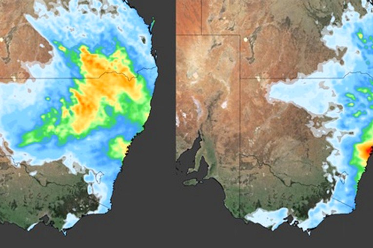
Flood warnings have also been issued for the Northern Territory as a tropical low lingers.
The Top End’s north-west corner copped widespread 100 millimetres falls and strong winds with the Adelaide River south of Darwin recording 140 millimetres overnight.
“We are looking at the next couple of days maintaining that rainfall,” the bureau spokesman said.
The tropical low is set to shift south and head inland in coming days, with no cyclone threat imminent.
“It is going to continue to bring that strong wind and rain, gradually tracking to the south,” the spokesman said.
“Looking at the next seven days, there is a very low chance of that system becoming a cyclone.”
There is a severe weather warning current for heavy rainfall and damaging winds of up to 90km/h for the NT’s north-west.
Scattered six-hourly rainfall totals between 100-160 millimetres are likely for the Daly, Tiwi, Arnhem, Gregory and Barly districts, along with parts of Carpentaria.
There’s also wet weather ahead for major centres. Rain or late thunderstorms and strong winds are forecast for Brisbane, Canberra, Sydney, Melbourne, Perth, Darwin and Adelaide on Tuesday.
-AAP