Conditions shaping towards El Nino, but it’s unpredictable

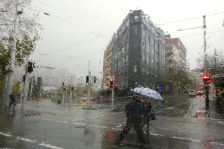
Reports of El Nino hitting Australia have stoked fears of a dry winter, hot summer and more bushfires, but meteorologists trying to predict if that will occur have been hampered by the Earth’s atmosphere.
They say that winter will be dry, which is a relief for much of eastern Australia after almost two soggy and flood-filled years.
But it is too early to say if that dry winter will make the risk of bushfires worse in summer.
As the central tropical Pacific Ocean continues to warm (an indicator of El Nino), the Bureau of Meteorology said in its most recent Climate Driver Update this week there was “little to no shift towards El Nino in atmospheric ENSO indicators”.
For meteorologists to be certain of El Nino, they need to see the right indicators in the ocean and in the atmosphere. So far, the atmosphere is not reacting to the indicators being shown in the sea.
Therefore, Brad Jackson, senior climatologist at the BoM, told The New Daily, there was only a 50 per cent chance of El Nino forming.
“The reason why we’re on El Nino watch at the moment, is we are waiting for the atmosphere to couple with those sea surface temperatures,” he said.
“But at this stage it hasn’t done so.”
In other words, the water has warmed, but the atmosphere hasn’t.
Forecaster Weatherzone said the lack of feedback from the atmosphere was giving forecasters a reason to be cautious in their outlook.
“If the atmosphere continues to defy the ocean, the emerging El Niño could fizzle. But if the atmosphere becomes coupled with the ocean, there is potential for a strong El Niño later this year,” it said.
However, there is still a good chance that El Nino is coming.
“Six of the seven international models indicate El Niño thresholds will be met or exceeded from July, with all models meeting thresholds by August,” the bureau said in its update.
El Nino events usually begin in the autumn, develop in winter and spring and then “decay” in the summer, the bureau stated. By the following autumn, El Nino is usually over.
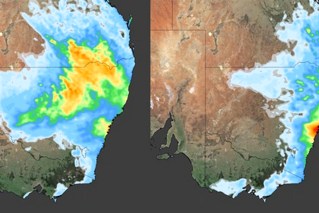
Tweet from @weatherzone
Winter this year
The bureau’s latest outlook period covers much of winter – July to August.
Mr Jackson said there seemed to be a low chance of rainfall exceeding median levels across the country.
That means NSW, Victoria, South Australia, southern Queensland, large areas of the Northern Territory, south-west and south-east Western Australia will likely get lower-than-average rainfall in coming months.
“The only areas that might receive average, to maybe slightly above average, rainfall will be up in Cape York, up around [the] Arnhem Land region of the Northern Territory and in the mid-north-west of Western Australia,” Mr Jackson said.
“Let’s not forget Tasmania, in the eastern half of Tasmania the chance of exceeding median rainfall is reasonably low and in the west, it’s probably about average.”
Too early to predict summer
Sadly, for those already feeling the chill, Mr Jackson said it was far too early to forecast what summer will look like.
Before meteorologists can make any if those predictions, the climate driver needs to be determined.
El Nino systems generally brought drier weather, but each El Nino event was different, Mr Jackson said.
“There’s no two El Nino [events] that are exactly the same,” he said.
“It’s something that we’re going to have to probably unpack as we get closer to summer.
“It’s really hard to say exactly if we go into El Nino what effects, what impacts this is likely to have on bushfires, on weather outlooks, on rainfall, outlooks, temperature … until we get a bit closer.”