Stormy week will bring heavy rain, strong winds, even hail to the east coast

Source: Twitter / Bureau of Meteorology
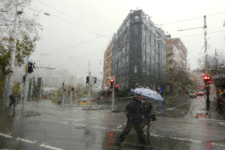
Biting winds and pounding rain will hit southern and eastern Australia in the coming days, with Queensland, NSW, Victoria and Tasmania all expected to cop a barrage of foul weather.
The Bureau of Meteorology has advised severe thunderstorms are likely over southern Queensland and inland NSW north of Bourke, and are possible through inland parts of southern Queensland, NSW and north-west Victoria on Thursday.
Heavy rain may lead to flash flooding, damaging winds and large hail.
Gusty winds are also expected, with rainfall totals of 15 to 40 millimetres likely.
Tweet from @BOM_au
The BoM warns heavy rain may lead to river rises and could prolong flooding in already flooded parts of inland NSW, Queensland and Victoria.
There are already several minor to major flood warnings current, and further flood watches and warnings may be issued by BoM.
The bureau is also monitoring the risk of winds reaching damaging thresholds over parts of Victoria, Tasmania and southern NSW. Warnings will be issued if required.
Communities are advised to stay updated with the latest forecasts and warnings via the bureau’s website and BoM Weather app and follow the advice of emergency services.
The wild weather originated in Western Australia, with parts of the state receiving a soaking earlier this week.
“Persistent showers are still drenching the wheatbelt and surrounding areas in two bands stretching from just south of Perth to just north of Geraldton, while Perth itself is expected to see frequent showers through till the end of the working week, albeit nothing as heavy as last night,” forecaster Weatherzone said.
‘‘The period from late autumn through winter and into early spring is of course traditionally the wet time of year in south-west WA, although in the past couple of decades, a distinct drying trend has been experienced in the region – possibly attributable to climate change.’’
In southern WA, there was 21 millimetres of rain in the 24 hours to 9am Tuesday, bringing Perth’s September total to 39.4 millimetres already.
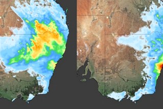
South Australia and southern parts of the Northern Territory were the next to receive a deluge, with the cold front moving across those regions on Wednesday.
Australia should expect wetter-than-average conditions during October to December.
The bureau said the 70 per cent chance of a La Nina developing during spring was likely contributing to the damp outlook.