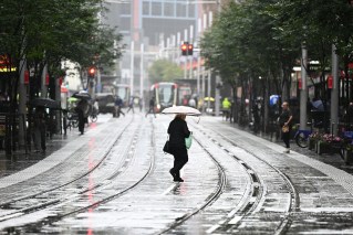
Hot and dry in the west, while summer rain in the east puts a dampener on Christmas

Any hopes for a break from the relentless rain in eastern Australia have been dashed, after the weather bureau officially predicted a wet summer with above-average rainfall and the risk of further flooding.
The news, which increases the likelihood of a Christmas indoors, came in the Bureau of Meteorology’s (BoM) official outlook for summer released on Thursday, which also predicted large areas of Western Australia are likely to be drier than usual.
New South Wales, Victoria, parts of Queensland and south-eastern Western Australia are in for a chilly start to summer with below-average daytime temperatures forecast.
Cloudy skies are expected to keep overnight temperatures warmer than average for most locations, except in parts of New South Wales and the Nullarbor.
Floods a big risk
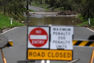
The chance of unusually wet conditions remains above average across most of eastern Australia, increasing the risk of flooding, in a major blow to much of the country still reeling from relentless flood conditions.
Above-average rainfall also increases the risk of landslides and tree falls in areas of steep terrain and very wet soils.
“Higher than average streamflows are forecast for nearly all sites along the east coast and northern Tasmania,” BOM senior hydrologist Dr Paul Feikema said.
“With wet soils, full rivers and dams, and forecasts showing more rain and high streamflows, the risk of further flooding remains high across eastern Australia.
“Communities near rivers, creeks and in low-lying areas should be prepared and stay up to date with flood warnings,” he said.

People carry sandbags through flood waters on November 4 in Forbes. Source: Getty
This wet outlook over northern and eastern Australia is due to several factors including La Nina, a weakened negative Indian Ocean Dipole (IOD) event, a positive phase of the Southern Annular Mode, and record warm waters around Australia.
Earlier in the month, the BoM reported that the IOD had started to slip, which is typical for this time of year.
But even as the IOD retreats, above-median rainfall is still expected for northern and eastern Australia over the coming months.
La Nina is expected to hang around until early 2023.
Fires and cyclones
Although the outlook is cooler for eastern Australia, many parts of Australia will have warmer than average days over the coming months.
Heatwaves and fires still pose a risk for parts of the country.
La Nina encourages heatwaves due to high overnight temperatures and humid conditions.
And there’s a grassfire risk due to abundant growth in recent years.
The official summer bushfire outlook will be released next Tuesday.
The tropical cyclone season started in November, with Australia likely to experience an above-average number of tropical cyclones and lows this season.
Cyclones can also bring their own flood risk, and although there have been fewer tropical cyclones in recent decades, La Nina does increase the risk.
There is a 73 per cent chance of an above-average number of tropical cyclones this season.
The BoM also warned that the risk of thunderstorm asthma events in the south remains high while pollen counts are elevated in early summer.
Farmers prepare for the worst
Farmers are bracing for a rough summer.
Kellie Penfold, a farmer in southern NSW, told the ABC the relentless rain and cold weather meant she hasn’t had a break.
“It’s probably been one of the most challenging years we’ve had in our 30 years of farming together, my husband and I,” she said.
“You never should wish for no more rain, but probably no more rain would be quite good for a while, just to let it dry out.”
