Flood threat spreads, with more rain for SE Australia

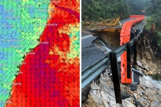
Source: Twitter/Bureau of Meteorology
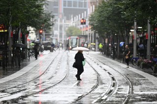
Millions more Australians face further flood danger this week, as another band of rain brings more deluges across the country’s south-east.
With NSW enjoying two days of relatively dry weather, the immediate focus has moved to Victoria and Tasmania, where flooding is expected in coming days.
But despite blue skies over much of NSW on Monday, its reprieve will be only temporary. Another heavy rain band is expected to further soak already sodden areas of south-eastern Australia from Wednesday.
Forecaster Weatherzone said a cold front and associated low-pressure trough interacting with a stream of tropical moisture would bring cloud and rain across south-eastern states.
“Rain will start to increase over parts of South Australia, Victoria, Tasmania and south-west NSW on Wednesday as a north-west cloudband becomes established along the front and trough,” it said on Monday.
Rain is expected to intensify and spread further east on Thursday and Friday.
“This system will cause three days of rain and some thunderstorms over a broad area of south-eastern Australia, impacting parts of SA, Tasmania, Victoria, NSW, the ACT and southern Queensland,” Weatherzone said.
Tweet from @andrewmiskelly
The heaviest falls are likely on Thursday and early Friday, with up to 200 millimetres in 24 hours in some parts of central and eastern Victoria and northern Tasmania.
Severe thunderstorms are also possible in western NSW and south-west Queensland on Thursday.
Monday’s bleak predictions of yet more rain came as skies finally brightened over much of NSW. However, dozens of rivers are still flooding and evacuation orders remain.
People across NSW fled their homes at the weekend amid rising floodwaters. Thousands of others remained poised to leave on Monday if ordered, as dams spill and river peaks move downstream.
Seven rivers were already experiencing or might experience major flooding in coming days, the Bureau of Meteorology’s Dean Narramore said.
There is major flooding along the Murrumbidgee River with people in Gundagai, Gunnedah, Wee Waa, Warren and Forbes on high alert.
“Events can quickly change. In some areas we’re anticipating anywhere between 30 to 75 millimetres of rain,” Fire and Rescue NSW senior official Ken Murphy told ABC on Monday, referring to the Forbes area.
He also warned dams across NSW could overflow this week.
There were more than 100 flood warnings and 16 emergency warnings across NSW, while the State Emergency Service received more than 1000 calls for help over the weekend and responded to 44 flood rescues.
NSW Premier Dominic Perrottet said the areas of most concern were in the state’s west and the Hawkesbury-Nepean area.
“The dams are full, the rivers are full, there is water right across the state,” he said.
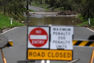
“Please do not drive through floodwaters. We see time and time again in these situations, people put their lives at risk, their family lives at risk. Please do not do that.”
The weather bureau said no heavy falls were expected in the next couple of days but there would be some rain east of the Great Dividing Range. The second system is expected from Wednesday.
NSW SES Commissioner Carlene York warned people not to become complacent because the rain had stopped.
“We’re seeing flash flooding and serious riverine flooding rising,” she told Sydney radio 2GB on Monday.
“Just because it’s not raining, it doesn’t mean those rivers aren’t rising – water is still flowing into our catchment areas.”
Tweet from @NSWSES
The SES issued evacuation orders on Sunday night for low-lying areas along the Hawkesbury River and an evacuation centre has been established at North Richmond.
Major flooding is occurring along the Murrumbidgee River at Gundagai with moderate flooding expected at Wagga Wagga as the water travels downstream.
Mr Narramore said relief from the rain on Monday did not signal the end of flooding.
“We’re still very much watching the rivers and the outlook because there’s more rain on the way,” he told ABC TV.
Downstream along the Macquarie River, moderate flooding is occurring at Dubbo and Narromine, with major flooding at Warren.
The Macquarie River at Warren Town may reach around 9.60 metres late on Monday and into Tuesday, bringing major flooding.
Agriculture Minister and Dubbo MP Dugald Saunders said there were many road closures in the district.
“The deluge of rain that happened turned what are normally just little creeks of less than a metre into rampaging rivers of 30 and 40 metres wide through paddocks,” he told 2GB.
“There’s a lot of crops that will be lost.
“We’re just bracing for another weather event … from Wednesday to Friday.”
Mr Saunders urged landholders to report flood damage to their properties, including land, infrastructure and animals.
“Since the heavy rain began last week, we have already assisted three farmers in western NSW with emergency fodder drops because their livestock was stranded,” he said.
“We expect this number to increase in the coming days.”
Source: Bureau of Meteorology
Gloomy long-term outlook
Monday’s warning of further flooding came as the weather bureau released its long-range forecast for Australia’s coming severe weather season.
It included an increased risk of widespread flooding for eastern and northern Australia and an increased risk of an above average number of tropical cyclones and tropical lows.
“While severe weather can occur at any time of the year, October to April is the peak time for flooding, tropical cyclones, heatwaves, bushfires and severe thunderstorms,” BOM said on Monday.
The 2022-23 long-range forecast includes:
- An increased risk of an above average number of tropical cyclones and tropical lows;
- An increased risk of widespread flooding for eastern and northern Australia;
- Normal bushfire potential in eastern states, but an elevated risk of grass fire in southern Australia;
- Increased risk of prolonged heatwaves in southern areas with higher humidity;
- Normal risk of severe thunderstorms, but with possible increase in risk of thunderstorm asthma events if conditions are dry in late spring and early summer.
See full details here
-with AAP
