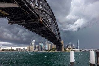
‘Large hail, damaging winds’: Dangerous storm threats for two states

Source: Bureau of Meterology
Severe thunderstorm warnings have been issued in two states, with further heavy rain putting NSW and Queensland on watch for more flooding.
The weather bureau issued a warning for “large hail [and] damaging winds” in an area of NSW from Coffs Harbour north to the Queensland border on Tuesday afternoon.
It was accompanied by a similar warning for South Burnett and Queensland’s southern downs.
An hour later, it was followed by another warning for storms in NSW, this time to Sydney’s south-west.
Tweet from @NSWSES
“The Bureau of Meteorology warns that, at 3.15pm, severe thunderstorms were detected on the weather radar near Hill Top and the Avon Dam,” it said.
“These thunderstorms are moving towards the east to north-east. They are forecast to affect Springwood and Lake Nepean by 3.45pm and Bargo and the area south of Wilton by 4.15pm.
“Damaging winds, large hailstones and heavy rainfall that may lead to flash flooding are likely.”
There was also a more general severe thunderstorm warning for Sydney, the northern rivers, Illawarra and parts of the NSW mid-north coast, central and northern tablelands and Hunter districts.
Tweet from @BOM_Qld
Tweet from @EWNAlerts
It came as Resilience NSW boss Shane Fitzsimmons warned of more flood danger across the state this week.
“With areas across NSW already experiencing minor to major flooding, preparation is key,” he tweeted.
Bureau of Meteorology senior meteorologist Jane Golding said earlier that western parts of NSW near the South Australian border would be first in line for a drenching on Tuesday.
Severe storms could form and threaten short bursts of heavy rain, which could lead to flash flooding in some areas.
“Storms by their nature, they’re pretty hit and miss so not everywhere,” Ms Golding said on Monday.
Tweet from @ShaneFitzAU
Damaging winds up to 90km/h were possible, and with many catchments already saturated gusts could bring down trees quite easily, Ms Golding said.
Storm season kicked off officially on October 1 in NSW, Ms Golding said, meaning the latest band of storms was not unusual for this time of year. However, conditions in the Pacific and Indian oceans, and the recent declaration of a third La Nina system were also influencing the weather.
The NSW south coast has a wet Wednesday forecast, while Thursday is expected to be the wettest day of the week in Sydney, before showers ease but continue into the weekend.
“Expect showers to continue through to the weekend but not as heavy and widespread as mid-this week,” Ms Golding said.
There is already major flooding in central-west NSW at Wee Waa and Warren, which is not expected to recede for some days.
“The inland catchments certainly are the highest at the moment as this low pressure system winds up,” Ms Golding said.
The bureau was also monitoring the south coast.
“That would be the area we’d be most concerned about along the coast in the short term, having said that it’s not looking too bad at the moment,” Ms Golding said.
Flooding is also possible in Victoria, mostly in the east, where heavy rain is also forecast.

Forecast accumulated rain between Tuesday and next Monday, according to one model. Image: Weatherzone
Rain builds up over Australia’s north
The renewed storm warning came as forecaster Weatherzone reported the build-up was “well and truly underway” in northern Australia.
Showers and thunderstorms are forecast for Darwin for most of the coming week, as the dry season in country’s north ends and the build-up begins – a time of year is characterised by rising humidity and increasing rain and thunderstorms in the tropics.
“In a normal year, the northern rainfall onset typically occurs in parts of coastal Queensland and the NT’s Western Top End around late October or early November, before spreading to other areas of Australia’s tropics in the following weeks,” Weatherzone said.
“However, during La Niña periods, the rainfall onset usually comes a bit earlier than usual, typically around early-to-mid October for large areas of the NT, Queensland and far northern Western Australia.”
With a third consecutive La Nina underway, Weatherzone said forecast models showed rain and thunderstorm activity was likely to increase from later this week and persist into early October.
Some inland areas of WA could get up to 200 millimetres of rain in the next week.
-with AAP
