Get set to shiver – cold blast brings taste of winter for eastern Australia
Millions of Australians are about to get their first taste of winter with a cold snap bringing chilly temperatures and even snow to some areas for the rest of the week.
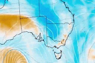
South Australia is the first to feel the brunt of the cold snap, with it sweeping across parts of the state on Wednesday morning as it moves east across Victoria, NSW and Tasmania.
Even Queensland won’t escape the first taste of winter.
Temperatures are expected to fall well below average in parts of Victoria by Wednesday night, with snow down to 900 metres in alpine regions in all three states.
“This powerful front will cause temperatures to drop around five to 10 degrees across a broad area of southern Australia,” Weatherzone forecaster Ben Domensino said.
“Days and nights will both become noticeably cold behind the front and many areas likely to see their lowest temperatures so far this year.”
Tweet from @BOM_au
Weatherzone said the chilly blast was due to a large pool of cold air from the Southern Ocean crossing southern, central and south-eastern Australia by the weekend. It would drop temperatures low enough for snow to settle in Tasmanian, Victoria and NSW.
“Some of the Australian main ski resorts should get their first proper ground cover of the season from this system,” Weatherzone said.
The weather bureau is predicting a top temperature of 15 in Melbourne on Thursday, and just 13 on Friday. Up to 20 millimetres of rain is also expected by the end of the week.
The Bureau of Meteorology has also issued a sheep graziers’ warning for “cold temperatures, showers and westerly winds” across much of regional Victoria on Wednesday, but particularly for Thursday.
“This wintry mix of hail, snow and rain will also be exacerbated by blustery winds near and behind the front, with wind chill likely to make it feel several degrees colder than it actually is for some places,” Mr Domensino said.
The temperature drop will be less extreme in Sydney, where Wednesday started out sunny and with an expected maximum of 25. The harbour city can expect a top of 23 on Thursday, with rain, and 20 on Friday.
It will be cooler in the national capital, despite a balmy top of 18 forecast for Canberra on Wednesday. A maximum of 15 is expected on Thursday, but it will be followed by two days no warmer than 13 degrees.
Tasmanians can also expect to shiver, with maximum temperatures of just 14 in Hobart for the rest of the week – and up to 65 millimetres of rain forecast for the next three days.
The BOM has also issued marine wind warnings for the island state.
By Friday, Queenslanders can also expect to be reminded that winter is coming – at least in the state’s south, where up to 50 millimetres of rain is forecast into early next week. Temperatures, however, will remain in the low to mid-20s.
Want to see more stories from The New Daily in your Google search results?
- Click here to set The New Daily as a preferred source.
- Tick the box next to "The New Daily". That's it.