Temperatures plunge, snow forecast as cold snap hits NSW, Qld


A snowy visitor at Oberon, west of Sydney. Photo: Twitter/Anthony Clark
Brace yourself NSW and Queensland – the cold is here.
A cold snap is crossing NSW and heading north into Queensland, bringing snow and plunging temperatures.
Elsewhere drenching rain is forecast for Victoria as an east coast low develops off its eastern coast.
Temperatures plummeted to 10 degrees below average in parts of Queensland on Wednesday as the polar blast moved in, while towns across NSW and South Australia were blanketed in snow.
There were reports of snow in Bathurst, Orange and Berridale in NSW as the cold snap bit.
Bureau of Meteorology senior forecaster Jordan Notaro said the icy front, which crossed the NSW south coast on Tuesday night, would bring snow to a broad section of the state, including the central and northern tablelands.
Tweet from @DaleDrinkwater
That will include areas such as Oberon, Orange, Barrington Tops, the Blue Mountains, Guyra, Armidale, and Glen Innes.
“And particularly those areas of the northern tablelands that typically don’t see snow very often, it is going to be translating also into some quite hazardous driving conditions over the coming days,” he said.
“That’s going to be mainly slippery conditions on the roads, and potentially areas of black ice.”
Snow had already fallen over the Snowy Hydro construction site on Tuesday night.
By Wednesday afternoon, more snow was falling at Thredbo, with the mountain village a chilly 7.3 degrees and up to 50 centimetres of snow forecast by the end of the week.
Perisher, the country’s biggest ski resort, kicked off its 2021 early last Friday, while Thredbo remains on track to open on Saturday.
Canberra might also get some snow, with temperatures sitting at just 1 degree on Wednesday morning. The ACT is aiming for a minimum of -1 overnight, and a maximum of just 10 on Thursday.
“There’s a slight risk. I wouldn’t rule it out completely,” Queensland-based Bureau of Meteorology lead meteorologist Matthew Bass said.
Tweet from @AnthonyClarkAU
Many areas that have missed out on the snow can expect drenching rain instead, with up to 200 millimetres forecast for parts of Victoria.
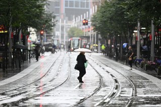
Greater Sydney is not expecting significant cold, although but some showers have been forecast for later Wednesday and into Thursday.
A dry and sunnier outlook is predicted for Sydney before the long weekend.
Sydney is forecast to reach a high of 16 degrees on Wednesday, but only 14 degrees on Thursday.
Tweet from @NSWRFS
Shivering in the sunshine state
Queenslanders can also expect temperatures to drop well below average, with the BOM forecasting snow, a powerful wind chill factor and icy roads.
The chill will sweep across most of the state, with temperatures dropping to up to six degrees below average.
BOM forecaster Pieter Claassen said most of Queensland would be colder than usual for June.
Snow is expected to reach the Granite Belt, where temperatures could be up to 10 degrees below average.
“The peak of the cold will be around the Granite Belt region on Thursday, when we’re forecasting low temperatures of just -2 degrees for Stanthorpe and a maximum temperature of just 6 degrees.”
Stanthorpe’s average maximum for June is 15.5 degrees.
-with agencies
