Eastern states brace for ‘unusual’ May weather, bringing heavy rain, flash flooding

The Bureau of Meteorology forecasted an 'unusual' weather event for the time of year. Photo: AAP
Unusual autumn thunderstorms, heavy rains and flash flooding are expected to hit much of the NSW coast, southern Queensland and parts of eastern Victoria.
Weatherzone forecasters said severe storm cells could pop up anywhere from southern NSW up to central Queensland on Tuesday, with some lightning strikes from mid-morning.
The Bureau of Meteorology is warning a trough of low pressure will move across NSW in the coming days, bringing with it the risk of severe thunderstorms in the state’s east.
Heavy rainfall is forecast for the state’s south coast on Tuesday, with small hail also possible while in the state’s north east – from the Queensland border to the mid-north coast – large hail, damaging winds and significant downpours are expected.
“Mid-May is a very unusual time of year to see severe storms in NSW, but in this particular case it’s due to the combination of having a relatively significant amount of humidity around for this time of year, and also a very powerful upper level system moving through,” BOM forecaster Jake Phillips said.
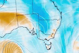
Tweet from @BOM_Vic
Victoria is not immune in what has been described as a “broad unstable weather pattern” with the autumn blast bringing heavy rain and flash flooding in parts of southeast NSW and Victoria.
In the southeast of the state, already up to 20mm of rain has already fallen on Tuesday morning with a flood watch alert issued for flash flooding and rising rivers as the region braces for upwards of 100mm of rain.
Tweet from @weatherzone
Weatherzone’s website said eastern Australia didn’t “usually brace for a lot of severe thunderstorms in May, but Tuesday will be a dangerous day of weather in multiple states.
“An upper-level cut-off low pressure system passing over southeastern Australia will create an ideal environment for widespread severe weather on Tuesday,” the website reported.
“Severe weather warnings have been issued in both states, with some places likely to see over 100mm by the end of Tuesday. This rain could cause flooding.
“The combination of an unstable atmosphere, abundant instability and favourable wind shear (a change in wind speed and direction with height) will also produce dangerous storms in eastern Australia on Tuesday,” it read.
Tweet from @BOM_NSW
Severe storms in NSW are “very unusual” for mid-May, according to the state’s weather bureau.
The Bureau of Meteorology (BOM) forecaster Kimba Wong said storm and shower activity across eastern Queensland was set to increase, especially on Tuesday and Wednesday.
“Perhaps a sign of things to come for the next couple of days so we certainly are expecting quite active conditions,” Ms Wong said.
-with agencies
Want to see more stories from The New Daily in your Google search results?
- Click here to set The New Daily as a preferred source.
- Tick the box next to "The New Daily". That's it.