Residents urged to evacuate as floods in rivers burst banks in SE Qld
Flooding closed the Mount Lindesay Highway at Jimboomba on Tuesday afternoon. Photo: ABC
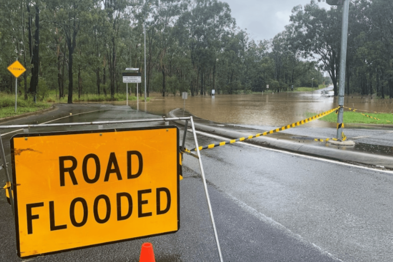
Major flooding continues in Beaudesert, south of Brisbane, on Wednesday, after days of heavy rain that has left floods covering roads and threatening homes across south-east Queensland.
Householders in Beaudesert were ordered to evacuate on Tuesday night as the Logan River reached major flood levels, beyond 12.22 metres.
In an emergency alert, residents were told to “secure their belongings, warn their neighbours and move to higher ground.”
Scenic Rim Mayor Greg Christensen said emergency services were sending text messages to warn residents around Glen Eagle to reach higher ground.
“We can’t access them because they’re cut off,” he said.
“We’d rather warn them … it’s not nice to wake up in the middle of the night having to deal with something.
“If you’re in a low-lying area, particularly through the Logan River corridor, assess whether you’re in a suitable, safe position or move to higher ground.”
River levels have commenced to generally ease across the upper reaches of the Logan and Albert River catchments according to the Bureau of Meteorology.
Further downstream river rises continue as upstream floodwaters arrive during the morning.
Bureau of Meteorology senior forecaster Jonty Hall said residents could expect mostly clear skies on Wednesday.
“Good news for a lot of places is [the rain] has pretty much done its dash,” Mr Hall said.
“We’ve seen the heavy rainfall clear out several hours ago across south-east Queensland.
“All the water we’re dealing with is now in the river systems.”
He said with the sunny skies, temperatures were also expected to climb up to 32 degrees.
Tweet from @AnnastaciaMP
Rain fails to top up major dams
Mr Hall said the significant rainfall in the past few days had failed to top up the region’s biggest dams.
“The bad news … was it didn’t really stretch into the upper parts of the Brisbane River, Stanley River, upstream of the main dams there – Wivenhoe Dam and Somerset,” he said.
“We haven’t seen any significant inflows from this into the dams, so that’s a bit of a shame.”
Wivenhoe Dam is at 37 per cent capacity, while Somerset Dam is at almost 78 per cent.

Sam Covey and her children watch the swollen Albert River from a bridge at Cedar Creek on Tuesday. Photo: ABC
‘Lots of dynamic weather’
Meanwhile, Bureau of Meteorology senior forecaster Laura Boekel said dozens of gauges across Queensland had surpassed 120 millimetres of rain.
The highest falls were recorded in the south-east, though no records have been broken so far.
In 72 hours to Tuesday, Springbrook in the Gold Coast Hinterland recorded 509 millimetres and North Tamborine received 490 millimetres.
More than a dozen roads were cut due to flooding on the Gold Coast, from Ormeau to Currumbin Valley.
Residents have been encouraged to listen carefully to flood watches and warnings, and to follow the advice of emergency services.
“There’s lots of dynamic weather systems going on at the moment, which is why we’re not seeing consistent rainfall in one particular place,” Ms Boekel said.
Some areas, including the Capricornia, Wide Bay and Burnett regions have not seen many falls.
But that could change in the next 24 hours, Ms Boekel said.
“They’re looking at potentially seeing some higher totals today [Tuesday] and tomorrow [Wednesday].”
Ms Boekel said while the rain band remained “dynamic”, the system was expected to clear throughout Wednesday.

Mice try to escape rising floodwaters at Braithwaites Bridge at Junabee, east of Warwick, on Tuesday. Photo: Donna Cecil
Pimpama on alert
Residents north of Pimpama on the Gold Coast were also on emergency alert, with the council advising that heavy rainfall could cause moderate flooding overnight for low-lying properties near rivers and creeks.
Sam Bloomfield, a Logan teacher aide in Flagstone, said some of her students were excited to be “jumping in puddles” when the school had to be closed early on Tuesday.
Ms Bloomfield said she was not concerned about flooding until she saw a police post on Facebook.
“It’s pretty scary, especially when the water does come up to the houses,” she said.
“You think your house is going to go under.”
Ms Bloomfield has lived in Logan for 12 years and said she had seen the roads this flooded “about five times”.
Residents of Cedar Creek, about 40 kilometres south of Brisbane, are also braced for more rain.
Sam and Dean Covey said they had checked the flood maps before moving to the area in December.
Ms Covey said her three children were “pretty excited” for the rain.
“Hopefully it eases off … otherwise we have a birthday party to cancel on the weekend,” she said.
Tristan Street said his family would be anxiously watching the banks of their land in Cedar Creek.
“My in-laws have farmland behind the river,” he said.
“In the last lot of flooding that came through, they lost their entire crop.”
They are expecting the river to rise as water flows in from Tamborine, south-west of Cedar Creek.
“It’s normally about two days after it hits Tamborine that we get it, and I’ve just come from Tamborine – it’s 10 times worse there,” said Mr Street.
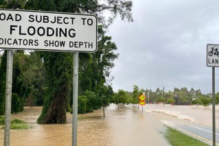
In Warwick, rising floodwaters at Victoria Street covered large areas of land and blocked access to the town’s Showgrounds.
The region recorded 120 millimetres of rain in just 24 hours, and over 200 millimetres over the week.
All over flooded areas, animals – including rodents – sought higher ground to escape the water.