Evacuations ordered as Tweed River breaks its banks
The rain is falling for a fifth day in the north of NSW, where some places have already had more than 500 millimetres. Photo: AAP
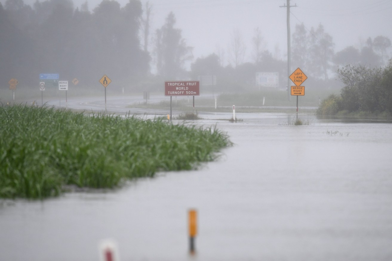
People in the northern NSW town of Murwillumbah were ordered to evacuate on Tuesday as record-breaking heavy rain continued to inundate the area as well as south-east Queensland.
On Tuesday morning, the NSW State Emergency Service urged anyone from Condong to Tumbulgum and in surrounding areas to leave via the Tweed Valley Way.
An SES spokesperson said the region has been deemed “a high danger area”, with about 1000 properties are affected.
The order came after the Tweed River burst its banks near Tumbulgum on Tuesday, leading to minor local flooding. Flash flooding has closed roads and isolated small communities.
Meanwhile, in Bryon Bay, one local ocean-front business is breathing a sigh of relief after “dodging a bullet” with the onslaught of the king tides in recent days.
Ben Kirkwood, his family and the Fink family co-own the salubrious Beach Byron Bay restaurant, which came close to going under as a mountainous swell smashed into the dunes under it in the early hours of Monday morning.
Mr Kirkwood says a six-layer wall of sandbags installed in November held out, but the easterly swell direction had also helped spare the building in the northern NSW town.
“The waves were whitecapping across the bay and smashing into Belongil and Main Beach and we had big surf crashing over the sandbags at the foot of our restaurant,” he told AAP.
“At the end of day we are looking like we might have dodged a bullet so we’re very lucky in that,” he said.
Tweet from @NSWSES
The SES said electricity, phones, internet, water and sewerage could be interrupted. It urged people in the areas to closely monitor the weather and road closures.
Energy provider, Essential Energy said more than 700 homes from Kempsey to the Queensland border were without power and crews were working to restore services, although flooding had restricted access to 120 homes.
The SES said residents should monitor the rapidly changing situation in NSW.
Earlier an SES spokesperson said “around 1000 homes in the Murwillumbah area are potentially affected”.
It warns that once floodwater began inundating the area, roads might be cut, trapping anyone who stays behind.
“If you remain in the area after this time, you may become trapped and it may be too dangerous for NSW SES to rescue you,” the SES said.
Tweet from @GeorgiaSchefe
The Bureau of Meteorology said some of the rainfall totals were expected to be record breaking.
Several locations across the Tweed catchment have more than 500 millimetres of rain in the past four days.
The BOM said 578 millimetres had fallen at Terania Creek on the NSW mid-north coast since Friday.
Meteorologist Helen Reid said “we’ll be looking to the database, with some places expected to break new records”.
One of the heaviest falls in the past 24 hours was recorded at Bellingen on the mid-north coast of NSW, where 251 millimetres fell in the 24-hours to 9am on Tuesday. The town was split in two on Tuesday when floodwaters topped Lavenders Bridge, its only connection between north and south.
The BOM said the damaging weather system was moving further south. Heavy rainfall was expected on the mid-north coast between Grafton and Taree on Tuesday, with some areas tipped to get up to 150 millimetres in the next 24 hours.
Later on Tuesday, the bureau issued a flood warning for the Wilsons River at Lismore. It is expected to peak at more than eight metres on Tuesday night.
“Even though the rainfall is starting to ease it doesn’t mean the flood situation is easing,” a spokesman said.
“We still have that floodwater coming down through those river systems.”
Senior climatologist Agata Imielska said areas further south – including Sydney – should also be prepared for wet weather.
“We are not expecting anything like the rainfall totals that we have seen up north but again more of a wet few days still ahead,” she said.
“Beyond just this system we are expecting some thunderstorm activity in the second half of the week.”
NSW Premier Gladys Berejiklian said weather experts had warned La Nina would have an impact all over Australia.
“We need to expect the unexpected,” she told ABC TV.
NSW SES Assistant Commissioner Nicole Hogan said there had been more than 1000 calls for help in the past few days.

The beach at Byron Bay on Monday. Photo: Twitter
The low-pressure system off the coast of south-east Queensland has brought massive rainfall and gale-force winds, which combined with king tides to wash away much of Byron Bay’s Main Beach on Monday.
On the Gold Coast the weather system has also caused massive erosion, with the surf club at Currumbin becoming an island.
Tweet from @DrBeachBumPhD
A team of 300 SES workers from across the state had been sent to support the northern NSW teams, as well as resources from Fire & Rescue, NSW RFS and NSW Police to support of the operation.
Queensland Fire and Emergency Services deputy commissioner Mark Roche said his crews had received about 1400 requests for help – mainly for leaking roofs and tarping and downed trees.
He urged people to remain vigilant, stay out of floodwaters, drive with caution and turn back if they see a road or a bridge that’s flooded.
“As we say, if it’s flooded, forget it,” he told ABC TV.
-with AAP