Icy blast brings snow, rain, hail and frost across SE Australia
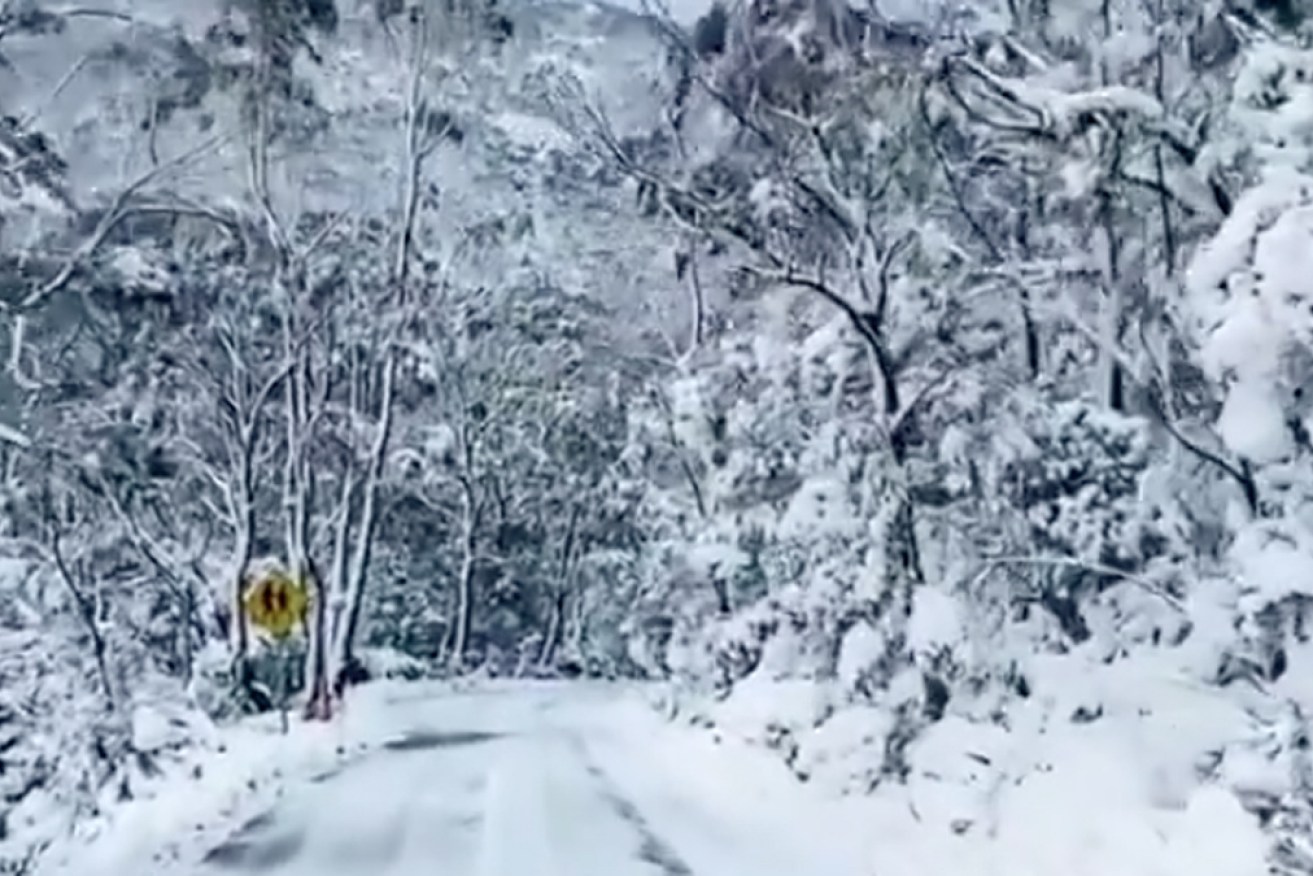
The road to Mount Field National Park in Tasmania on Tuesday. Photo: Twitter
Snow has fallen in central Victoria and on the fringes of Hobart as a wintry blast moves across Australia’s south-east.
It is the first of two low pressure systems forecast to sweep across the country this week, bringing snow, frost, hail and widespread rain.
In central Victoria, residents of Ballarat and nearby Buninyong woke to snow on Tuesday morning, while more was forecast for Melbourne’s far east later in the day. There were also reports of snow on the Great Ocean Road in southern Victoria.
Diana Eadie, from the Bureau of Meteorology’s extreme weather desk, said the first complex was “going to fling a series of cold fronts over the area, bringing a good amount of snow”.
“It’s definitely looking like a favourable set-up for snow,” she said.
“In fact, we could see snow levels drop to unusually low levels for large parts of the south east.”
Tweet from @Tolmansweather
In Tasmania, snow was expected to fall at 100 metres above-sea level.
In the end, the dry conditions meant just a dusting of snow on Hobart’s kunanyi/Mount Wellington in the morning – although some suburbs did follow later in the day.
In the state’s north, tourists to Cradle Mountain got a surprise wake-up call to minus two degrees before reaching 1 degree just before 3pm.
Earlier, snowboarder Tim Harmsen rose before 6am to take advantage of the cold snap.
Mr Harmsen rode his bike as far up the mountain as he could, then walked the rest of the way when the snow got too deep and fluffy.
He told the ABC the snow on the summit was “some of the deepest and softest powder I’ve ever seen in Australia”.
Tweet from @rogersbstock
Tweet from @SNOWSEARCH_aus
Alpine areas in Victoria and NSW can also expect snow on Tuesday and Wednesday. Ms Eadie said the forecast would be welcome news.
“A lot of alpine areas haven’t really seen all that much snow so far this season,” she said.
But it’s not just alpine regions that are expected to see snow.
Ms Eadie said there might be snowfall in the Dandenong Ranges, east of Melbourne, and Mount Macedon, to the city’s north-west. Snow is also likely on the hills around Canberra.
Tweet from @BOM_au
‘Exceptionally cold’
By the middle of the week maximum temperatures across much of the south-east are expected to be up to 6 degrees below average for this time of year.
“Temperatures in the single digits for large parts of Tasmania, and even southern parts of Victoria just clipping up into the low teens,” Ms Eadie said.
“That’ll be compounded by that windchill as well, with an increase in the southerly winds associated with that low.”
Overnight minimums are also expected to be “exceptionally cold”.
By Wednesday or Thursday, particularly in parts of Tasmania, south-east South Australia, southern NSW, and much of Victoria, minimum temperatures would be about 8 degrees below average, Ms Eadie said.
She said it was hard to pinpoint exactly where records could fall but large parts of Tasmania, Victoria, south-east South Australia and southern NSW could potentially record new cold August maximum and minimum temperatures.
“It’s going to depend on the low and just how cold this air mass is,” Ms Eadie said.
“But definitely be watching those maximums and minimums, we could see those records fall.”
Unsurprisingly, widespread and even severe frosts are also expected.
Tweet from @sharonkitt
Then comes the rain
The first system might be cold but it is not expected to bring a lot of rain.
“It’s looking more like just sort of patchy, shower activity,” Ms Eadie said.
“We are certainly going to see showers and some thundery hail in the wake of this first system.”
The second system, which has brought cold and heavy rain to south-west Western Australia, is expected to start moving east from Wednesday, bringing rainfall to central Australia.
Ms Eadie said much of South Australia, the southern parts of the Northern Territory, and eventually parts of western NSW and western Queensland could have “widespread falls between about 5 and 30 millimetres”.
“With systems like this, you could see locally much, much heavier rainfall totals, with thunderstorms that develop with this system moving through,” she said.
From Friday and Saturday the rainfall is expected to ramp up on the east coast.
“Again, sort of looking in that 5 to 30-millimetre range, but we could see some much higher totals right about the coastal fringe,” she said.
“But certainly shaping up to be a very wet end to the week and through the weekend for the east coast.”
Ms Eadie said it was still going to be unusually cold in Sydney, with strong southerly winds, especially on Wednesday.
But conditions were not likely to approach the record cold expected to grip the south.
-with agencies


