Central, eastern Australia in for a drenching from ex-tropical cyclone
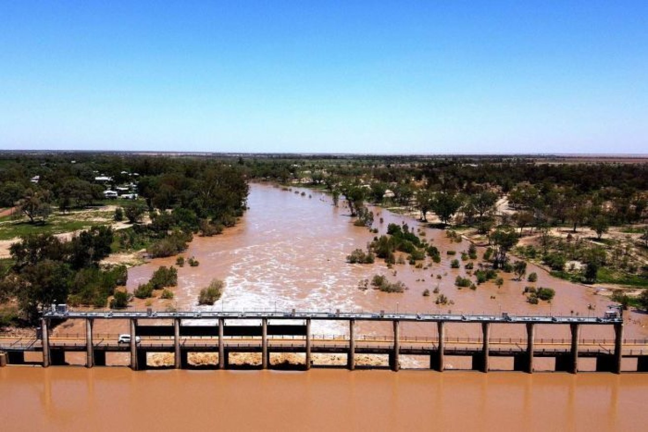
The flooded Balonne River in south-western Queensland after recent heavy rain. Photo: ABC
Drought-stricken parts of central Australia are expecting a deluge in coming days as the remnants of a tropical cyclone sweep down through Queensland and NSW and into Victoria.
Parts of the east coast can also expect more than 100 millimetres of rain over 48 hours as ex-tropical cyclone Esther crosses the region.
The system – which stretches all the way from the Northern Territory down to Australia’s south-eastern coast – has already brought record-breaking rain to some areas as it moves across the country.
In western Queensland, Boulia has already had 63 millimetres of rain, Birdsville has had 46 millimetres, and there has been 47 millimetres at Urandangi.
Towns in northern NSW also had heavy rain on Tuesday and into Wednesday.
Tweet from @birdsvilleraces
In Alice Springs, the usually dry Todd River is expected to flood on Wednesday after widespread rain across the catchment.
Northern Territory Police said flooding was possible early on Wednesday, with more rain forecast. River crossings in Alice Springs were likely to be closed, and motorists have been asked to avoid the area.
Weather bureau forecaster Jonty Hall said some areas in western Queensland could expect another 100-150 millimetres on Wednesday.
“There could be some areas of quite intense rainfall as well,” he said.
“We could see hourly totals getting up to 80-90 millimetres per hour.”
As it moves south-east, Esther is forecast to meet an upper trough moving over South Australia. The combination will bring widespread rain to western Queensland’s Channel Country on Wednesday and Thursday – wet weather that could linger for days.
On Wednesday morning, the Bureau of Meteorology issued a severe weather warning for Canberra, Wagga Wagga, Albury, Deniliquin, Griffith, Hay, Tibooburra, Cobar and Bourke.

The area covered by the weather warning on Wednesday morning.
“Widespread rain is expected across the inland and south-east of NSW during Wednesday as this trough deepens,” it said.
“Rain is likely to intensify Wednesday night and during Thursday as the remnants of Esther move across the state.”
Across the border, there are flood watch warnings for rivers in Victoria’s north-east. Affected areas include Shepparton, Wodonga, Wangaratta, Corryong, Bright and Falls Creek.
The bureau said two-day rainfall totals of 60-120 millimetres were forecast for Wednesday and Thursday, with isolated higher totals possible.
Rain is also forecast for Sydney for the rest of the week. The Bureau of Meteorology is expecting up to 20 millimetres of rain – and possibly a storm – in Sydney on Thursday.
The forecast puts both semi-finals of the Twenty20 World Cup in jeopardy. The first, between India and England, is scheduled for Thursday afternoon, while Australia plays South Africa in the second later in the day.
Meanwhile, the NSW Rural Fire Service declared on Monday that – for the first time in eight months – there were no active bush or grass fires in the state.
The declaration brought to an end more than 240 days of continuous fire activity across NSW.
-with AAP


