‘Border to border’: Flood warnings continue for NSW, Qld with more dangerous weather ahead
The weather bureau says most of us are in for a wetter than average winter this year. Photo: AAP
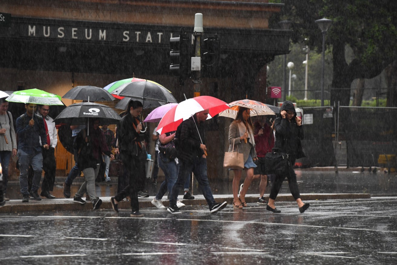
Emergency services have been kept busy by heavy rain drenching parts of NSW, with further heavy rainfall possible over the weekend.
The Bureau of Meteorology on Friday afternoon warned that extremely heavy rainfall and “life-threatening flash-flooding” was possible over the coming 24-36 hours around the Central Coast, Sydney and Illawarra regions, as well as eastern parts of the Central Tablelands.
A number of areas had significant falls including Byron Bay which recorded 283mm at Belongil Creek Bridge in the 24 hours to 9am Friday.
Mt Elliot on the Central Coast received 146mm between 9am and 4pm on Friday, while Palm Grove had 104mm in the same period.
A severe weather warning was in place on Friday night, stretching along the coast from the Mid North Coast to South Coast regions.
“A coastal trough near the northern and central NSW coast is bringing increased rainfall and other severe weather to the area,” the warning said.
“This trough is expected to deepen and gradually shift southwards, increasing rainfall and bringing dangerous winds and surf conditions along the central and southern parts of the coast and adjacent ranges during the next few days.”
BOM has issued a gale wind warning for the Sydney coast and closed waters, Hunter coast and Illawarra coast, and a strong wind warning for the Batemans coast and Eden coast on Saturday.
A hazardous surf warning is also in place for the Macquarie, Hunter, Sydney, Illawarra and Batemans coasts.
Earlier
Millions of residents from the Queensland border to southern NSW are bracing for dangerous flash flooding, road closures, abnormal high tides and landslides over the weekend as forecasters warn of more wild weather.
In the past 24 hours to Friday afternoon, the Queensland regions of Eumundi and Yandina on the Sunshine Coast recorded 90 millimetres of rain in just one hour on Thursday night, while further south in northern NSW, the coastal towns of Byron Bay and Newcastle had almost 300 millimetres, damaging dozens of homes and businesses.
Inland, farming communities in both states who had not seen decent rain for months, jumped for joy as rain filled dams, water tanks and dry river beds.
Queensland’s Cecil Plains farmer Sarah Pearce told the ABC she had “goosebumps” after a week of rain, describing the deluge as a “miracle” for graziers and struggling families.
And there’s more torrential rain to come.
NSW Emergency Services Minister David Elliott urged people to use common sense over the weekend while driving and to heed closures on beaches with abnormal high tides and damaging surf.
“You would not walk into a bushfire, so why would you drive through a flood?” he told the ABC.
“In previous seasons we have seen unnecessary risks taken by SES volunteers to recover … the bodies of motorist who have not heeded that particular warning.”
Severe Weather Update: widespread heavy rainfall and flood risk along the east coast. 7 February 2020
Video is current at 1 pm AEDT 7 February 2020.
For the latest weather and warnings, information visit https://t.co/qlzYU0jRuR and follow advice from emergency services. pic.twitter.com/t64rcJS249
— Bureau of Meteorology, Australia (@BOM_au) February 7, 2020
New South Wales
In Sydney, several roads were closed and public transport was brought to a standstill on Friday morning, including trains on the T1 North Shore line.
Buses also replaced ferries between Parramatta and Rydalmere because the Parramatta Weir was overflowing.
In Sydney’s outer west, Penrith was expected to receive 100 millimetres on Friday and up to 150 millimetres on Sunday. Inner suburbs can expect 90 millimetres on Friday and Saturday.
Significant falls were also predicted over Sydney’s main drinking water catchments, which are at just 42 per cent capacity.
The NSW Bureau of Meteorology issued a warning on Friday at 12pm for heavy rainfall and damaging winds from Goulburn to the Queensland border.
BOM duty forecaster Jane Golding said the system might evolve into an east coast low in the next two days, which could be extremely dangerous.
“Bridges have been washed away … there are some really awful events that have happened from east coast lows.”
NSW RFS Commissioner Shane Fitzsimmons, who has managed the bushfire crisis during the past two months, turned his attention to the dangerous conditions forecast for the weekend.
“The rain is good for business and farms, as well as being really good for quenching some of these fires we’ve been dealing with for many, many months,” he told the ABC.
“We don’t want to see lots of widespread damage and disruption from flooding, but it is certainly a welcome change to the relentless campaign of hot, dry weather.”
With significant focus shifting from fires to floods, the @NSWRFS State Operations Centre has now been reconfigured to operate as the @NSWSES Sydney Zone Operations Centre in support of state-wide flood operations. #NSWRFS #NSWSES pic.twitter.com/5NuxpiLpQR
— Shane Fitzsimmons (@ShaneFitzAU) February 7, 2020
The weather bureau’s warning came after downpours on Thursday night brought heavy rain and flooding to much of the state. The heaviest falls have been on the NSW north coast, with several areas recording more than 200 millimetres by Friday morning.
Byron Bay has 281 millimetres of rain and Newcastle had 250 millimetres.
“What we’re going to expect today is that rainfall to shift further south,” BOM forecaster Gabrielle Woodhouse said.
“We’ll start to see the focus of that rain through southern parts of the mid-north coast, Hunter and then into Sydney and Illawarra going into tonight.”
The NSW State Emergency Service said it had received nearly 340 calls for assistance across the state since the rain started.
Most were related to water over roads, roof damage and downed trees.
Assistant Commissioner Paul Bailey told the ABC that the SES had “rescue crews right up and down the coast because we know this event will really go border to border”.
The road to the Jenolan Caves, south-west of Katoomba, has already been closed due to fears the heavy rain could cause landslides.
NSW Maritime executive director Mark Hutchings said conditions were also dangerous out at sea.
“Skippers and owners of small boats should be on high alert and check the conditions before considering crossing a coastal bar or heading offshore,” he said.
Queensland
In south-east Queensland, flashing flooding caused road closures after Tin Can Bay and Coops Corner had 395 millimetres of rain in three days, while Eumundi had 340 millimetres.
Steady rain fell on the Gold Coast and Brisbane, with falls of 50-100 millimetres overnight on Thursday. More is forecast for the weekend amid concerns a tropical low forming off New Caledonia and Vanuatu could track south.
A tropical low tracking near Vanuatu & New Caledonia is not expected to head towards the #Queensland coast. However, tropical lows & cyclones are unpredictable beasts to track so stay up to date & #GetReadyQueensland. #CycloneDamien is off WA coast … https://t.co/7YwoyKN5kX 🌀 pic.twitter.com/dsN3XGI66d
— Bureau of Meteorology, Queensland (@BOM_Qld) February 7, 2020
Tropical Cyclone Damien
Meanwhile, the threat of a cyclone approaching Western Australia’s northern coast has prompted ports to be cleared as residents bunker down.
Tropical Cyclone Damien is estimated to be 300 kilometres north-west of Port Hedland. It is moving south-west at 11km/h.
It is expected to intensify to category three on Friday afternoon, then become a category four cyclone when it hits the Pilbara coast on Saturday.
The Pilbara Ports Authority said the Port Hedland port was being cleared. The Port of Dampier was also being shut down.
Tropical Cyclone Damien is the third cyclone of the season off the WA coast.
-with agencies
Want to see more stories from The New Daily in your Google search results?
- Click here to set The New Daily as a preferred source.
- Tick the box next to "The New Daily". That's it.