‘Hazardous’ weather closes in on south-eastern Australia

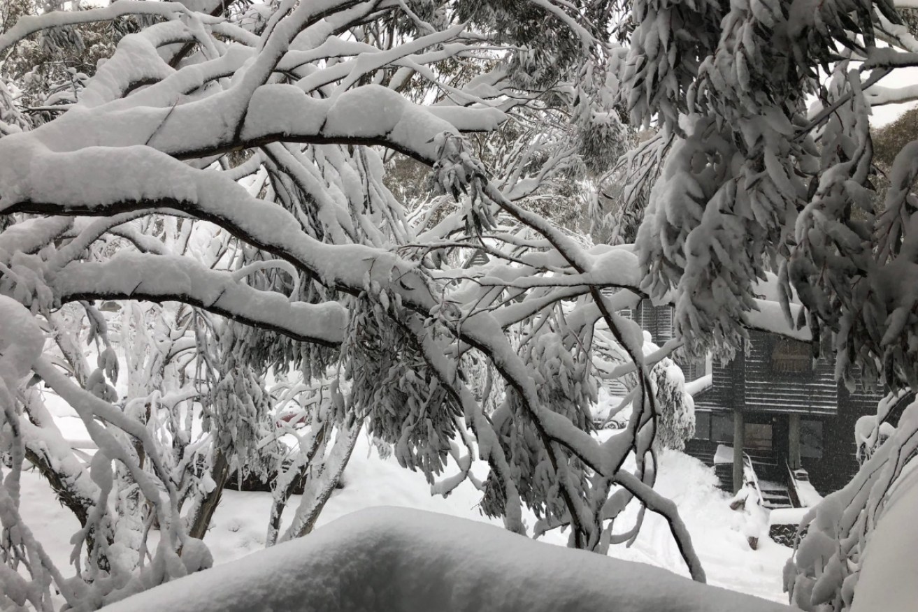
Snow lovers at Dinner Plain were delighted to find snow-coated trees outside their windows on Thursday. Photo: Twitter/Heather Ewart
Police have warned Victorians to stay off the roads as a severe cold front approaches south-eastern Australia, bringing rain, snow and dangerous winds.
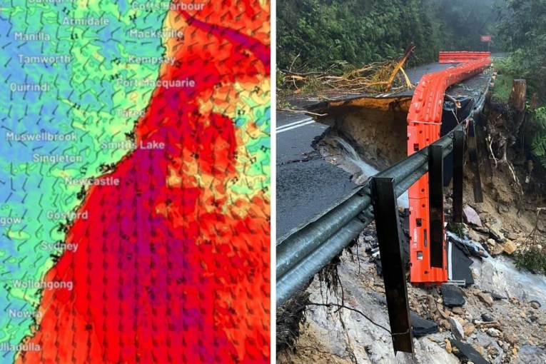
Forecasters continue to warn that the “strongest weather system” seen this winter will bring rain, snow and gale-force winds to a huge stretch of Australia, from Victoria and Tasmania in the south to as far north as the Queensland border.
“Conditions will be hazardous about southern coastal areas with rough seas and heavy swells expected, with significant wave heights of five to seven metres,” bureau spokeswoman Catherine Kennedy said.
“This is due to a cold front linked to a low to our south, which will also bring with it squally showers and possible thunderstorms and small hail.”
As a series of cold fronts whip through SE Australia, we're expecting damaging winds 💨 with showers & thunderstorms & snow down to 400–600 m, creating dangerous conditions about alpine areas 🏔️ Check the latest weather warnings at: https://t.co/Q8WIN1B0hJ pic.twitter.com/eFlHpwmxSJ
— Bureau of Meteorology, Australia (@BOM_au) August 8, 2019
South Australians have already felt the full force of the dangerous weather, with thousands left without power after gales overnight Wednesday. The front was moving steadily east, and expected to hit Melbourne by Thursday night.
As it closed in, Victoria Police urged people to stay off the roads.
“However, if you can’t, take extra care,” they said.
“Road conditions will change due to rain and strong winds on our roads.”
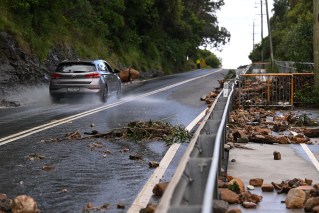
Drivers across South Australia had already been warned of similar conditions there. Mid-afternoon, SA Police Police closed part of the Sturt Highway near the Barossa Valley because of a serious crash involving two trucks, as wild weather lashed the state.
It came as the Bureau of Meteorology warned of dust storms in parts of South Australia as winds intensify. There was also a road weather alert warning for reduced visibility due to heavy rain, possible storms and small hail is in place for Adelaide.
The bureau said it was expecting wind gusts of more than 125km/h as the front hit.
The front is about to smash Adelaide. Storm force winds producing 120kmh gusts have been recorded at Neptune Island. Batten down the hatches! @SA_SES @SAPowerNetworks pic.twitter.com/1xd5PzOT4D
— Victorian Storm Chasers (@VicStormChasers) August 8, 2019
Forecasters have also urged NSW residents to remain vigilant, warning that snow might fall as far north as the NSW-Queensland border as the peak of the front was felt on Friday and Saturday.
Along with the snow and dangerous winds, the cold fronts will bring cold temperatures.
Snow was reportedly falling around Ballarat, in central Victoria, early on Thursday. The city has four consecutive days of single-figure maximum temperatures to look forward to.
But despite the severe weather warnings, it’s not all doom and gloom.
Snowboarders and skiers itching to hit the slopes have welcomed freezing temperatures in alpine regions.
The view from my bedroom window at #DinnerPlain this morning. Snowed all night and still snowing #Backroads pic.twitter.com/Sx36URNXcL
— Heather Ewart (@heatherewart1) August 7, 2019
The Bureau of Meteorology has forecast up to a metre of snow on the southern high country on Friday and Saturday – and it’s already started. Visitors and residents at Falls Creek woke up to 23 centimetres of fresh snow on Thursday morning, with a further 50 centimetres likely in coming days.
Blizzard conditions at Mount Hotham produced 30 centimetres of fresh powder on Wednesday night, covering gumtrees and ski lodges with thick swathes of snow.
Resorts have also urged skiers and snowboarders to check weather updates regularly and to take extra care on the slopes amid forecasts of winds of up to 100km/h.
-with AAP