‘We are expecting the worst to come’: Flood warning as rain batters NSW and Qld
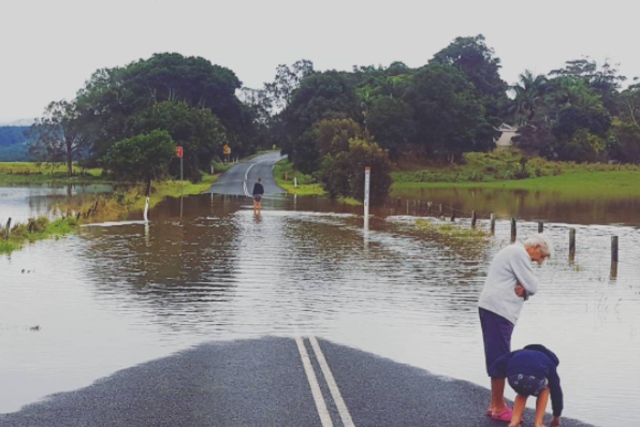
Floodwaters at Wooyung in the NSW Northern Rivers. Photo: Instagram
Rain has continued to batter parts of NSW and is threatening to cause flooding, as residents are warned the worst is yet to come.
The Bureau of Meteorology (BoM) issued a severe weather warning on Monday for heavy rainfall for the next 48 hours.
Another 200mm could fall in parts of the Northern Rivers district over the next two days. The area has already been drenched with in excess of 100mm over the weekend.
Heavy rain and thunderstorms could lead to flash flooding in the northern end of the NSW mid-north coast, the BoM said.
“We are expecting the worst to come,” SES spokesperson Becky Gollings told AAP on Monday.
“Tuesday is the day of greatest concern for us at the moment.”
Lismore, Grafton, Coffs Harbour, Port Macquarie, Sawtell and Dorrigo were of most concern. There were also warnings for the Brunswick, Wilsons and Richmond rivers.
A low pressure system off the far southern Queensland and northern NSW coasts caused the heavy showers, the BoM said.
The SES warned motorists to take extra care to avoid floodwaters as people head home after the long weekend.
“Don’t drive through floodwaters and weirs. Take it easy. It is better to actually be delayed than to risk your life and having to send somebody to rescue there,” Greg Murphy from the SES said.
The heavy rain that has been falling over NE NSW & SE QLD will continue today & tomorrow. The latest warnings at https://t.co/wdUcA3jLa8 pic.twitter.com/jCfqaS4ln0
— Bureau of Meteorology, Australia (@BOM_au) June 11, 2017
The Rural Fire Service, Fire & Rescue, local police, councils and the SES are preparing for emergencies and possible flooding in the coming days.
Queensland’s Gold Coast is also bracing for possible flooding.
After receiving almost 200mm in parts of the region over the weekend another 60-100mm is forecast for the 24-hours to Wednesday.
Gold Coast City Council’s disaster management centre is monitoring the event and on Monday afternoon said the risk to the city was low.
They are however warning about the dangers of flash flooding and road closures in flood-prone areas.
More than 110mm of rain was recorded on the coastal fringe from Saturday afternoon into Sunday morning.
Two women and a dog were rescued from a car in floodwater at Billinudgel in the NSW Northern Rivers on Sunday afternoon.
The SES responded to 350 calls for help in 48 hours, with most about leaking roofs, sandbagging properties and damage caused by fallen trees and branches.
Lismore, which was badly hit by floods at the end of March after Cyclone Debbie, had 190mm of rain in the 48 hours to Sunday evening. Evans Head copped more than 257mm in the same period. More than 210mm of rain fell over the Richmond and Wilsons River valley.
Heavy rain over the weekend cleared in Sydney on Monday, with sunny skies and a top of 20 degrees. Possible showers will return on Tuesday and continue through the week until Sunday. Maximum temperatures are expected to reach 19 and 20 degrees.
https://www.instagram.com/p/BVI1neyjQpm/?tagged=sydneyweather
Brisbane has also been battered by rain, which is expected to continue until Sunday. Showers are expected to be heaviest on Tuesday in the Queensland capital. Maximum temperatures in Brisbane are expected to sit in the low to mid-20s for the rest of the week.
Possible showers will hit Canberra on Friday and stay for the weekend. Until then, the nation’s capital is expected to wake to frost before sunny days. The temperature is expected to drop to -1 degrees overnight, while maximum temperatures should reach the mid-teens through the week.
Showers are predicted to hit Adelaide on Sunday, after enjoying sunny skies through the week. The temperature is expected to dip to a chilly six degrees overnight, while maximum temperatures should continue in the mid to late-teens for the rest of the week.
Perth will hit a maximum of 23 degrees on Tuesday with a late shower and drop to a minimum of six degrees overnight. The Western Australian capital will experience showers on Wednesday before clearing for sunny skies for the rest of the week.
Tuesday will be mostly cloudy in Hobart with a top of 15 degrees, with conditions continuing until possible showers on Sunday when the maximum temperature is forecast to hit 12 degrees.
A wind warning is in place for the Byron Coast and Coffs Coast over Monday and Tuesday.
Meanwhile, Melbourne has managed to avoid heavy rain. The Victorian capital was tipped to reach a maximum of 15 degrees on Monday, with a minimum of seven degrees overnight. Tuesday is forecast to be mostly cloudy and mild conditions are expected to continue through the week.
Summer never left Darwin, where a top of 29 degrees is forecast for Tuesday. The maximum temperature is expected to peak at 31 degrees on Thursday, Friday and Saturday. The sun will stay out every day of the week, according to Weatherzone.

A severe weather warning for heavy rainfall has been advised for the region marked in dark yellow. Photo: Bureau of Meteorology
If you are trapped by flash flooding, seek refuge in the highest available place and ring 000 if you need rescue. For emergency help in floods and storms, ring your local SES Unit on 132 500.