Magnitude 6.1 quake strikes south of Bali
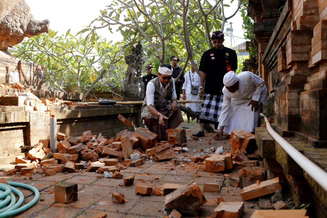
A Balinese temple suffered minor damage in the earthquake. Photo: AAP
A magnitude 6.1 earthquake has struck south of Bali in Indonesia, the European-Mediterranean Seismological Centre says.
The undersea earthquake struck about 10am (AEST) on Tuesday.
Its epicentre was 102 kilometres south-west of Denpasar and 100 kilometres deep, EMSC said.
No tsunami warning was issued by Hawaii’s Pacific Tsunami Warning Centre. However, the shaking did prompt some residents and visitors to the tourist island to briefly rush out of buildings.
A Twitter user with the handle Indounik in the Balinese city of Ubud said the quake was “strong enough to make me adopt the drop, cover & hold approach recommended to survive a quake”.
I’m here in #Bali. The hotel was shaking when I was in the room. Now evacuated to the lobby. #dpareporter https://t.co/yAr9aNviJ9
— Hathai Pia (@HathaiPia) July 16, 2019
Another Twitter user, Marc van Voorst, described the quake as feeing like “a heavy truck or train passing by at close range”.
He said there was no panic, even though his hotel in the Uluwatu area shook quite a bit.
Indonesia’s disaster mitigation agency distributed a photograph of damage at the Lokanatha temple in Denpasar, showing smashed masonry lying on the ground.
Bali is a predominantly Hindu enclave in overwhelmingly Muslim Indonesia.
There was also minor damage at a school, a house and a temple in different areas on the southern side of Bali, according to Balipost.com.
A roof of a mosque in the city of Banyuwangi in East Java also partially collapsed, another photo from the disaster mitigation agency showed.
The transport ministry said Bali airport was operating normally.
Tuesday’s quake follows a magnitude 7.2 tremor that killed two people on Indonesia’s Moluccas islands on Sunday, and one of 6.6 in the Indian Ocean off the northern coast of Western Australia on Sunday afternoon.
That quake struck about 200 kilometres off the coast, between Broome and Port Hedland, but was felt as far away as Darwin and Perth.
#Earthquake (#gempa) possibly felt 2 min ago in #Provinsi Bali #Indonesia. Felt it? See https://t.co/wPtMW5ND1t pic.twitter.com/WZ3Mymgosq
— EMSC (@LastQuake) July 16, 2019
The Bali quake was also felt in cities on the neighbouring islands of Lombok and Java, Indonesia’s meteorology and geophysics agency said.
Indonesia suffers frequent earthquakes, sometimes causing tsunamis, because it lies on the seismically active Pacific Ring of Fire.
The most devastating tremor in recent Indonesian history was on December 26, 2004, when a magnitude 9.5 quake triggered a tsunami that killed about 226,000 people along the shores of the Indian Ocean, including more than 126,000 in Indonesia.
A tsunami also hit the city of Palu in Sulawesi last year, killing thousands.
-with AAP


Thousands flee Indonesian volcano