New Zealand earthquake: How it happened

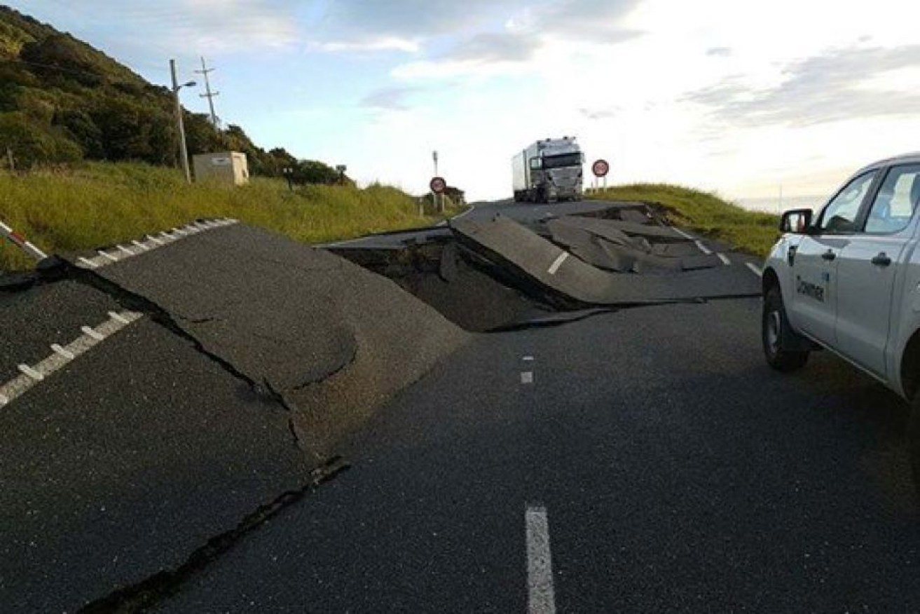
The quake severely damaged some roads, making access to affected areas difficult. Photo: Twitter: Marlborough Emergency
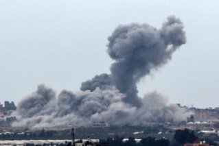
The 7.5 magnitude earthquake that shook New Zealand’s South Island on Sunday night was its largest in seven years, and seismologists say the fact that the loss of life and damage to property wasn’t bigger was a matter of luck.
The quake, located 20km south-east of Hanmer Springs in North Canterbury, originated at a depth of 16km and struck just after midnight local time.
The tremor was larger than the 6.2-magnitude Christchurch earthquake of 2011 that claimed almost 190 lives.
However, this latest quake was very different to previous, more damaging tremors with a deep, long, rolling feeling effect rather than sharp jolts.
Professor Sandy Steacy, head of physical science at the University of Adelaide, said New Zealand’s varying quakes, but specifically Sunday’s, were a result of fault planes located at the meeting point of the country’s North and South islands.
“It’s a fairly complex area. In the southern part of the North Island we have what is called subduction, which is where one plate goes underneath another,” Prof Steacy said.
“And then as you move to the north part of the South Island you get a transition where you get a combination of some subduction type earthquakes and also strike-slip, which are horizontal earthquakes.
“This earthquake happened in that transition zone between subduction and strike-slip.”
Prof Steacy said New Zealand’s positioning between two tectonic plates causes its numerous earthquakes.
“New Zealand is on a plate boundary and so you have a collision of the Australian plate and the Pacific plate, so all the earthquakes in New Zealand are a result of that,” the earthquake scientist said.
It is also theorised that New Zealand is frequently rocked by tremors because it lies within the geographical area of high volcanic and seismic activity in the Pacific known as the Ring of Fire.

Comprising a 40,000 km horseshoe shape area ringing the Pacific Ocean, the Ring of Fire is home to around 90 per cent of the world’s earthquakes.
The area is also associated with an estimated 75 per cent of the world’s active and dormant volcanoes.
How does a bigger quake cause less damage?
Sunday’s earthquake has so far been responsible for the deaths of just two people, prompted a tsunami warning and was the strongest since the magnitude-7.8 Dusky Sound earthquake in 2009 on the south-west corner of the South Island.
But while the latest quake was incredibly powerful and lasted two minutes, it was less destructive because of the location of its epicentre and difference in depth.
“The key point is distance to people,” said Graham Leonard, a senior scientist with earthquake agency GNS Science.
“Most of these quakes were in relatively unpopulated areas, as opposed to the Christchurch earthquake which was directly under Christchurch city,” Dr Leonard said.
It's getting worse #eqnz #newshub pic.twitter.com/ftmJeNVk8T
— Henry McMullan (@HenryMcMullan) November 13, 2016
“The magnitude 7.5 has caused a lot less urban damage than a small earthquake that was directly under a city and the reason is the amount of ground shaking at the buildings themselves,” he said. “And that’s completely a function of distance and it can be compounded by ground shaking.”
Dr Leonard also said the widespread dissipation of the Sunday night’s quake – covering a fault plane 150km long and 25km wide – and the epicentre being offshore, helped mitigate much of the potential damage.
It struck approximately 90km north of Christchurch.
Aftershocks expected possibly for months
GeoNet, which monitors seismic activity in New Zealand, has warned residents to expect more quakes to come.
“We can say one thing with certainty: there will be more earthquakes to come in this area,” it said in a statement.
The organisation provides a likely scenario relating to aftershocks, suggesting a sequence of tremors will likely be spread from the epicentre near Culverden, right up along the Kaikoura coastline to Cape Campbell on the north of the South Island for the next few months.
https://twitter.com/dickbicknell/status/797764569179377664
Almost every three minutes on Monday afternoon, GeoNet recorded an aftershock. Over 400 aftershocks had been noted at the time of publication.
“Most earthquake aftershock sequences decay over time, with spikes of activity and occasional larger earthquakes,” it said.


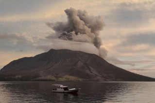
Thousands flee Indonesian volcano