‘Damaging waves, dangerous flooding’: Cyclone Megan bearing down on Top End
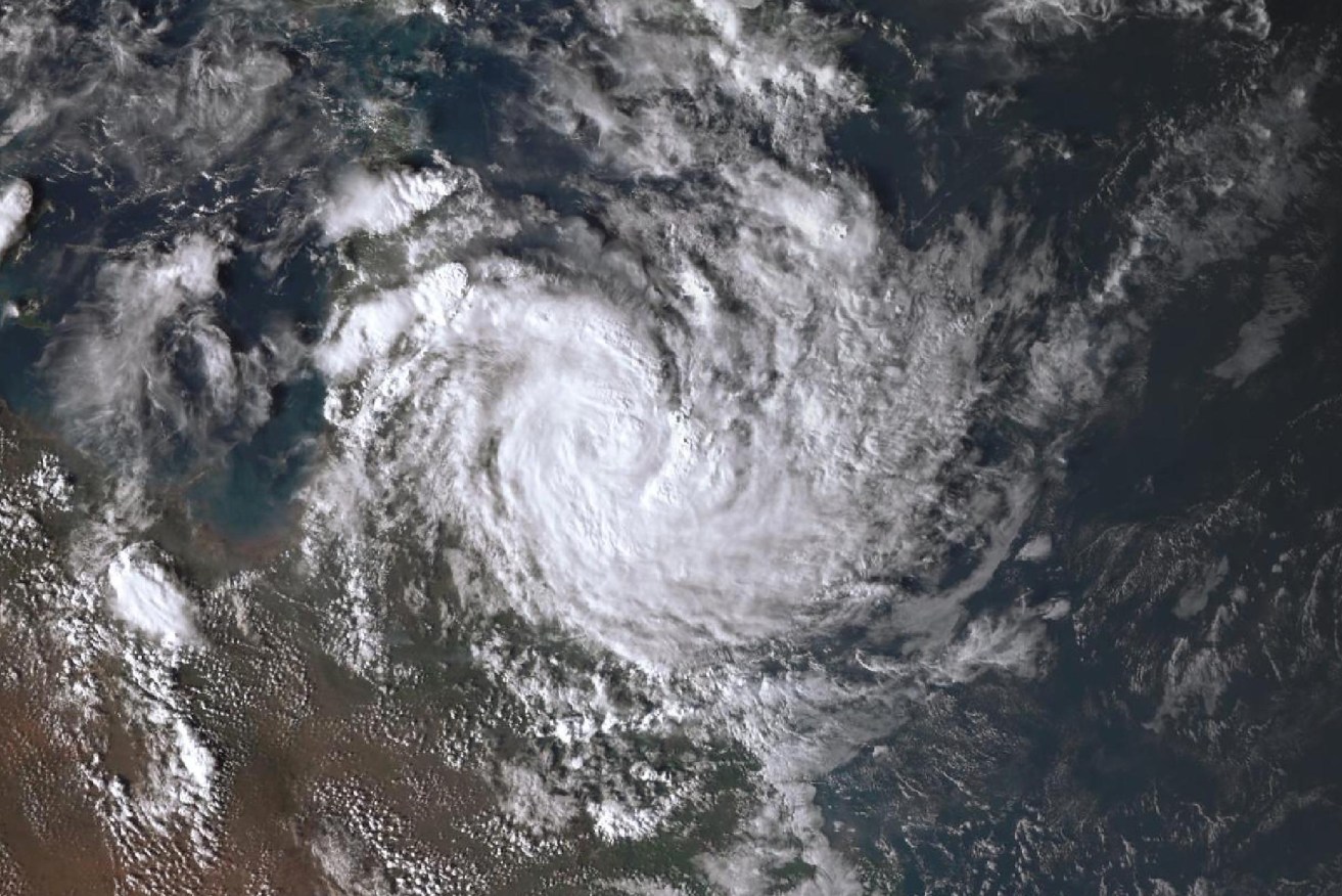
Cyclone Megan is gathering strength over tropical on its way to a Territory landfall. Photo: BoM
Top End residents have been warned to expect days of wild weather as Tropical Cyclone Megan moves towards the coast.
The warning zone for the category two system stretches hundreds of kilometres from Alyangula in the Northern Territory’s northeast down the coast to the border with Queensland.
It’s expected to become a category three system by Sunday night before it reaches the coast on Monday morning.
The Bureau of Meteorology said the cyclone would have a “very destructive core” when it made landfall, with wind gusts of up to 200km/h expected from the Nathan River in the NT down to the NT-Queensland border.
Coastal residents between Nathan River and the border are specifically warned of a dangerous storm tide as the cyclone centre crosses the coast.
‘Damaging waves’
“Tides are likely to rise significantly above the normal high tide, with damaging waves and dangerous flooding,” the bureau warned.
Severe conditions across the region are expected from early Sunday, with meteorologist Miriam Bradbury warning communities to expect sustained gale-force winds and damaging gusts of up to 125km/h.
“We could see trees and tree limbs downed by these winds, leading to debris on the roads and potentially disrupted transport routes,” Ms Bradbury said.
Communities outside the tropical cyclone warning zone could still feel the impacts of wind and rain, with a severe weather warning for heavy rainfall issued in the East Arnhem district, she warned.
“Twenty-four-hour rainfall totals could exceed 200 millimetres, which can lead to flash-flooding,” Ms Bradbury said.
The weather system is expected to return to a tropical low as it heads further inland on Tuesday and Wednesday, prompting the bureau to issue flood watches for further river rises across the territory.
Abnormally high tides are likely along the gulf’s coast and large waves could produce minor flooding along the foreshore, the bureau said.
It comes one month after category one ex-tropical Cyclone Lincoln crossed the territory’s coast in the southern Gulf of Carpentaria, bringing high winds and heavy rainfall.
-AAP