Kirilly makes a U-turn to drench northern Queensland all over again
Australia's north is bracing for another possible tropical cyclone following Kirrily and Jasper. Photo: AAP
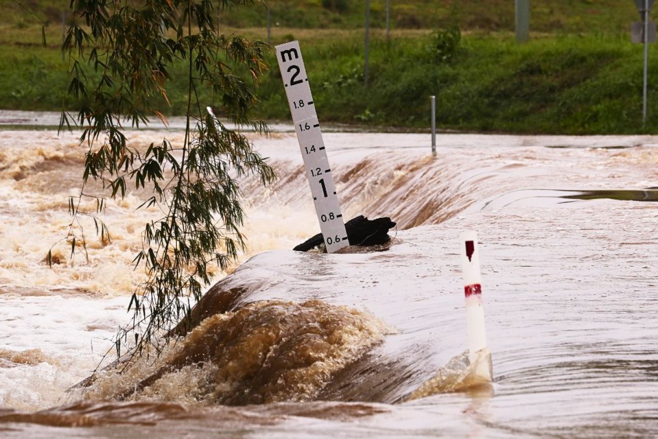
After subjecting Far North Queensland to some of the biggest drenchings ever recorded, ex-Tropical Cyclone Kirrily has turned around to give the region another huge soaking.
After hammering the region days earlier, the former cyclone is set to pass through again with heavy rain before tracking south along the Queensland-Northern Territory border.
A severe weather warning has been issued for the border regions, encompassing the Carpentaria, Barkly and Simpson districts to the west, as well as Queensland’s Gulf Country, North West and Channel Country.
Some areas could receive as much as 300mm of rain in 24 hours, with six-hour totals between 90 and 150mm likely, the Bureau of Meteorology warned on Saturday.
In the 24 hours to 9am on Friday, 332mm of rain was recorded at Queensland’s Westmoreland Station, near the Gulf of Carpentaria.
As of early on Saturday, ex-Kirrily was hovering to the south-southeast of Wollogorang over the southwestern Gulf Country in Queensland.
“At this stage, the system and associated severe weather are expected to move into the Simpson district early on Sunday morning and continue to track further southeast to clear the Territory by late Sunday,” the bureau said in a statement.
Inestimable damage
The full extent of Kirrily’s damage may not be known for some time, with already flood-hit Queensland regions bracing for another drenching.
However, authorities have received a glimpse of the devastation in the state’s northwest, prompting calls for the “neglected” region to receive more resilient infrastructure.
Federal and state ministers tried to gauge the damage to date with more wild weather on the way, visiting the inundated Kynuna and McKinlay areas on Friday.
“There’s going to be a big repair bill for the cattle stations,” local state MP Robbie Katter said.
“The pub in Kynuna, the Blue Heeler, was wiped out, and the vast majority of fencing and stock water in this district have been wiped out.
“It will be a fair while getting back on track.”
Roads have been cut leaving road trains idle, rail networks are affected and properties have been inundated. Mount Isa has been without fresh food for a week.
Mr Katter said the state government had not addressed calls by the Doomadgee, Burke and Carpentaria Shire mayors to bolster road infrastructure.
“Upgrades to bridges and crossings are what’s really needed right now to make them resilient to the affects of major floods,” he said.
Burke Shire Mayor Ernie Camp called for federal government assistance, saying communities such as Doomadgee had already been isolated for a month.
‘Regions have been neglected’
“We need more resilient infrastructure in our region so people can get supplies and are not cut off,” he told AAP.
“The regions have been neglected for at least two decades.”
Ex-cyclone Kirrily is set to finally weaken next week, but another potential windstorm is brewing. (Jono Searle/AAP PHOTOS)
Ex-Tropical Cyclone Kirrily is set to finally weaken when it tracks into northern NSW by Tuesday.
However, yet another potential tropical cyclone looms.
A weak low is off the Queensland coast in the Coral Sea and is a moderate chance, 25 to 35 per cent, of developing into a cyclone by Thursday.
It is expected to develop in Fijian waters but could track back towards the Queensland coast next week.
-AAP