Severe storms for Qld after Christmas scorcher
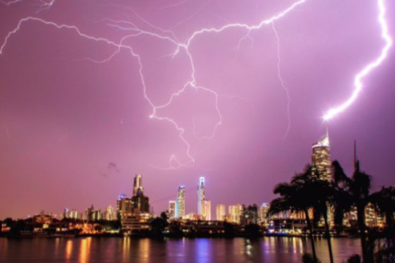
The Christmas Day storms over the Gold Coast. Photo: Twitter
Queenslanders in parts of the state’s south and south-east could be in for a repeat of Monday’s weather, with the Bureau of Meteorology forecasting late showers, storms and possible hail.
The weather bureau’s Diana Eadie said the storms were most likely to affect western parts of the Darling Downs and the Maranoa.
“Places around Roma, Goondiwindi, Dalby, possibly Chinchilla and Warwick, and possibly even Toowoomba are all in the firing line today [Tuesday] for severe thunderstorms,” she said.
“The most likely hazard with these storms is damaging wind gusts … in excess of 90 kilometres per hour.
Christmas Day lightning in south-east Queensland
Mother Nature with a Christmas Day Storm across SouthEast Queensland this Evening 🇦🇺 @7NewsBrisbane @abcbrisbane @9NewsQueensland @abcsunshine @SteveAustinABC @brisbanetimes @hit105Brisbane @HigginsStormCh @nova1069 @couriermail @SEQUESTQLD @SESBrisbane @SBS @QPSmedia pic.twitter.com/EqAKR6hwm4
— Ben Mihan (@BenMihan) December 25, 2017
“Heavy rainfall’s always a risk, and there is a slight possibility of large hail as well.”
She said there was a slight chance the storms would reach the south-east coast later on Tuesday.
Brisbane is forecast to receive up to 40 millimetres of rain on Tuesday.
Yesterday more than 19,000 homes across south-east Queensland lost power as the region was hit by severe thunderstorms after a scorching Christmas Day.
Areas from the Scenic Rim and the Gold Coast through to Brisbane and Moreton Bay were hit by storm cells from about 5.30pm, with heavy rain and damaging winds thrashing the region.
The storms came after a hot summer day in the south-east, with Brisbane, Ipswich, Gatton and Beaudesert reaching a top of 36 degrees Celsius.
Power had been restored to almost all homes by 9am.
Radar problems
Queensland’s summer storm season is continuing to test the Bureau of Meteorology’s ability to monitor severe weather.
The Mt Stapylton weather radar in the state’s south-east is offline again, following Monday’s extreme conditions. Forecaster Gordon Banks said the radar is integral to the bureau’s operations, and has had multiple upgrades over the last few months.
“It doesn’t affect much in the way of predictions as far as forecast are concerned but certainly for monitoring severe storms and where they are going, they’re quite important to us,” he said.
“We’re able to determine the potential of a storm for generating hail, also it helps us identify features in the storm that may be associated with rotating storms and severe weather.
“Our technicians attempted to get in there remotely last night [Monday] and see what could be done with it but nothing could be done.”
Mr Banks said he didn’t know when the technology would be up and running.
“It’s just a case of wait and let them diagnose the problem and repair it,” he said.
“We do have a back-up radar at Marburg which was very useful yesterday [Monday], but we like to have all our radars working in peak condition.”
Bondi mourns stabbing victims
Death of boy, 10, under govt care a tragedy: Marles