Top End breathes easier as cyclone alert downgraded to ‘rain and damaging winds’
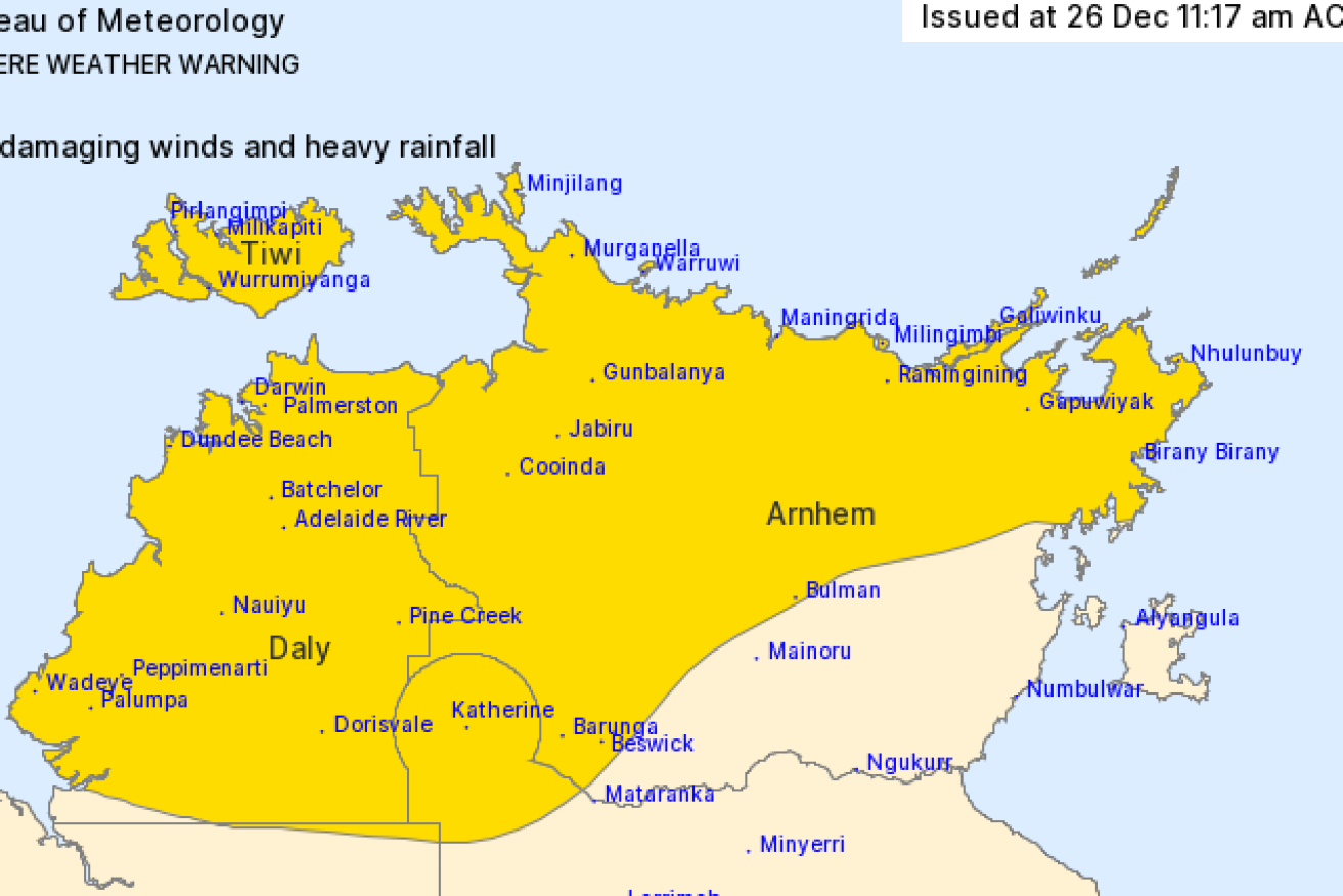
NT remote communities expected a cyclone but still must contend with howling winds and driving rain. Map: BoM
The tropical cyclone alert for the Northern Territory has been cancelled but residents have been urged to prepare for heavy rain and damaging winds.
Forecasters had warned that a tropical low brewing north of Darwin over Christmas could intensify into a category one Boxing Day cyclone.
But the Bureau of Meteorology downgraded the alert late on Saturday, saying the weather system would remain a tropical low.
It crossed the coast about 150km southwest of Darwin overnight and is currently moving slowly southeast across the Daly region.
The bureau said parts of the Top End had been hit by heavy rain and squalls.
Batchelor, 97km south of Darwin, recorded 149mm of rain in the 24 hours to Sunday morning and 131mm fell at nearby Adelaide River.
Darwin CBD received 68mm of rain for the same period.
A severe weather warning has been issued for people in Daly, Tiwi, Arnhem and Carpentaria regions.
Heavy rainfall that could lead to flash flooding is expected to continue throughout Sunday across the Arnhem, Daly, Tiwi and northwest Carpentaria districts.
Rainfall of 150 to 250mm and isolated falls to 300mm are possible.
Damaging winds with gusts of up to 100 km/h with monsoonal squalls may develop in coastal areas.
The extreme weather conditions may push further east and south into the Carpentaria and Arnhem District later in the day
A flood watch is also current for parts of the Top End.
-AAP
Want to see more stories from The New Daily in your Google search results?
- Click here to set The New Daily as a preferred source.
- Tick the box next to "The New Daily". That's it.


