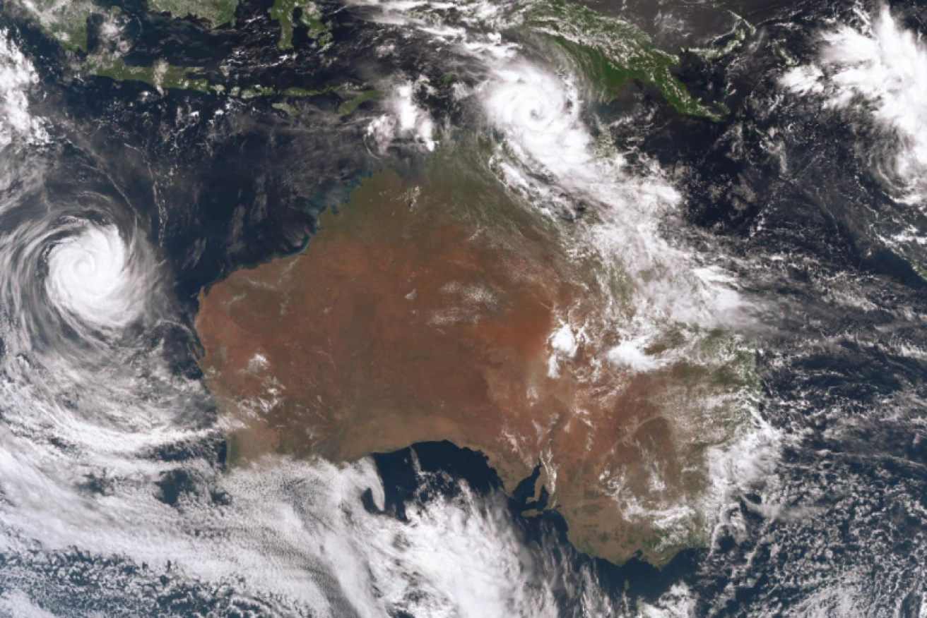
‘Cyclone Nora is cranking’: Warnings as four storms converge on Northern Australia
Cape locals will be hoping and praying they're n ot due for a repeat of 2018's savage Cyclone Nora. Photo: BoM
Cyclone Nora is forecast to intensify into a category four storm as it moves towards Cape York with heavy rain and winds gusting up to 170km/h expected.
Nora is rapidly intensifying off the Northern Territory coastline and the unpredictable system is expected to make landfall on Saturday or Sunday on Queensland’s northwestern coast.
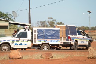
Extra police officers were rushing to remote Cape York communities on Friday while cyclone preparations are already in full swing.
Minor flooding is likely to occur from the Cape, possibly down to Townsville, and authorities are also warning people to beware of tidal surging as Nora approaches.
No cyclone has crossed the coast in the forecast area since 2001 but Queensland Premier Annastacia Palaszczuk is happy with preparations.
Senior officers from swift water rescue crews and SES leaders have been deployed to remote communities and Ms Palaszczuk said regional mayors would be updated every three hours.
“A category four is a big system. A category four is intense, and it’s the tidal surge that comes afterwards,” she said.
Queensland Bureau of Meteorology manager Bruce Gunn said flood watches were in place as up to 200mm of rain could fall daily with isolated pockets possibly being hit with 300mm.
#CycloneNora is cranking! Already a Cat 2 and expected to reach Cat 3 tomorrow. View some awesome satellite imagery here (use the 'layers' button to adjust the view) https://t.co/7gduifB6gq pic.twitter.com/qA3QdmBrF7
— Bureau of Meteorology, Northern Territory (@BOM_NT) March 23, 2018
Forecaster Jonathon How said there was a slim chance the Coral Sea system would become a tropical cyclone, the ABC reported.
“We can’t rule it out, but it looks like there will be generally unfavourable conditions for the system developing,” Mr How said, adding the storm cell is expected to move towards Fiji next week.
Emergency Services Minister Craig Crawford said residents on the Gulf Coast from Thursday Island to the NT border should prepare for strong winds and heavy rainfall.
“Until this afternoon we won’t be able to really … say where we think this is going,” he told ABC radio.
“But we’re prepared for an impact, or certainly a cyclone, in the area of a significant part of our coastline in the Gulf. It’s very much a wait and see at the moment.”
Cyclones on the Gulf are notoriously unpredictable, and forecasters say there’s still uncertainty over its path.
The latest tracking map suggests Nora will be a category three on Saturday night, when it will be off Aurukun on the Cape York Peninsula’s western coast.
It’s expected to remain a category three on Sunday when it will be even closer to the coast, but further south between Kowanyama and the Gilbert River Mouth.
Queensland’s emergency services commissioner, Katarina Carroll, said rapid response teams were being assembled in preparation, including swift-water rescue specialists.
“These crews will have the ability to fly into any area requiring assistance within four hours of being notified and will be self-sustaining for 48 hours,” she said.
Gales with gusts to 110km/h could develop in coastal areas between Elcho Island and Cape Shield during Friday, including at Nhulunbuy, if the system takes a slightly more southerly track than is forecast.
Gales with gusts to 110km/h may develop in coastal areas between Thursday Island and Pormpuraaw, including Weipa, on Friday night.
They could extend south between Pormpuraaw and the Northern Territory border with Queensland, including Mornington Island, on Saturday.
Heavy rain is forecast in the Torres Strait and Cape York Peninsula in coming days, and it could extend to the Gulf country late on Saturday and into Sunday depending on how Nora tracks.
-with AAP