Severe storm warning as Sydney cleans up
Flooding has caused afternoon mayhem in Sydney as the city was smashed by more wild weather on Tuesday which had been predicted to bring heavy rain.
Roads, highways and airport runways went underwater, leaving motorists stranded or rushing to escape as the severe thunderstorm hit mid-afternoon.
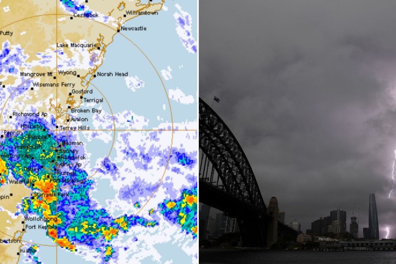
The Bureau of Meteorology earlier warned the dangerous weather was detected on waters near Stanwell Park, Wollongong and Port Kembla, south of Sydney, after midday Tuesday.
The storm was heading west and was forecast to affect Bulli, Darkes Forest and Thirroul mid-afternoon.
It followed thunderous weather on Monday which smashed Sydney and other parts of NSW, unleashing wild lightning and intense downpours.
Weatherzone detected 864,000 lighting strikes within 500 kilometres of Newcastle in the 24 hours to 9am Tuesday.
In the same period, rainfall totals of 40 to 80 millimetres were recorded from Sydney up to southeast Qld.
Sydney Airport copped 39 millimetres which was its heaviest rain in two months, while Kings Langley and Little Bay both saw more than 50 millimetres.
“While Monday was the peak of this storm outbreak for many areas of NSW, a coastal trough will continue to generate showers and thunderstorms in the state’s east on Tuesday,” said Weatherzone.
“The most likely areas to see more storms on Tuesday are the central and northern coast and ranges.
“Some storms could also develop over the southern ranges in NSW and extend across the border into eastern Vic.”
On Monday in Sydney, four people briefly lost consciousness when struck by lightning while sheltering from intense storms in the city’s Royal Botanic Gardens.
The quartet, aged from teens to their 30s, had been sitting under a tree in the gardens when it was hit by lightning about 12.45pm.
All four suffered burn injuries and “cardiac symptoms” and were taken to hospital in a stable condition, NSW Ambulance said.
“They all had a brief loss of consciousness,” Ambulance Inspector Dominic Wong told reporters.
As the storms passed between 11am and 2pm, the runway at Sydney Airport had earlier reached a near-standstill as more than 30 departures were cancelled and 340 services in and out were delayed.
Delays at times exceeded an hour for arriving flights.
More than 10,000 households and businesses lost power in the northern suburbs.
A lightning strike on the train line at North Sydney about 2.45pm cut services from there to Gordon for three hours around the afternoon peak.
Passengers were advised to delay their trip.
Cyclone could reform
In Australia’s north, a massive storm that lashed the Top End with heavy rain could gather strength and redevelop into a tropical cyclone.
Ex-tropical Cyclone Lincoln crossed into Western Australia near Halls Creek late on Monday and was tracking toward the coast.
It’s expected to move west-northwest through the Kimberley, bringing heavy rain, strong winds and flash flooding, the Bureau of Meteorology has warned.
The weather system is likely to cross the coast by mid-week and could gather strength and redevelop into a tropical cyclone as it tracks south.
The bureau said it was possible the weather system could cross the coast near Exmouth at the weekend as a severe tropical cyclone.
The system has bucketed heavy rain in the Northern Territory in recent days, with 24-hour totals of more than 100mm recorded in some areas.
A severe weather warning was in place from Lajamanu to Halls Creek, with six hourly rainfall totals up to 100mm and flash flooding possible.
The northern Tanami and the southern Gregory Districts in the NT should prepare for potential flash flooding on Monday and Tuesday.
A flood watch is in place for parts of Bonaparte coastal rivers, Carpentaria coastal rivers and central inland rivers in the NT.
It extends into WA’s Kimberley region and also takes in the Fitzroy Rivers and Sturt Creek district.
Catchments in these areas are already wet because of rain over recent weeks and are likely to respond quickly to further heavy falls, the bureau said.
Major flood warnings remain in place for Queensland’s already saturated far northwest.
Heavy rainfall in the region caused by ex-cyclone Lincoln has triggered warnings for the Diamantina, Nicholson and Flinders rivers.
-with AAP