ADF standing ready as extreme weather threatens NSW with flooding and evacuations
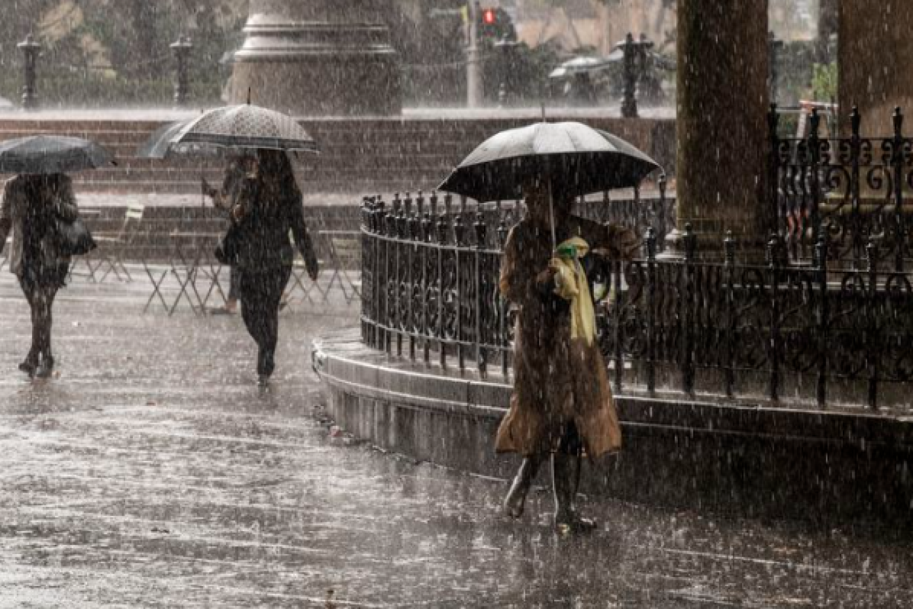
A driving rain pelts down in the centre of Sydney. Photo: Nine News
Two Australian Defence Force helicopters will be available to assist with rescues as areas of NSW brace for intense rainfall and possible flooding.
The federal government approved ADF support at the request of NSW on Friday night, with 100 troops also available from Sunday onwards, Emergency Management Minister Murray Watt said.
There is a risk of severe flooding around the Illawarra and Sydney as well as the Hawkesbury and Nepean regions from Sunday through to next week.
“I want to assure people that the federal government … is 100 per cent prepared for what might lie ahead,” Mr Watt said from Brisbane on Saturday.
“One of the things that we’ve learned over the last couple of years is that when we don’t have a federal government that takes responsibility and isn’t proactive, bad things can happen.”
Pelting down in Wollongong
More than 200 millimetres of rain fell south of Wollongong overnight, and there are warnings for six hour totals of between 80 and 150 millimetres in Sydney and the Illawarra.
Mr Watt said he was hopeful the ADF resources wouldn’t be needed, but they will be ready to assist.
“We’re not exactly sure how this weather event will pan out, but it could be quite serious over the next couple of days,” he said.
I left my base in Surry Hills with just a light drizzle in the air, I was headed to Sydney’s Bronte Beach.
Then the drizzle turned to rain and I paused my ride at this bus stop at Queens Park to check my weather radar app.
I then turned around and went home. pic.twitter.com/gscvdP1wdm— tim ritchie (@timritchie) July 1, 2022
The weather system comes on the first weekend of school holidays in the state, and drivers are being asked to take extreme caution.
“We know floodwater is extremely dangerous, especially for drivers. If the road is flooded, turn around and find another way,” Transport for NSW’s Roger Weeks says.
Routes in and out of Sydney are likely to have congestion and heavy traffic is expected at known pinch points, particularly around Sydney Airport.
Wet week ahead?
Hazardous surf and swell conditions could also develop in coming days.
The Bureau of Meteorology said the system may develop into a low on Sunday or Monday, prolonging the persistent rain into next week.
Heavy falls across the weekend could to lead to rising river levels as the deluge hits multiple already-saturated catchments.
“We know these are quite dangerous systems,” Bureau of Meteorology Manager of Hazard Preparedness and Response Jane Golding told media on Friday.
Ms Golding said the deluge could lead to flash flooding and landslips.
Flooding is possible for the Hunter, Central Coast, the Greater Sydney region and the South Coast from Saturday, with flood watches in place for catchments between Newcastle and Batemans Bay, including Sydney and the Illawarra.
Areas at risk include Newcastle, the Central Coast, Lake Macquarie, the Upper Coxs, Colo, Macdonald, Woronora, Patterson, Williams and Lower Hunter rivers.
Also at risk are the Upper and Lower Nepean and Hawkesbury rivers.
-AAP
Want to see more stories from The New Daily in your Google search results?
- Click here to set The New Daily as a preferred source.
- Tick the box next to "The New Daily". That's it.