Thousands ordered to evacuate as NSW’s latest rain-bomb drenching worsens


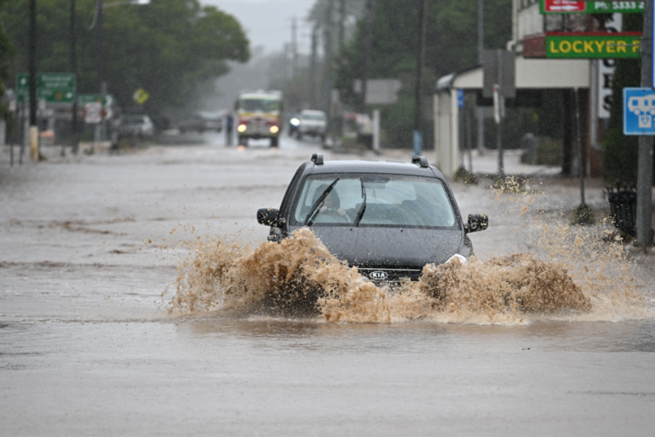
Hard-hit towns like Lismore have yet to recover from the last extreme weather event. Now another is on the way. Photo: Getty
NSW is facing danger on multiple fronts with rain set to worsen, threatening floods and erosion as conditions deteriorate earlier than expected.
Areas stretching from Newcastle to the South Coast and as far inland as Oberon are in the danger zone, including western Sydney’s flood-prone Hawkesbury-Nepean area.
The Bureau of Meteorology had a severe weather warning in place for heavy rain leading to flash flooding, winds up to 90km/h and damaging surf along the coast on Sunday afternoon.
Warragamba Dam in Sydney’s west began overflowing at 2am, well ahead of predictions, NSW Emergency Services Minister Steph Cooke said.
The Hawkesbury-Nepean River also exceeded major flood levels on Saturday night.
A developing east coast low-pressure system was expected to drive further rain in the coming days.
Thunderstorms are also expected, further complicating a rapidly changing situation, raising fears of flash flooding and putting even more pressure on the SES and emergency workers.
‼ EVACUATION ORDER Parts of #Camden ‼
NSW SES is directing residents and businesses within parts of Camden to evacuate now.
Go to https://t.co/FZooFaii4k for the complete evacuation order with exact locations affected and nearest evacuation centre.#NSWFloods pic.twitter.com/jCQ4Aw2bC5— NSW SES (@NSWSES) July 2, 2022
Residents in a number of areas have been ordered to evacuate, but Ms Cooke said people don’t need to wait to be told to leave.
“If you are feeling uncomfortable or unsure about your circumstances, and there is an opportunity for you to leave earlier, don’t necessarily wait for an evacuation order to be issued to your area,” she said.
SES Commissioner Carlene York said the agency conducted 29 flood rescues in the past 24 hours.
While the SES endeavoured to issue evacuation warnings before orders, the speed at which the situation unfolded overnight meant several areas were ordered to evacuate with no warning.
Ms York said locals should monitor the situation on the ground while also checking for SES warnings.
“Be prepared and be aware of your surroundings so that you can make a sensible and safe decision to get to a location of safety,” she said.
The SES will be joined by other agencies, including about 100 Australian Defence Force members on Sunday, assisting with sandbagging and other preparedness measures like doorknocking communities to warn of the flood threat.
“At this stage, we’ve asked them to really concentrate on the Hawkesbury-Nepean Valley area which seems to be the big risk,” Ms York said.

Sydney is under drenching clouds and it could get much worse. Photo: AAP
The catchment’s residents have faced repeated flooding in recent years, including in March and April this year.
The weather front battering the state’s east coast is forecast to get worse before it gets better, with wild winds, rough seas and heavy rain expected to last until Tuesday.
Bureau of Meteorology hazards preparation and response manager Jane Golding said a coastal trough lingering since Friday had deepened and an east coast low-pressure system had formed off the Mid North Coast.
“That’s produced some extraordinary rainfall rates over the last 24 hours … many locations have seen up to 200mm and some close to 300mm,” she said.
The weather system is expected to move south along the Hunter and Central Coast before hitting Sydney in the next 24 hours, before shifting offshore.
Thunderstorms are also expected, potentially delivering more rain that could trigger flash floods, Ms Golding warned.
There’s a risk strong winds could topple trees after heavy rain saturated soils.

Trying without success to stay dry in Sydney’s CBD. Photo: AAP
The SES warned residents not to expect the same consequences from heavy falls as previously, with saturated catchments likely to produce different results.
“The accumulation of heavy rainfalls over the number of days will have a different effect on the flow of rivers,” NSW SES Commissioner Carlene York said.
“A different effect on flash flooding which, by its name, can come very quickly and be very unexpected.
“The main message from the SES is for people to think about their own safety and the safety of their family and friends.”
EVACUATION ORDERS IN PLACE IN PARTS OF:
- Agnes Banks, Gronos Point, Plough and Harrow Dam near Abbotsbury and Cecil Hills, Pleasure Point, Bents Basin, Wallacia, Camden, Woronora, Chipping Norton, Georges Hall, Lansvale, Moorebank, Warwick Farm
EVACUATION WARNINGS IN PLACE IN PARTS OF:
- East Hills, Picnic Point, Penrith, Emu Plains, Mulgoa, Jamisontown, North Richmond, Pitt Town, Cornwallis, Cattai
MODERATE TO MAJOR FLOODING POSSIBLE ALONG:
- Hawkesbury and Nepean Rivers, Colo River, Georges River
-with AAP


