Thunderstorms forecast for flood-stricken areas in two states
The Namoi River peaked at 8.61 metres at Gunnedah on Sunday – with the local mayor saying there is a "mind-boggling" amount of water in the district. Photo: Facebook/Gunnedah Shire Council
Severe thunderstorms are forecast to bring damaging winds and giant hail to areas on the NSW-Queensland border already battered by a week of torrential rain.
The weather bureau issued the warning for the NSW north-west slopes and plains, central-west slopes and plains and upper western forecast districts on Monday afternoon.
Across the border, there was a similar warning for the towns of Thargomindah, Charleville, Cunnamulla, Quilpie, Windorah, and Stonehenge.
“Severe thunderstorms are likely to produce heavy rainfall that may lead to flash flooding, damaging winds and large hailstones in the warning area over the next several hours,” the BOM said.
Monday’s warning came with many towns in northern NSW and southern Queensland already battling floods.
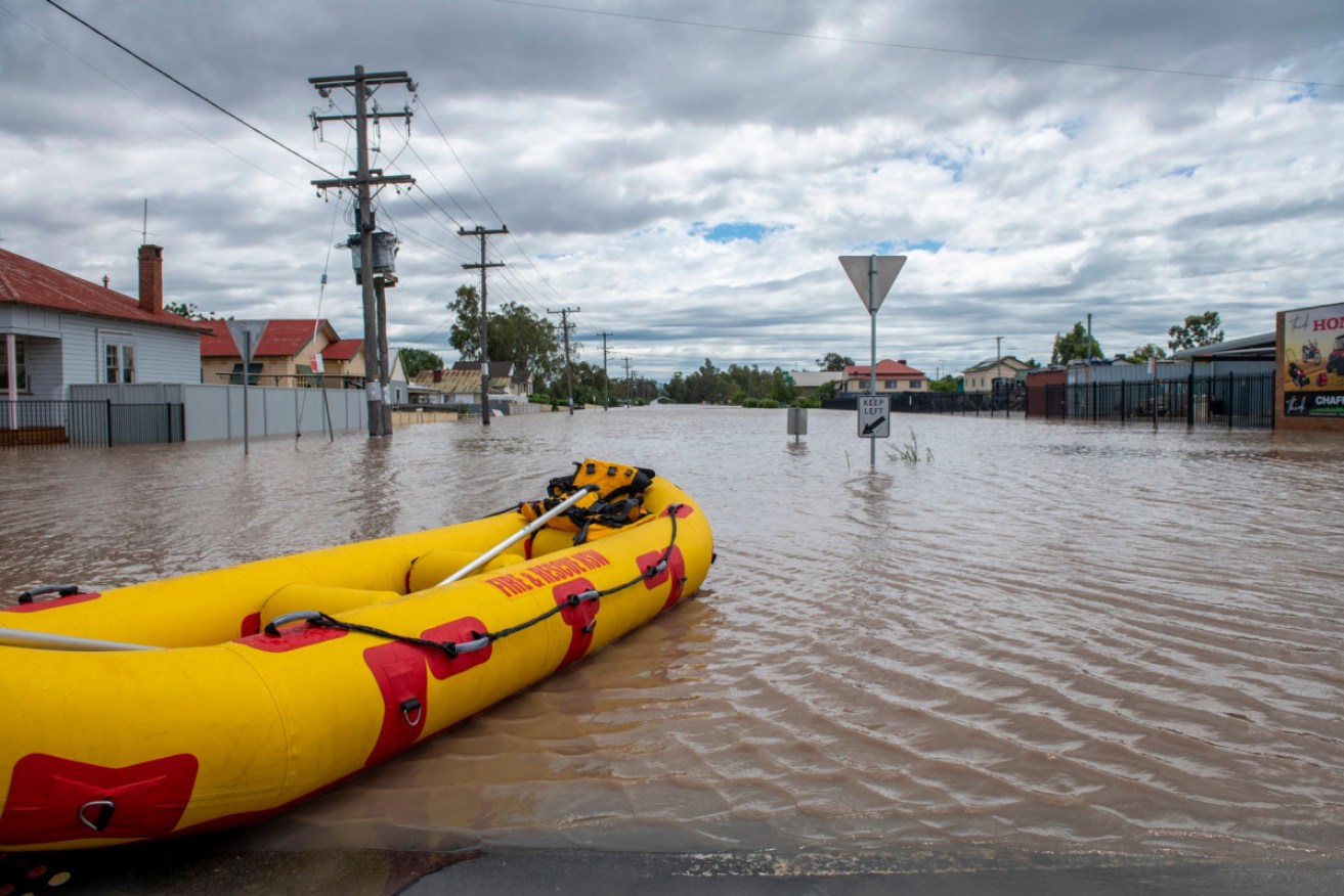
In NSW, the SES has had nearly 5000 calls for help in flood-stricken areas.
Gunnedah Mayor Jamie Chaffey said the volume of water pooling across the region was mind-boggling.
“We’ve got an extraordinarily large amount of damage right throughout the shire,” he told the ABC.
The Namoi River broke its banks at Gunnedah when it peaked at 8.61 metres on Sunday morning. There was major flooding and reports of inundation in some homes in the flood plain.
Floodwaters are slowly receding in Gunnedah but levels are rising downstream at Narrabri.
More than 400 SES workers remain on the ground across the state. They have performed more than 71 flood rescues since Thursday.
NSW Premier Dominic Perrottet urged people in flood zones to follow advice and heed warnings.
“There are many challenges in relation to this facing our state at the moment,” he said on Monday.
The SES had performed more than 30 flood rescues in 24 hours as people took risks by trying to drive through floodwaters.
“That is way too many,” he said.
“They are putting their lives at risk to protect you and your families.”
The Namoi and Lachlan rivers pose the biggest risk, with the SES dropping emergency supplies by helicopter to people who are isolated.
There is a minor to major flood warning for the Namoi River at Gunnedah, Boggabri, Narrabri, Wee Waa, Bugilbone and Goangra.
Tweet from @BOM_au
Queensland drivers have also been urged not to try to cross flooded areas, with the RACQ saying about 280 roads were closed due to heavy rain on Monday morning.
BOM senior meteorologist Helen Reid said severe thunderstorms with heavy rainfall were possible across Queensland in the next 48 hours.
“Heavy falls from thunderstorms could lead to flash flooding in addition to the riverine flooding throughout much of southern and eastern Queensland at the moment,” she said.
“Many rivers are in flood, lots are at moderate level, some are at major as well, particularly in the south.
“Rivers that don’t already have a minor flood warning have a flood watch covering most of eastern and southern Queensland.”
Tweet from @WRHS_official
Showers and thunderstorms are expected to also continue throughout NSW until Wednesday.
There is minor flooding at Singleton and along the Hunter River at Maitland, while similar conditions are possible at Raymond Terrace with the high tide on Monday night and Tuesday morning.
The Severn River at Ashford in the Northern Tablelands peaked on Sunday with moderate flooding, and minor flooding is occurring at Yetman, where river levels peaked on Monday morning.
The Castlereagh River at Coonamble peaked at about 5.1 metres on Sunday with moderate flooding. It is expected to slowly fall but river rises will occur downstream of Coonamble for several days.
Along the Macquarie River in the central west, the flood peak is approaching Warren Town and moderate flooding is expected.
Elsewhere, parts of north Queensland were on flood alert on Monday after with heavy rain triggered a landslide and closed schools and roads.
The Mackay region has been the worst hit by thunderstorms that have drenched Queensland since the weekend, with Paget copping 304 millimetres in the 24 hours to Monday morning.
The downpour flooded the Mackay Christian College campus and grounds – forcing the school’s closure on Monday –along with roads throughout the region.
Heavy rain has also been blamed for causing a landslide near Sarina, south of Mackay, that restricted access to a northbound lane.
The SES has helped Mackay residents sandbag their properties.
Want to see more stories from The New Daily in your Google search results?
- Click here to set The New Daily as a preferred source.
- Tick the box next to "The New Daily". That's it.