NSW coastal towns brace for deluge as Sydneysiders told to ‘stay indoors’
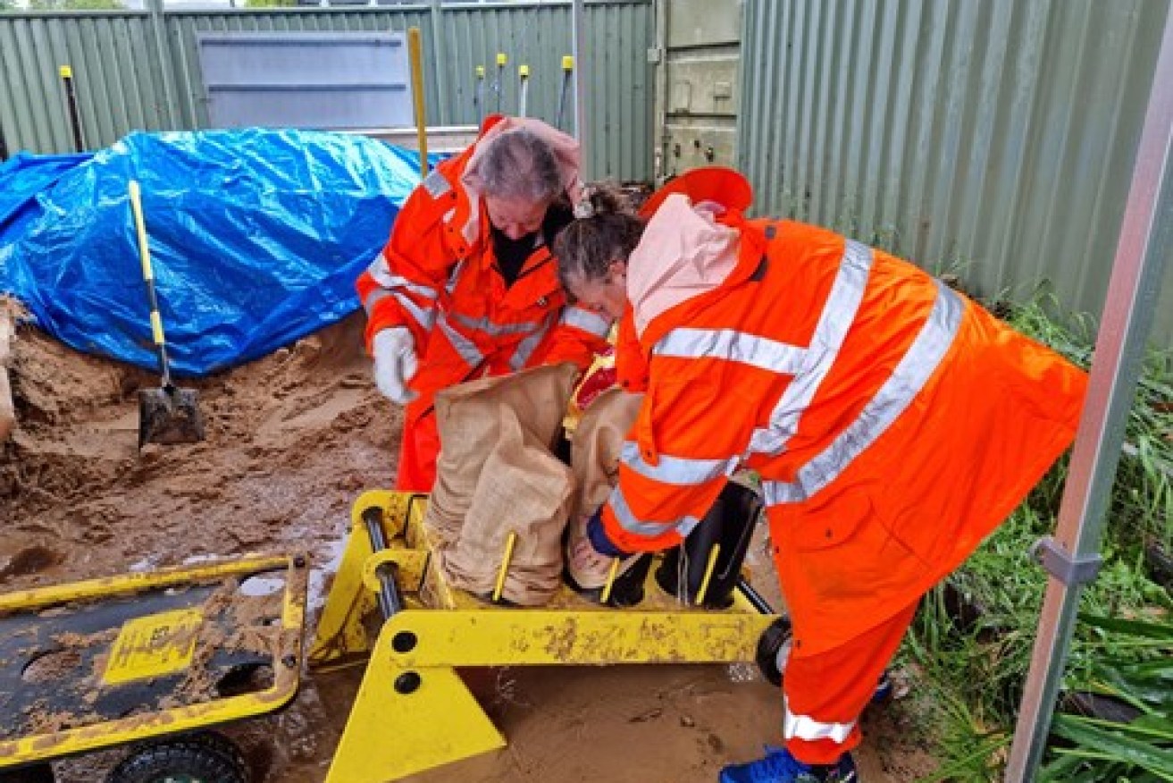
SES volunteers preparing sandbags at Lake Macquarie. Picture: SES
Sydneysiders have been warned to “stay inside” as a large stretch of the NSW coast braces for a wild weekend which could include dangerous downpours causing “life-threatening” flash flooding.
The weather bureau on Saturday morning issued a severe weather warning for an area stretching from the mid-north coast to the far south coast of NSW as well as Canberra.
Sydney has been plagued for most of the week, but the deluge arriving on Saturday will be on another level, the Bureau of Meteorology warned.
The BOM’s Agata Imielska said the falls in Sydney would be significantly more intense than in recent days.
“This will be the difference between what could seem like inconvenient rain, to actually something that might be quite dangerous and threatening,” she said.
“It is really important for Sydneysiders to be mindful about reconsidering their plans.”
While the rain will be “substantially heavier” than what Sydney copped earlier this week, it will not be of the same intensity that hit the mid-north coast on Thursday and Friday.
Over the next 24 hours, the weather bureau forecasts heavy rain and flash flooding for the Mid North Coast, Hunter, Sydney Metropolitan, Illawarra, Central and Southern Tablelands, ACT, Southern Highlands and South Coast districts.
“The focus of heavy rain…is expected to be across the Hunter district during the early hours of Saturday morning, extending to the Sydney Metropolitan, Blue Mountains, Central Tablelands and Southern Tablelands districts through the day,” the BOM warning states.
“In these areas, there may be periods of intense rainfall, potentially leading to life-threatening flash flooding.
“Roads are likely to be cut off by water, and there will be an increased risk of landslips over this period.”

Work underway on a sea wall in an area prone to coastal erosion, at Collaroy beach in Sydney. Picture: AAP
The NSW weather warning includes damaging winds averaging 60-70km/h with gusts exceeding 90km/h, damaging surf and significant wave heights of 5 metres.
The latest update comes as some areas have experienced record rainfall and up to 100mm fell in an hour in some catchments while the rain gauge at Delward collected 327mm from 9am Friday.
The heaviest rainfalls from 9am Friday to 130am Saturday were in Delward 327mm, Redoak 286mm, Logans Crossing 289mm, Upper Rollands Plains 258mm (including 125.8mm in 3 hours), Koree Island 262mm, Kindee Bridge 257.4, Wauchope 250mm, Mt Seaview 247mm and Bowraville 210.0mm (including 124mm in 1 hours).
SES volunteers spent overnight Friday performing 57 rescues and responding to more than 800 calls for help as a dozen rivers along the NSW coast flooded.
Eight evacuation orders were in place overnight Friday and people were ordered to flee to higher ground in low-lying areas of North Haven, Dunbogan, Laurieton, Port Macquarie, Lower Macleay, Kempsey CBD, Wauchope and Rawdon Island, Bulahdelah, Kings Point and Macksville CBD.

SES volunteers preparing sandbags at Lake Macquarie. Picture: SES
“We’re seeing rainfall totals of over 100mm falling in about an hour,” meteorologist Agata Imielska told reporters on Friday.
“That is very dangerous rainfall.”
The Hastings River was expected to exceed record levels overnight, and the Kempsey CBD was forecast to flood.
NSW Flood Operations Manager Justin Robertson said there were concerns about “significant flash flooding” in Greater Sydney.
“We’ve got a flood watch current for both the Nepean and Hawkesbury rivers, we’re expecting that to be around the moderate level, but even higher flood levels are possible,” he said.
“Some of our modelling does indicate that we’re likely to see a spill from Warragamba Dam and that will then impact those communities downstream.”

Road washed away by floodwater on Foreshore Drive in Corlette, NSW. Picture: AAP supplied
The SES issued an update at 3.30am Saturday saying saturated catchments coupled with more rain would create a “potential life-threatening weather event”.
“The NSW SES is asking all people in areas impacted by floods and storms to monitor the situation closely and act on all advice given by emergency services immediately,” the SES said.
“The accumulative effects of heavy rainfall on now soaked catchments has increased already flooded rivers, rates and rises.”
Since Thursday the NSW SES has received over 2700 jobs across NSW and performed 135 flood rescues.
-with AAP