BOM warns of ‘life-threatening’ flooding and winds across NSW
Coffs Harbour was flooded after the region received over 200 millimetres of rain. Photo: Sue Howson
Heavy rain lashing the NSW coast from the Illawarra to the mid-north coast has sparked warnings of “life-threatening” flash flooding and windstorms for multiple areas, including greater Sydney and the state’s far west.
On Thursday night, the Bureau of Meteorology issued severe weather warnings for the northern half of NSW for damaging winds and heavy rainfall.
Overnight on Thursday, up to 100 millimetres of rain fell across the regions, sparking more than 400 calls for help to the NSW State Emergency Service.
Tweet from @weatherzone
In the 24 hours to Friday morning, SES crews carried out 11 flood rescues, including three in western Sydney.
And the dangerous weather shows no signs of easing.
Up to 50 millimetres of rain is expected in Sydney on Friday, with up to 120 millimetres on Saturday. The downpours will be accompanied by windgusts of up to 90km/h.
Premier Gladys Berejiklian urged NSW residents to stay home this weekend.
“If you did have plans to travel on the roads, please reconsider,” she said.
“This weekend is going to be quite severe in terms of weather conditions, and we don’t want to see any lives lost because of that.
“Please follow the warnings, please stay home where you can, and don’t go travelling around on the roads.
Tweet from @BiancaNogrady
On Friday morning Sydney’s light rail network was knocked out between Central and Circular Quay when overhead wires went down and a train was evacuated near Kellyville.
NSW Transport Minister Andrew Constance said replacement buses had been sent out ahead of the looming storm. Engineers were investigating why the overhead wires went down.
“We’re looking at the root cause [but] it is a bit of a coincidence that we’ve had two of our major networks taken out during the height of the bad weather,” Mr Constance told the ABC.
BOM meteorologist Jackson Browne said the storms would move south towards Sydney and the Illawarra and continue into Saturday.
“Strong, moist easterly flow in the Tasman Sea is pouring into the NSW Great Divide, with a coastal trough forming, providing a focus for heavy rainfall,” he said.
Mr Browne said the coastline should expect to get drenched throughout the weekend. The bureau has forecast up to 300 millimetres of rain from Thursday night to late Sunday.
On Friday morning, the BOM raised the alert level.
Flood watch alerts have been issued for the mid-north coast, Hunter, Central Coast, Sydney metro and Illawarra coast and far west areas.

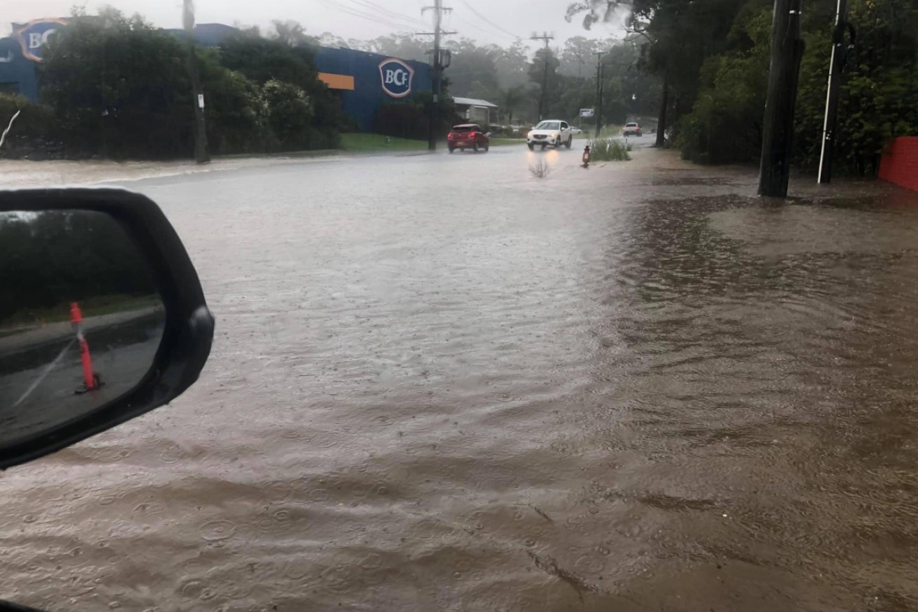
Newcastle and other parts of the Hunter also saw torrential rain. Photo: YouTube
NSW SES assistant commissioner Sean Kerns said drivers should reconsider their travel and avoid driving in flood waters. He said the service’s volunteers were preparing for a difficult weekend.
“We are responding as we get calls for assistance, we are putting warnings out to local communities. At this stage there is a flood watch for 23 river catchments,” Mr Kerns told the Nine Network on Friday.
The biggest risk is on the mid-north coast. where the Orara, Bellinger and Hastings rivers are being closely watched ahead of expected minor to moderate flooding.
The Georges, Nepean and Hawkesbury rivers in the Sydney region are also expected to be affected.
Tweet from @TysonMillar
Emergency services have warned conditions will remain dangerous and are telling motorists to take extreme care around flood warning areas.
The deluge is set to continue well into next week and could deliver the heaviest rainfall since February 2020, when greater Sydney was hit.
The mid-north coast copped the worst of the conditions on Thursday as a low-pressure system moves south to the Hunter, Illawarra and Sydney.
Catchments are already soaked and it won’t take much more for them to flood, the BOM’s Agata Imielska said.
“It’s the difference between being inconveniently wet to conditions drastically changing to being dangerously wet,” she said.
The bureau said the low-pressure system was a “significant system” bringing peak gusts of more than 90km/h.
Forecasters say more than 100 millimetres of rain is expected in a short period of time in some regions.
“We’re very concerned about the potential for flooding along the coastal rivers from the mid-north coast down to Sydney,” bureau flood operations manager Justin Robinson said.
Towns likely to be affected include Coffs Harbour, Port Macquarie, Taree, Woolgoolga, Sawtell, Bellingen and Dorrigo.
Inland NSW is also expected to get its share of the rain when a separate system moves in next week.
-with agencies