‘Slow down’: Dozens of people rescued from cars as heavy rain hammers NSW
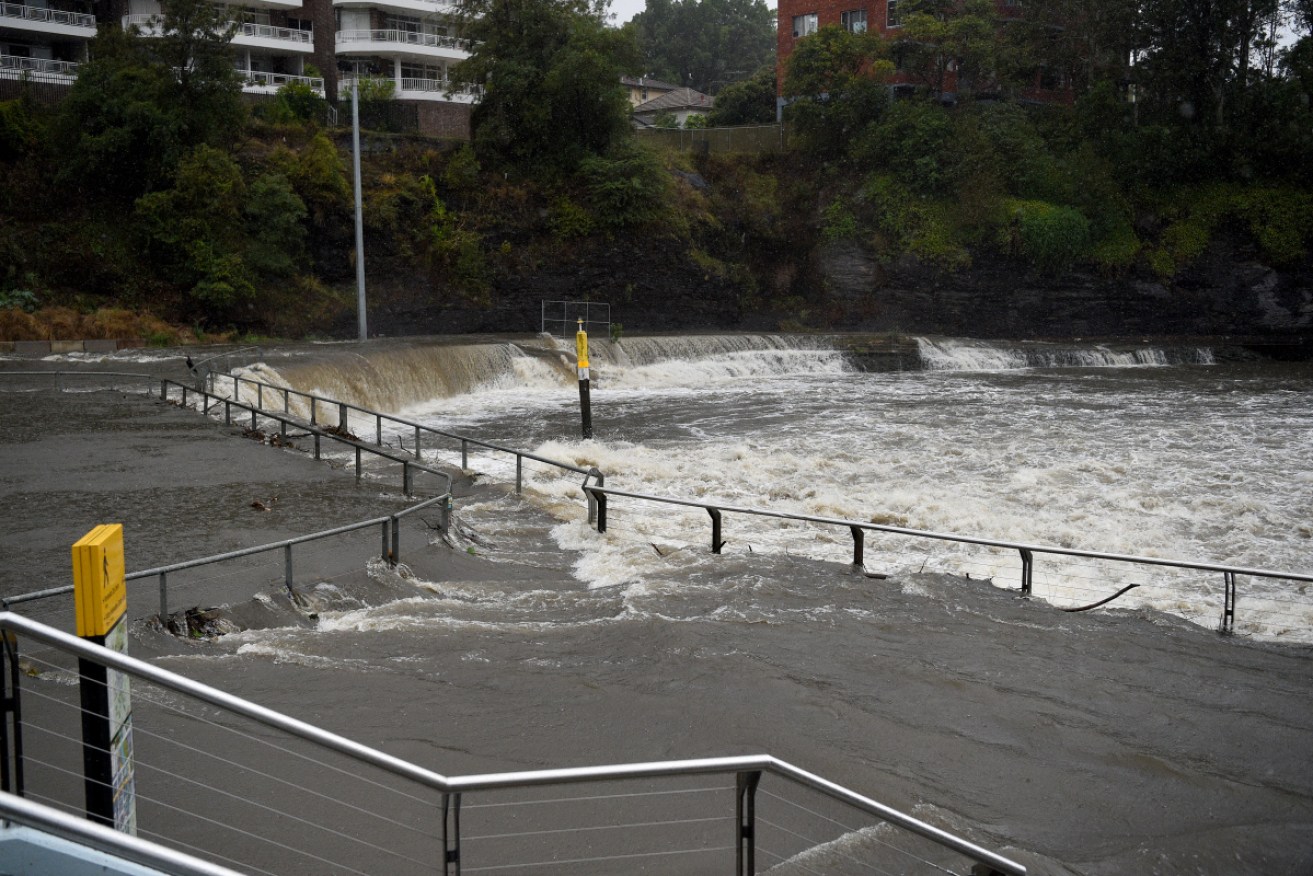
Heavy rain flooded the Parramatta River on Friday afternoon, as thousands of commuters struggled to make the trip home. Photo: AAP
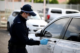
Emergency services are pleading with motorists to take care after rescuers came to the aid of 15 carloads of people who became stuck trying to drive through floodwaters on the NSW Central Coast overnight.
The New South Wales State Emergency Service warning comes as the Bureau of Meteorology forecast more wild weather and flooding across NSW on Saturday, with potentially the heaviest rain in 25 years.
“There’s always an alternative route, never drive through floodwaters,” SES spokesperson Terri Langenemdam said, after carloads of people had to be rescued in the Gosford and Wyong areas (80km north of Sydney) overnight.
“There’s also a reminder to keep kids away from creeks, drains and causeways.”
The SES has so far received 1600 calls for help and has more than 600 volunteers on the ground as a severe weather warning was issued from Coffs Harbour to Moruya.
The Bureau of Meteorology is warning of flooding on the Central Coast, greater Sydney and Illawarra regions, Central Tablelands and Blue Mountains.
The weather bureau’s acting NSW state manager Jane Golding said parts of the state had over 200mm of rain on Friday and falls of 100mm-plus were expected on Saturday with rain expected to intensify over the next 24-36 hours.
“The system that is driving this rain looks like it moves off the coast during Monday,” Ms Golding said.
“We have showers forecast for the next week but that intense, widespread steady rainfall looks like it will rapidly ease either late Monday or during Tuesday.”
The BOM had warnings in place for the Brunswick, upper Nepean, Orara, Moruya, Clyde and Colo rivers, Wollembi Creek, Tuggerah Lake and St Georges Basin with moderate to major flooding expected.
Strong winds were also expected with waves of between five to six metres set to batter the coast between Bateman’s Bay and the Central Coast.
After being ravaged by recent fires, the South Coast was now set to be lashed by heavy rain from late Saturday.
“There is an elevated risk for things like landslips occurring,” Ms Golding said.
“There is also a lot of debris around at the moment because of the fires and that tends to get washed into creeks.
Flooding at Parramatta river weir!!#sydneyweather#sydneyrain pic.twitter.com/T7VYtmRJ9b
— Ben Mackey (@Bengmackey) February 7, 2020
The NSW SES warned drivers to take care on the roads.
“Its pretty treacherous on the roads, slow down, stay away from creeks and swollen waterways … flash flooding occurs quickly and people need to have their wits about them,” Mr Langenemdam said at a news conference at the State Control centre on Saturday morning.
A deluge that started last night & by the end of the weekend, the drenching rain will be a game changer for Sydney's water crisis. More than 200mm are expected to fall in our dam catchment areas, raising levels from 42% to close to 70%. https://t.co/mKb4PBUYxN #SydneyRain #7NEWS pic.twitter.com/whoGIE0O1G
— 7NEWS Sydney (@7NewsSydney) February 7, 2020
Overnight, rain bucketed down on the Central Coast with Mt Elliot receiving 184mm of rain, while Toukley (159mm), Kangy Angy (140mm) and Wyong (125mm) received similar amounts from 9pm Friday to 4am Saturday.
A trough lying along central and northern NSW is expected to bring heavy rain and wind to Sydney and the surrounding regions on Saturday before extending to the South Coast late Saturday and Sunday.
Fears of another notorious east coast low
A so-called “east coast low”, bureau forecaster Abrar Shabren told the ABC the low had a possibility of developing when the existing offshore trough combines with warm sea surface temperatures and a cradling high to the south, with signals it could develop over the next few days.
“At this stage it might develop somewhere along the mid north coast of New South Wales,” he said.
They are quite erratic and notorious systems to predict, and can produce gale force winds and torrential rain, he said.
“Most of the worst conditions will be to the south of the low, while to the north of the low there could be areas of clear skies,” he said.
Previous east coast lows impacted during the Sydney to Hobart yacht race in 1998, in 1997 when the Pasha Bulker washed ashore in Newcastle and nine people were killed in the region and in 2016 when a swimming pool fell into the sea off Collaroy.
Heaviest rain to 7am this morning: Wallis Lakes 211mm, Bungwahl 200, Erina Heights 172, Palm Grove 167, Narara 143. Sydney 71 (150mm since 10pm Thursday). Severe Weather Warning current with heavy rain areas to continue. Latest forecast: https://t.co/qPvmEzHb16 pic.twitter.com/Kj4Tbwhn6r
— Bureau of Meteorology, New South Wales (@BOM_NSW) February 7, 2020
The Bureau of Meteorology is warning of flash flooding and river flooding on the Central Coast, Sydney, Illawarra, Central Tablelands and Blue Mountains.
Heavy rain and flash flooding is also expected in the Mid North Coast and lower Hunter regions.
- Related: Border to border flood warnings
The NSW SES said they had pre-positioned resources in regions which were expected to be flooded and warned residents to avoid unnecessary travel during storms.
Forster on the Mid North Coast and Nowra on the South Coast were also expected to cop damaging wind gusts in excess of 90kmh and abnormally high tides.
Football matches and other sporting events have also been impacted, with the Sydney Derby postponed due to the torrential rain.
The #SydneyDerby that was scheduled to be played at Netstrata Jubilee Stadium today has been postponed due to torrential rain in the Sydney basin over the past 48 hours: https://t.co/oeeBzZ87Lj #WSW pic.twitter.com/rAjsUx9he5
— WS Wanderers FC (@wswanderersfc) February 7, 2020
-with AAP