Late winter soaking coming to NSW, Queensland
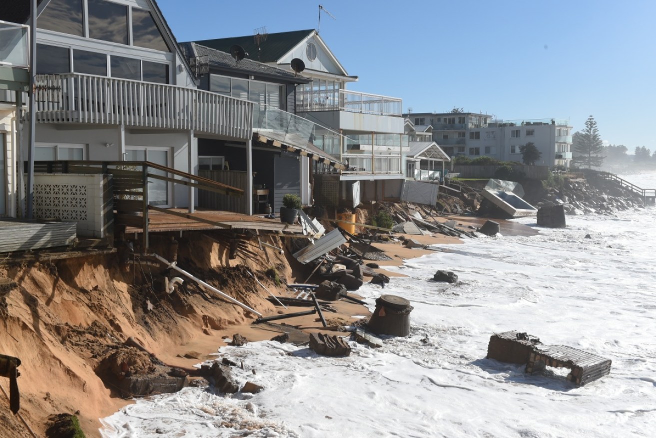
The damage caused by violent storms which hit Sydney in June.
If you live in Queensland or New South Wales, grab your brollie. It’s going to be wet, wet, wet for the rest of the week.
Both states are being warned to brace for days of torrential rain, with flooding forecast for Wednesday and Thursday and potentially damaging winds to lash the coastal fringe of Sydney.
The rain will hit Sydney in earnest on Wednesday, says the Bureau of Meteorology (BoM), and will continue into the weekend. The NSW capital is forecast to record up to 70mm of rain in a single day, while Brisbane sloshes around in 35mm.
After a rainy start to the week, Melbourne will be dry but cold through to the weekend. Residents of Adelaide, Darwin and Hobart can also leave their umbrellas at home, but Perth will endure a stormy and wet Friday.
When will the sun return?
The late winter storms will ease in Queensland by Friday, but the rain will continue falling in Sydney through to Saturday.
“Heavy rain and strong winds will definitely be a risk around the Sydney coast over the next few days,” says Weatherzone meteorologist Craig McIntosh.
“Riverine flooding will definitely be a risk for the east coast. Flash flooding is likely in urban areas due to high amounts of rainfall.
“By the end of the week that could lead to 40mm to 80mm of rain, with which some pockets over 100mm,” he said, adding that the rain will stretch from the south coast of NSW right up to the mid north coast.

Storms wreaked havoc on parts of NSW in June. Photo: AAP
Where did spring go?
The damp conditions may come as a shock to Sydneysiders, who recently enjoyed a burst of sunny spring weather which pushed temperatures above 25 degrees. In fact, nine out of the first 21 days of August were above 20 degrees.
But the sun will take a winter break for the remainder of this week, with Sydney temperatures forecast to hover in the mid-teens, peaking at about 17 degrees on Wednesday. Brisbane temperatures won’t rise above the low 20s.
According to Weatherzone, the winter soaking is being driven by a broad trough of low pressure and associated upper-level cold air, which are “tapping into copious amounts of moisture in the air over eastern Australia”.

Sydney will get heavy rain for the next few days. Photo: Getty
BoM forecaster Peter Zmijewski said it was not unusual for the weather to jump about at this time of year.
“(It’s) very vulnerable to changes,” he said.
“So you can get hot days and you can get quite cold days as well. That is the nature of our climate.”
The cold weather is good news for the ski fields, with the chance of snow on Wednesday and Thursday, according to BoM.
But relief will come on Friday, when a high pressure ridge builds over eastern Australia which will push the weather offshore. Sydney can expect a largely dry but cloudy day on Sunday.
The wild weather comes just months after storms caused widespread damage in Sydney. A huge low pressure system, which brought flooding and strong winds to New South Wales, combined with a king tide to bring widespread coastal destruction, forcing people to flee homes.