BOM warns Tropical Cyclone Niran expected to intensify as it tracks away from coast
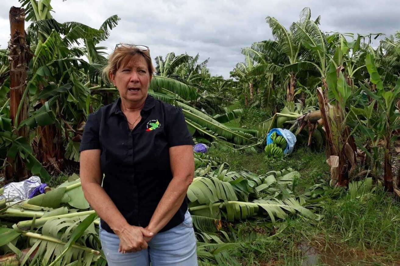
Banana farmers in north Queensland have been devastated by Tropical Cyclone Niran. Photo: ABC News/Holly Richardson
Tropical Cyclone Niran is expected to intensify into a category three storm within the next 24 hours, bringing gales to coastal and island communities.
The slow-moving category two system is hovering about 355 kilometres north-east of Cairns.
Winds of 100 kilometres per hour have been recorded at Niran’s centre, with gusts up to 140kph.
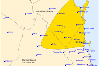
The Bureau of Meteorology (BOM) updated its warning zone on Wednesday morning, with communities from Cape Melville to Innisfail now in the warning zone.
The cyclone is not expected to make landfall.
However, as the system strengthens, gales up to 100kph may develop today or early tomorrow which will impact Innisfail, Cooktown, Port Douglas, and Cairns.

Cyclone Niran was 335 kilometres north-east of Cairns on Wednesday morning. Photo: ABC/BOM
BOM forecaster Rosa Hoff said the system would develop into a category three cyclone later on Wednesday or Thursday.
“From then we’re expecting it to steadily move off in an a south-easterly direction from Thursday and move further away from the Queensland coast,” she said.
With most of the system offshore, the coast will be spared from the worst of the wind.
Townsville and Mackay can expect to see strong winds from Wednesday, and they could be felt around the Capricornia coast all the way down to Fraser Island in the days ahead.
A flood watch is active for coastal catchments between Cooktown and Rollingstone.
“With the threat of heavy rainfall easing we are starting to see river levels go down,” Ms Hoff said.

Crews worked through the night in Cairns to restore power to thousands of customers as the region feels the effects of Cyclone Niran. Photo: ABC/Ergon Energy
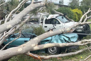
Eleven schools are closed in the Cairns region, and trees and powerlines are still down as drivers continue to ignore safety warnings.
The SES in Cairns said it had attended homes with leaking roofs and minor flooding and while no-one had been injured, emergency responders remained on high alert after responding to more than 165 jobs since Sunday.
Ergon crews in Far North Queensland worked into the night on Tuesday and were out again on Wednesday morning in a bid to restore power to thousands of customers.
Wind gusts have already torn through banana plantations along the coast, decimating crops.
Grower Dianna Sciacca at South Johnstone said farms were not prepared, after an already difficult season of lower prices and a shortage of international workers.
“Most of the farms beside us, they’re looking at 90 to 100 per cent [damage], we’re probably 80 to 90,” she said.
Tweet from @BOM_Qld
“We probably won’t have an income after we’ve cleaned up now until probably September, October this year.
“And same for everyone in this area as well.”
Meanwhile, Townsville’s BOM radar which went off-line on Sunday morning should be working again by Thursday.
BOM senior officer Peter Stone said a part had failed and was being replaced.
“One of the design features of the way we have our radars placed is, if one goes down there are overlapping radars,” he said.
“So, if you look at the radar image for Townsville on the bureau APP for example, the Bowen radar has been covering.”