Cyclone Owen expected to strengthen to Category 4 as it approaches Queensland
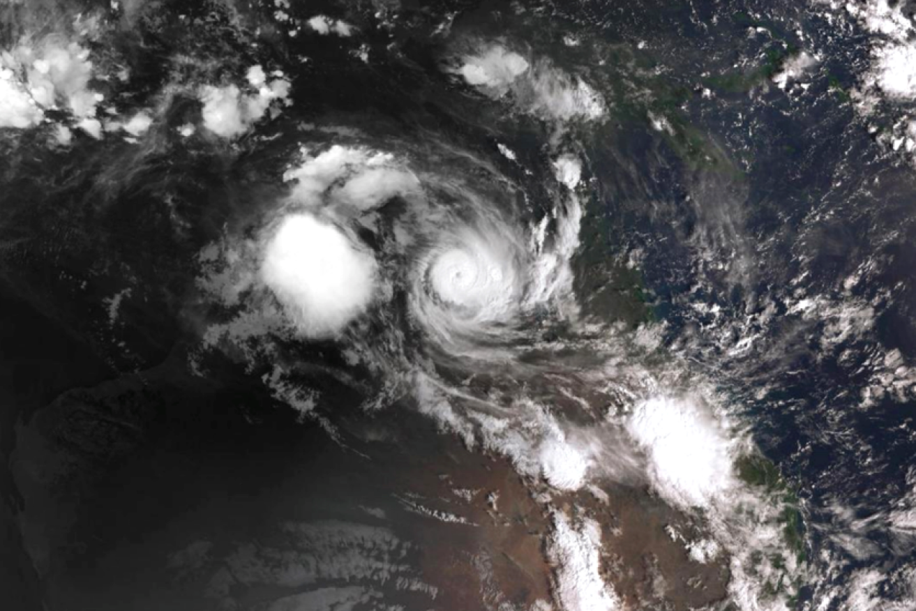
Indecisive Cylcone Owen builds its strength over the Gulf's tropical waters. Photo: BoM
Tropical Cyclone Owen is building strength and has intensified to a Category 3 system amid warnings of “significant building damage” and “widespread power failures” as it approaches the Australian coast.
Owen has been tracking over the Gulf of Carpenteria for the last few days, re-intensifying late Thursday, with authorities predicting it could reach category 4 later on Friday.
Queensland’s far north is battening down ahead of the storm’s arrival, while the Northern Territory town of Borroloola was drenched by torrential rain and lashed with furious winds of up to 130km/h.
Gulf residents were warned to expect gale force to “very destructive” winds between Numbulwar in the NT and Aurukun in Queensland.
The far-north Queensland town of Pormpuraaw is on emergency alert, battening down for the winds expected there from Friday afternoon.
Cyclone Owen could also spark flooding and landslides in other parts of the state, which is still recovering from its recent bushfire crisis.
Authorities are taking no chances and have already evacuated some medically vulnerable residents from the danger zone.

This BoM map charts Cyclone Owen’s meandering route across the Gulf and, if it doesn’t change its mind once more, back to Queensland.
The BoM’s Laura Boekel told reporters in Darwin that Owen was expected to head back towards Queensland and build from a category three to a four system.
“The U-turn has taken a little bit slower and is a little bit further to the coast than we were expecting yesterday,” she said.
“Systems in this area are notoriously erratic and move quite quickly – and the situation can move quite quickly as well.”
Hurricane force winds of 120km/h with gusts of up to 205km/h and rainfall of up to 200mm are expected on the coast between Port Roper and Port McArthur.
Dangerous storm surges and flash flooding are possible.
The Macarthur River Mine port and loading facility at Bing Bong, have been evacuated.
NT Police rescued three fishermen in distress when their boat failed in the Gulf and their EPIRB was activated on Wednesday.
The people living in the affected coastal area had been spoken to or left, including a man who lives alone on one of the nearby Pellew group of islands, police regional controller Travis Wurst said.
Schools were closed and emergency centres opened as communities in the firing line braced for winds that could peak at about 280km/h.
Owen is expected to head south after crossing the peninsula, bringing rain that could cause flash flooding to Queensland’s east coast.
Premier Annastacia Palaszczuk says authorities are worried about heavy rain in central Queensland after the recent bushfires. Eungella, inland from Mackay, is of particular concern.
“Once you have bushfires through an area, with large amounts of rain, there is then the potential for landslides,” she told reporters.
Queensland BOM senior forecaster Richard Wardle said an upper trough in the west of the state was also going to generate extreme weather over the parched southern interior over the next few days.
While decent rain was expected, he stopped short of calling it drought breaking.
Queensland’s disaster coordination centre has been activated and the state’s disaster management committee will continue to meet as the cyclone nears.
Extra rescue and emergency crews have been sent into the cyclone warning area.
-with AAP