Spring fire danger for much of Australia
Parts of NSW, Queensland and WA are facing a high risk of bushfires despite a forecast wet spring.
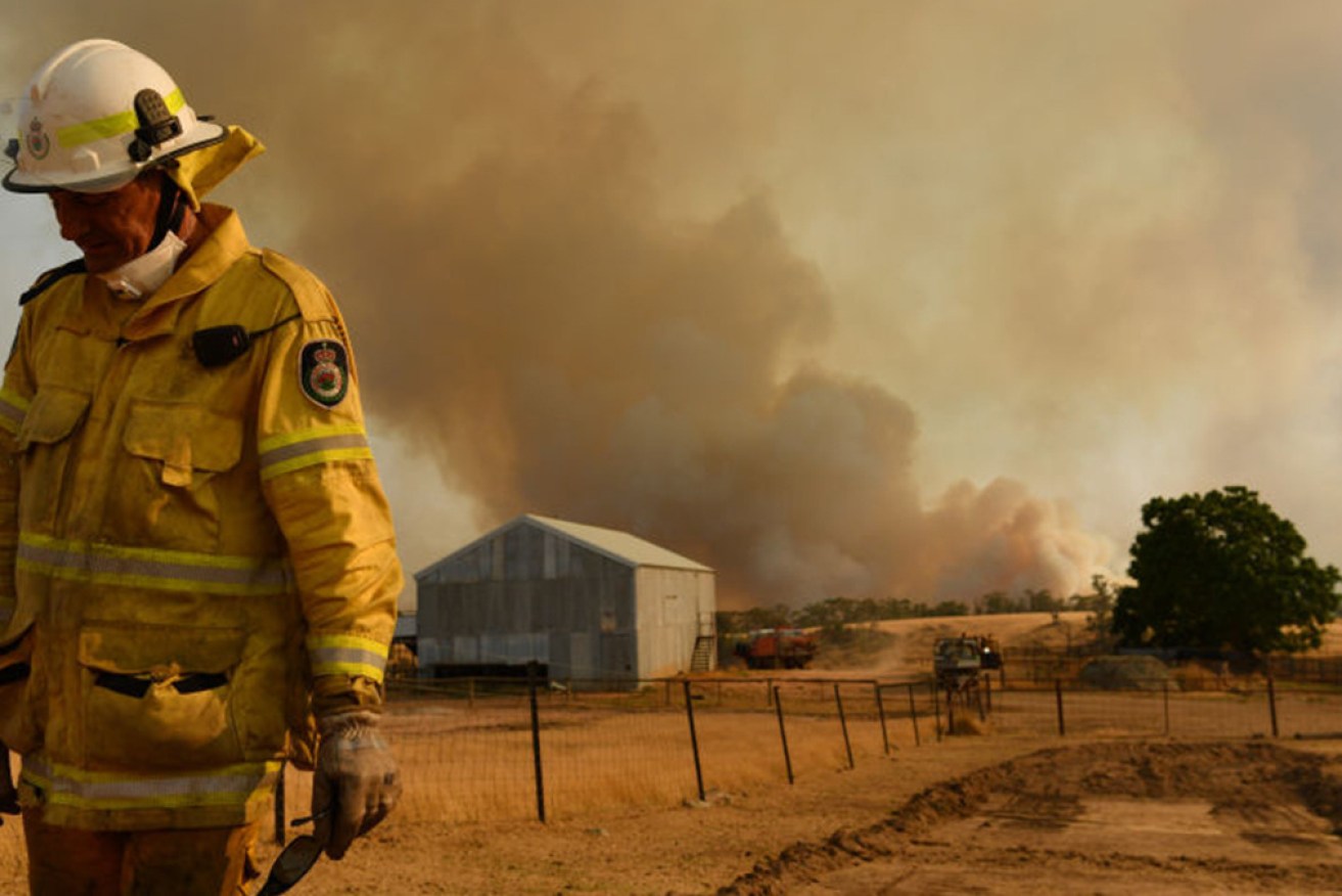
Northern NSW, south-east Queensland and parts of WA’s north are set for above-normal fire activity this spring, despite wet weather remaining across much of the country.
The spring bushfire outlook released on Thursday shows normal bushfire potential for most of Australia with a few exceptions.
Grass and crop growth in south-east Queensland and northern NSW are raising the potential for above-normal fire conditions.
The same risk rating is in place for snippets of WA’s north due to grass growth and dry soil.
The “red zone” covers the NSW regions of New England, Northern Tablelands and Liverpool Ranges, along with large swathes of south-east Queensland up the coast to Mackay.
In WA, the areas of concern include parts of the Pilbara, Dampierland, Central Kimberley and Ord Victoria Plain bioregions.
The outlook, jointly developed by the Australasian Fire and Emergency Service Authorities, the Bureau of Meteorology and local fire authorities, predicts below normal fire potential across other parts of NSW, Victoria and the ACT.
- Read the full report here
This, it said, was a result of vegetation recovering from the devastating 2019/20 black summer bushfire season.
Although the bushfire risk is rated lower in Victoria than normal for this time of year, the Wimmera and Mallee districts might experience elevated fire potential before harvest in late spring with above average rainfall forecast.
“Like last year, we can expect a grassfire-dominated start to the fire season,” CFA Chief Officer Jason Heffernan said.
A negative Indian Ocean Dipole, a natural climate phenomenon that influences rainfall patterns in southern and eastern Australia, is driving a wetter spring outlook for much of the country except western parts of WA.
It is not expected to end until November or early December but is weaker than Australia’s last negative IOD event in 2016, which led to the nation’s wettest May to October period on record.
Bureau of Meteorology climatologist Andrew Watkins said predictions of a wetter and warmer spring followed hot on the heels of the nation’s wettest winter since 2016.
“Australia’s average winter temperature is also expected to be one of the 10 warmest on record, particularly in the tropical north,” he said.
Elsewhere, all of South Australia, Tasmania and the Northern Territory are likely to have normal fire potential across spring.
-AAP