Carnage along Queensland, NSW coast linked to La Niña and climate change

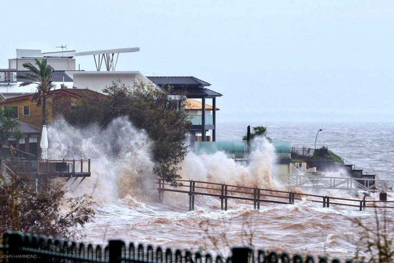
Waterfront homes at Scarborough in the Moreton Bay region are lashed by wild weather and big swells. Photo: ABC News
A violent storm is expected to continue lashing across 1000 kilometres of Australia’s east coast on Tuesday, with climate experts warning more extreme weather events are yet to come.
Since the arrival of heavy rain and abnormally high tides on Saturday, ferocious weather has been smashing buildings and flooding waterways and roads across southeast Queensland and northeast New South Wales.
Most of the destruction has been centred on the Gold Coast and Byron Bay regions, where dozens of beaches remain closed and coastal residents are bracing for homes and businesses to become further damaged on Tuesday morning.

Byron Bay holiday makers and ocean front residents bear the brunt of ‘dangerous’ weather event. Photo: Twitter
Already, dozens of coastal towns have been battered by 100km/h winds and days of rain topping 400 millimetres in some places.
Yet even more rain is forecast.
“Continued heavy rain will see further flash and riverine flooding, with widespread two-day totals of 100-250 millimetres likely,” said a Bureau of Meteorology spokesman on Monday.
Queensland Emergency Services Minister Mark Ryan has warned of the cyclone-like impact of the extreme weather event and said residents must prepare for the worst.
“Many of the impacts from this weather event will be similar to a category-one cyclone event,” he said.
Tweet from @BOM_Qld
In some areas, the combination of gale force easterly winds, spring tides and large waves more than eight metres tall is eating away sand from beaches, the BOM spokesman said.
The major coastal erosion event is doing serious damage.
A high tide hitting the Gold Coast has caused flooding on the streets, while the popular Surfers Paradise beach has been reduced to a thin strip of sand.
Tweet from @peterpanwine
The monster storm, described by the BOM as a “dangerous weather event”, is this summer’s first major sign of La Niña, a complex weather pattern linked to the Pacific Ocean.
Dr Linden Ashcroft, a climate researcher at the University of Melbourne, said “La Niña events are associated with more tropical cyclones and tropical low pressure systems that don’t quite form cyclones, but still bring a lot of damage”.
“We are experiencing a La Niña event at the moment, and it does generally lead to increased rainfall along our east coast,” she said.
“But to have half a metre of rain falling in 24 hours, that’s certainly significant.”
Does La Niña mean more storms are heading our way?
It’s hard to predict, Dr Ashcroft said, though La Niña conditions would certainly encourage more heavy rainfall.
During a previous La Niña event between 2010 and 2011, devastating floods in Queensland caused mass evacuations and resulted in billions of dollars of damage.
Although this year’s La Niña event is unlikely to be quite as strong, computer models predict it will continue until at least January 2021, Dr Ashcroft said.
And, in coming years, climate change will make floods worse.
“In a warmer world, these types of events are likely to become more frequent and when they do happen, they’ll be more intense,” Dr Ashcroft said.
Emeritus Professor Will Steffen, a climate scientist associated with the Australian National University, agreed climate change was likely a contributing factor.
“The sort of conditions that spawn violent storms like this are becoming more frequent because of climate change, because you have more heat and energy in the atmosphere,” he told TND.
However, he went a step further and said the wild weather hitting Australia’s east coast was more extreme than a typical La Niña event.
“It seems right at the edge of how extreme these events can get,” Emeritus Professor Steffen said.
“You’d normally expect to get more rainfall and cooler conditions, but not necessarily such violent storms as we’ve seen just now off the Queensland coast.”
How is the storm linked to climate change?
Between 1902 and 2015, the total sea level rose about 16cm, according to the Intergovernmental Panel on Climate Change (IPCC).
Though it might not seem like much, rising sea levels are contributing to the erosion of beaches along the Gold Coast and in Byron Bay, Emeritus Professor Steffen said.
“During storm surges – when waves pound in on the coast – those waves are now riding on a higher sea level, which means they penetrate further inland and do more damage to coastal areas, and sand dunes and so on,” he said.
“What they should expect is, whenever they do get storms like this, the storm surges will be more damaging and they can expect to get more intense rainfall events when these do occur.”