As NSW braces for more rain, Queensland prepares for a heatwave
The weather bureau says most of us are in for a wetter than average winter this year. Photo: AAP
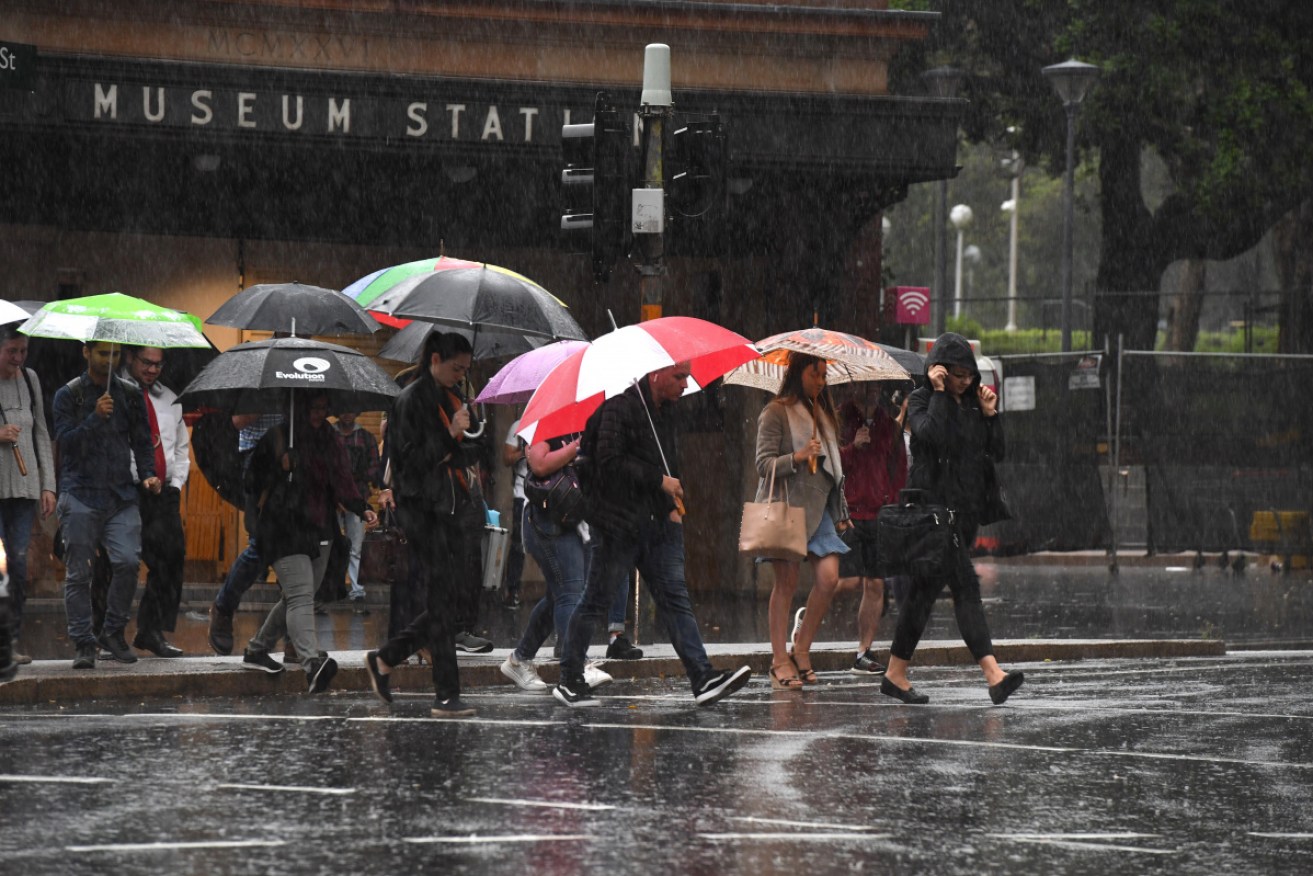
Heavy rain is expected to fall in parts of New South Wales, while north Queenslanders are preparing to swelter through the rest of the week as heatwave conditions set in.
The weather warnings come as Cyclone Uesi barrels through the Tasman Sea towards Lord Howe Island off Australia’s east coast, bringing with it larges swells, high winds and more rain.
What’s most concerning is the dangerous surf conditions Uesi may cause as it pummels beaches south of Fraser Island on Thursday, with forecasters warning of two-to-three metre swells, particularly on the Gold Coast.

It’s expected the category two system will move down the east coast before reaching waters off Sydney on Saturday.
Rain is forecast for much of the state’s coast on Thursday with Sydney, the northern tablelands, mid-north coast, Hunter and South Coast forecast to get a drenching.
Utility provider Ausgrid hopes to restore power to about 25,000 homes and businesses across Sydney and the Central Coast who will wake up on Thursday morning without any power.
Many are bracing for more days without power as utility company Ausgrid works to to get electricity back to all its customers by the end of the weekend.
“This is a natural disaster, it’s the second largest storm in Ausgrid history,” chief operating officer Trevor Armstrong told Channel Nine on Thursday.
“We are working hard to have all restored by the end of the weekend.”
Forecast rainfall threatens to cause the state further damage, with the Bureau of Meteorology issuing a severe thunderstorm warning on Wednesday for the northern rivers and northern tablelands regions, and parts of the Hunter, mid-north coast, central tablelands and north west slopes and plains.
Meanwhile, a moderate to major flood warning remained in place for the Orara River at Glenreagh and Coutts Crossing, northwest of Coffs Harbour.
Heatwave to hit Queensland
February weather records could be smashed by a fierce heatwave expected to hit the state’s far north, with temperatures set to reach into the mid-40s.
“What we have is extreme to severe heatwave conditions building across the tropical north, particularly in areas around Ingham, the Tablelands and across to Gulf country,” Bureau of Meteorology forecaster Kimba Wong said on Wednesday.
“A number of locations will have temperatures in the mid-40s with warm overnight lows only just below 30 degrees.”
There are still many flood warnings in place, with an alert issued for a woman who disappeared near flooded waterways on the Gold Coast.
⚠️WARNING UPDATE: The immediate threat of heavy rainfall in #SEQld has passed. As always, we will continue to keep a close eye on any storms that develop, and further warnings will be issued if required. Note numerous flood warnings are current: https://t.co/zV4t3F2GeX pic.twitter.com/xkCLS7Urkk
— Bureau of Meteorology, Queensland (@BOM_Qld) February 12, 2020
Police say 26-year-old Yang Chen was reported missing about 11am on Wednesday by a man who said he was walking near Gorge Falls in the Tallebudgera Valley when he lost sight of her.
Authorities warn a number of creeks in the area have been affected by recent rainfall and there are concerns for Ms Chen’s safety.
Meanwhile, the rain has impacted hundreds of residents on Queensland’s Sunshine Coast who were left to deal with power outages and submerged roads when the region was hit by torrential rain and flash flooding.
A severe thunderstorm warning for the region and parts of Gympie and the Moreton Bay Council area was issued late on Wednesday.
The Bureau of Meteorology warned of possible intense rainfall leading to life-threatening flash flooding, noting 79mm of rain was recorded at Yandina Creek in just one hour on Wednesday night.

The recent downpour in Queensland has seen some areas get a year’s worth of rainfall in a week. Photo: Getty
Sunshine Coast Airport copped 140mm of rain in three hours and Coolum was hit with 125mm over the same period.
Almost 2000 customers were affected by power outages on the Sunshine Coast, Energex reported shortly before 1am on Thursday.
The Department of Transport and Main Roads reported roads were flooded at various locations including Doonan, Sippy Downs, Mount Coolum, Tewantin and Nambour.
Inland, properties remain under threat in tiny communities isolated by an inland sea of floodwater west of Brisbane, in the state’s far north locals are bracing for searing heatwave conditions.
Other parts of Queensland remain on flood watch, with warnings for coastal catchments between Bundaberg and the NSW border.
-with AAP