No relief from choking smoke that has brought ‘hazardous’ air quality to Sydney
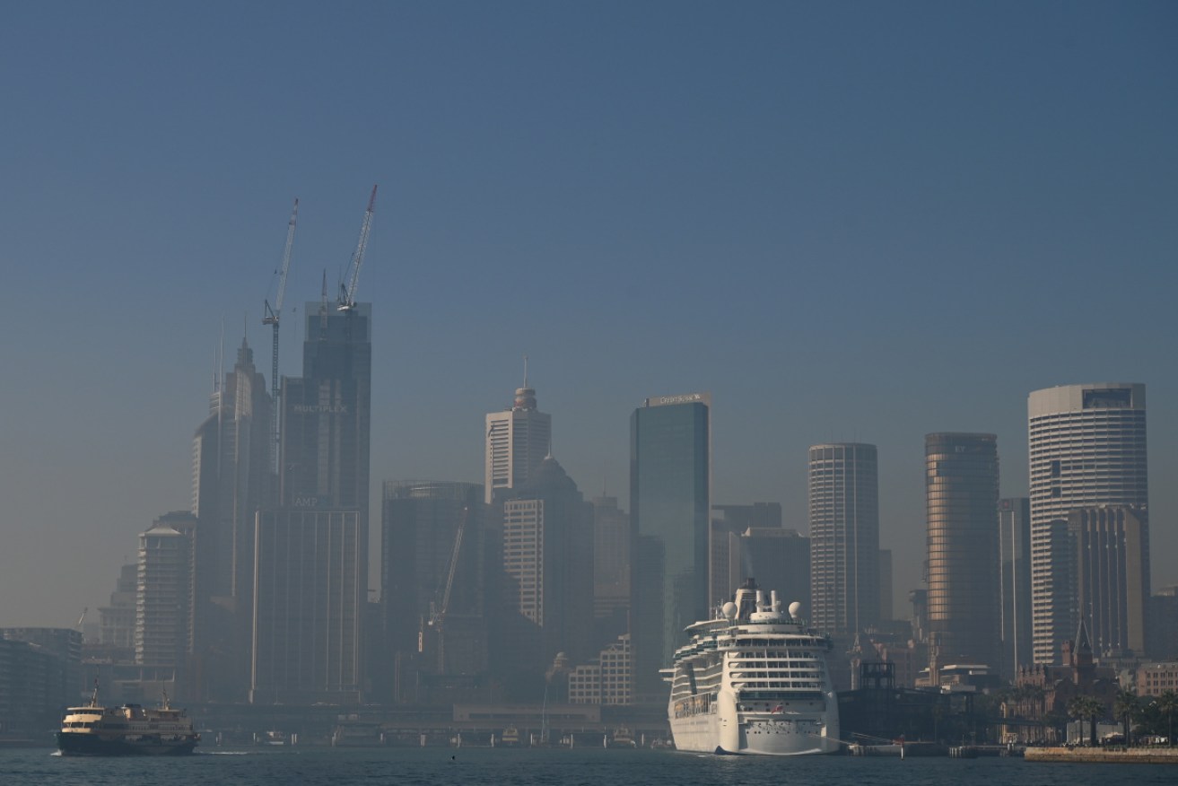
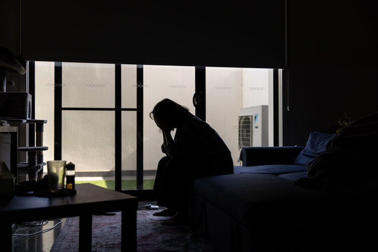
A smokey Sydney CBD skyline on Tuesday. Air quality was also poor across much of the city. Photo: AAP
Sydney-siders have been warned to expect little relief on Wednesday from the choking smoke that has blanketed the city and inner suburbs throughout Tuesday.
NSW Health said late on Tuesday that parts of the state were experiencing hazardous air quality comparable to cities in developing countries, while much of the coast was rated very high or severe in terms of fire danger.
Smoke from fires including a 144,000-hectare “watch and act” bushfire at Gospers Mountain, north-west of Sydney, has drifted over the city.
The Bureau of Meteorology said the haze was likely to be repeated on Wednesday.
The smoke could clear overnight but “the conditions are really there for that sort of thing to return”, the bureau’s NSW regional manager Ann Farrell said.
“We really aren’t going to be out of the woods for the coming days with that air quality issue from smoke over the eastern part of the state.”
Air quality was hazardous on Tuesday afternoon in Sydney’s east and north-west, as well as on the Central Coast, the Northern Tablelands and north-west slopes.
People with asthma or other breathing issues were advised to stay indoors, avoid outdoor exercise and seek medical advice as needed.
NSW Health director Dr Richard Broom said Sydney’s air quality “would at the very least be comparable to some cities in developing countries where they have very poor air quality”.
“On days when there’s high air pollution we see increased rates of hospital presentations and increased numbers of deaths as well, so it’s undoubtedly serious,” Dr Broom said, adding people with pre-existing conditions should be cautious.
Dust was also affecting air quality and a wind change expected on Thursday could exacerbate the problem from the state’s west through to the coast, Ms Farrell said.
That change could trigger thunderstorms into the weekend, which won’t bring much rain but could see lightning strikes ignite additional fires.
Parts of NSW could experience heatwave conditions this week with the state’s west forecast to reach 40 degrees and western Sydney expected to hit the high-30s.
“There’s a set of ingredients there that are going to make firefighting conditions challenging, but really this is part of what’s been quite a long season,” Ms Farrell said.

Air quality across NSW on Tuesday afternoon. Source: Environment NSW
A state of emergency declared by Premier Gladys Berejiklian ended on Tuesday. NSW Police deputy commissioner Gary Warboys said emergency services could request a repeat.
“It’s been pretty clear that if we need [a state of emergency, the] government is in a position to, and keen to, assist us to provide protection and safety to the community,” Mr Warboys said.
Sydney’s smokey weather came as authorities kept a close eye on dozens of fires still threatening communities in NSW and Queensland, where ‘severe’ or ‘very high’ danger ratings were in place on Tuesday.
Parts of Western Australia were under an ‘extreme’ rating, while a total fire ban was in place for the whole of South Australia, ahead of forecast record heat on Wednesday.
The RFS on Tuesday also revised upwards the number of destroyed NSW homes to 577, with more than 420 in the past fortnight alone. Six people have already died in this year’s bushfire season.
Weather conditions posed problems for the 1400 firefighters on the ground battling flames spread by “really problematic” gusts reaching up to 65km/h.
“Not only have we got these high temperatures, the mid to high 30s, dry atmosphere, we’ve got this real mix of converging winds,” Mr Fitzsimmons said.
#Heatwave conditions, severe in some areas, will develop in NSW and the ACT in coming days, with inland areas most affected. Beat the heat with these handy tips from NSW Health: https://t.co/23fUcEADcI For the latest weather forecast: https://t.co/OjBapTUURP pic.twitter.com/W1iHeySi7v
— Bureau of Meteorology, New South Wales (@BOM_NSW) November 18, 2019
On Tuesday morning, a “watch and act” alert was issued for an 11,000-hectare blaze at Guyra Road in Ebor, east of Armidale. Activity on its southern edge had increased but the blaze remained under control.
Elsewhere, Adelaide is forecast to reach a sizzling 42 degrees on Wednesday. The city’s record temperature is 42.7, set in 1962.
Ceduna will swelter through 45 degree-heat, while Murray Bridge, Whyalla and Port Lincoln can expect temperatures topping out about 44 degrees. Port Pirie is likely to reach 43 degrees.
“We are putting restrictions on activities on Tuesday to minimise the risk of fires starting,” CFS chief officer Mark Jones said.
Temperatures are also expected to reach up to 40 degrees in fire-ravaged Queensland as exhausted firefighters struggle to contain 71 bushfires burning across the state.
The weather bureau has forecast heatwave conditions for Queensland on Wednesday.
Of primary concern are the Pechey blaze, a cluster of fires in the Border Ranges region, from Cunninghams Gap to Mount Barney and Mount Lindsay, and one on Moreton Island.
QFES Acting Commissioner Mike Wassing said, with no significant rain expected, the best crews could hope for was to strengthen containment lines and be ready when the heat came.
“We’ve got weeks ahead of us,” Mr Wassing told ABC radio.
“Our planning, from a resourcing perspective across Queensland, is already now projecting out to Christmas and into the new year.”
-with AAP