South-east Australia bracing for heavy rainfall, possible flooding

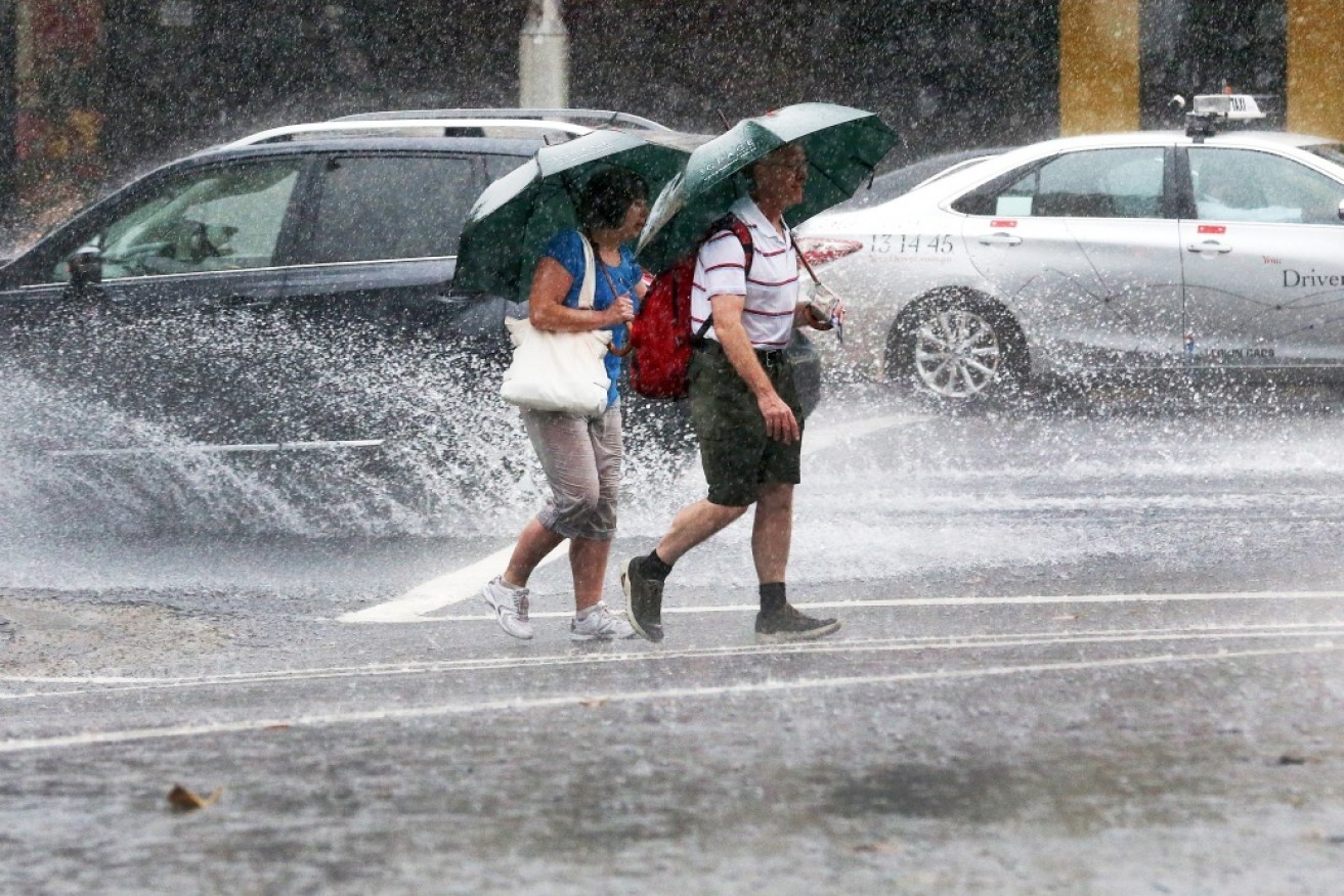
Millions of Australians can expect to shiver as a cold blast brings a taste of winter. Photo: AAP
Extreme rain is rolling across Victoria, New South Wales and South Australia, as flash-floods and thunderstorms threaten Australia’s south-east in what the Bureau of Meteorology warned could be a “10 out of 10” storm.
Wild weather has already lashed South Australia while the worst is yet to come for Victoria and New South Wales, with the Bureau of Meteorology (BoM) warning of possible “significant flooding events” on Friday afternoon.
Melbourne is predicted to receive a destructive downpour before a second trough brings possible storms overnight and across the weekend.
The BoM increased its estimated downfall for Melbourne with 150-200mm predicted in the coming days, meanwhile parts of NSW are also on high alert, with “more than a months rain forecast in 36 hours”.
Victoria braces for a battering
Victorian commuters have been warned of a possible drenching across Melbourne from 4-6pm.
Senior meteorologist at BoM’s extreme weather desk James Taylor told The New Daily Melbourne’s CBD could face “pretty intense stuff” with about 80-150mm of rainfall on Friday afternoon.
He also warned Melbourne’s afternoon shower could be followed by a second storm tonight.
“The most likely time for Melbourne to get heavy rainfall is just ahead of that second passage,” Mr Taylor told The New Daily at 2.30pm.
“The next three to five hours is a risk period for the Melbourne area.”
Meanwhile the greatest risk in Victoria is in the state’s north-east, with 250mm of torrential rain expected the fall by Sunday, Mr Taylor said.
Mr Taylor warned significant and widespread flooding is likely across all districts in Victoria from Friday onwards.
Moderate to major flooding is likely for the eastern half of Victoria, with minor flooding possible elsewhere.
It comes as authorities have warned lives and properties are at risk from the deluge, with 12 Victorians taken to hospital, one in critical condition, after preparing their properties for freak storms on Thursday night.
Eleven men and a woman fell from ladders on Thursday, many while clearing their gutters ahead of the predicted deluge.
Nine of the 12 ladder victims were aged over 50, Ambulance Victoria says.
The most seriously injured, a man in his 80s, was flown to Melbourne with critical head and spinal injuries after falling near Bendigo.
The others sustained head and back injuries, bruises and fractures.
Streets flooding in Pascoe Vale #melbourneweather #melbweather @abcnews @abcmelbourne pic.twitter.com/HFuj9Y1H1w
— Erdem Koch (@erdem_koch) December 1, 2017
South Australia escapes the downpour
For South Australians, the worst of Australia’s wild weather has come and gone, after overnight storms caused more than 3700 homes to lose power across the state.
Bureau of Meteorology (BoM) forecaster Simon Timcke said significant rainfall, strong winds and thunderstorm had struck much the state, with the north-east copping the brunt of it.
According to BoM, thunderstorms could continue into the evening but rainfall is predicted to ease.
“Our expectation of thunderstorms is towards the north-east and then during the overnight period there’s a slight chance there will be a few thunderstorms,” Mr Timcke told The New Daily.
The SES responded to about 60 calls on Thursday night with most in the Adelaide area.
More than 2600 homes near Bordertown were left without power, while 200 residents in the Port Pirie region were also hit.
Homes in Hindmarsh Valley, Nuriootpa and Bradbury are currently still without power.
New South Wales deluge on its way
Meanwhile, as Sydney-siders soak up the sun, the state’s north braces for a month’s-worth rain in the next 36 hours.
Sydney will be spared the worst of the weather event, as the heaviest falls are mostly expected to be during the latter half of the day on Friday, and throughout Saturday, according to BoM.
The rainfall totals for the next 48 hours are expected to surpass 100mm over the Riverina, South West Slopes, parts of the Lower Western regions, while 200mm is expected for areas to the Victorian border.
Areas including Yass, Condobolin, Wagga Wagga, and Albury are expected to be the severely affected in the coming hours.
The BoM also issued a severe thunderstorm warning for the Snowy Mountains, Australian Capital Territory and parts of Central Tablelands and Southern Tablelands Forecast Districts.
It states Severe thunderstorms are likely to produce heavy rainfall that may lead to flash flooding and damaging winds in the warning area over the next several hours.
More than a months rain forecast in 36 hours in some areas to start our summer. Check the #forecast at https://t.co/SrkQxr8aaY pic.twitter.com/gb9i8dBbYt
— Bureau of Meteorology, New South Wales (@BOM_NSW) November 29, 2017