Cyclone Blanche: Storm moves towards WA’s Kimberley coast as conditions in NT ease
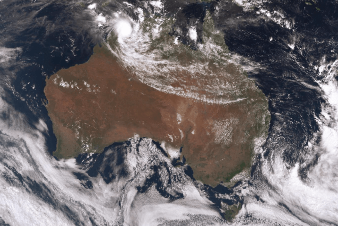
Cyclone Blanche can be seen in this satellite image. It is the swirl on the north-west tip of the continent. Photo: BoM
Tropical Cyclone Blanche is intensifying as it moves south-west towards Western Australia and is expected to cross the coast this afternoon, with conditions in the Top End easing in its wake.
The cyclone has strengthened to become a category-two storm as it heads for the north Kimberley coast.
Cyclone Blanche was located 165 kilometres north of Wyndham in the Kimberley at 8:00am, and was moving south-west at 17 kilometres per hour.
A yellow cyclone alert has now been issued by WA’s Department of Fire and Emergency Services (DFES) for the Mitchell Plateau to the Northern Territory border in the Kimberley, including people in or near Mitchell Plateau, Kalumburu, Wyndham and Kununurra.
“There is a possible threat to lives and homes as a cyclone is approaching the area,” DFES said.
“You need to take action and get ready to shelter from a cyclone.”
A separate blue alert remains in place for Kununurra to the Northern Territory in the Kimberley, including people in Kununurra and surrounding areas.
The Bureau of Meteorology (BOM) said Cyclone Blanche was expected to cross the coast between Wyndham and Kalumburu on Monday afternoon.
“It’s unlikely to be a direct hit for Wyndham, although it could still take a more southerly track and head that way,” BOM WA duty forecaster Rabi Rivett said.
Wind gusts of up to 150kph are expected when the cyclone makes landfall.
The BOM said gales with gusts of up to 120kph were developing on the coast between the NT/WA Border and Kalumburu.
“This is quite a small system, relatively speaking,” Mr Rivett said.
“So those stronger winds will only be really experienced right near the centre of the system.”
A flood watch is in place for WA’s Ord and Fitzroy rivers, with isolated rainfall of up to 200 millimetres forecast.
Kununurra Airport has recorded 45.8 millimetres of rain since 7:30pm on Sunday night, while Wyndham has received 35.4mm in the same period.
Threat eases for Top End
The threat eased overnight for many parts of the Northern Territory, but authorities warned some communities not to become complacent.
A cyclone warning remains are still in place for Mitchell Plateau to Wadeye, excluding Wadeye, with residents being urged to take shelter and prepare for severe weather.
“Those communities are being asked to actively review their cyclone plans,” NT emergency services commander Brent Warren said.
“[They need to] make sure they’ve got their cyclone kit in place, considering where they might shelter if they need to and being alert but not alarmed in relation to weather and listening to updates from their local emergency controller at what’s required.”
Residents from Wadeye to Daly River Mouth have been told it is safe for them to move outside but to drive safely and beware of debris and fallen power lines.
Darwin’s public transport was due to return to normal today — after being suspended in the wake of Blanche — and schools were also open.
Cyclone warnings for the Darwin region and the Tiwi Islands were cancelled on Sunday.