Amazing 3D images have revealed the wreck of the Titanic like never before and may even help “rewrite” the sunken ship’s history.
The first full-size digital scan showing the wreck “bolt by bolt” was created in “the largest underwater 3D capture project ever undertaken”.
The virtual replica, revealed on Thursday, shows stunning detail of the Titanic as it lies on the Atlantic sea floor, 111 years after hitting an iceberg.
The images could help end decades of speculation and alter storylines about the famous unsinkable ship.
They could answer such questions as which side of the ship hit the iceberg, and the character of the collision.
Previously, studying the Titanic was difficult in the dark, murky depths 3800 metres down. Earlier pictures have been taken only in sections — not in the ship’s entirety.
Now scientists can see sharp detail of such features as the serial number on a propellor, the boiler room, grand staircase and state rooms.
The pictures show at least one scene from James Cameron’s Titanic movie may need a rewrite — when Officer Murdoch was portrayed denying access to the last lifeboat.
In fact, the scans show the lifeboat was jammed and could not have been launched anyway.
The project to map out the entire wreck was a joint undertaking of Magellan Deep Water Specialists and Atlantic Productions.
The wreck was scanned from all angles, with 700,000 images creating the “digital twin”.
Tweet from @BBCMorelle
The pictures were “allowing science to completely rewrite everything we know about the tragedy” Atlantic Productions said in a statement.
“Through the largest underwater 3D capture project ever undertaken, research scientists have mapped the Titanic in its entirety.
“From this data a ‘digital twin’ has been created that shows the wreck to a level of detail and clarity never seen before.
“Using technology developed and perfected over five years by deep water specialist Magellan Ltd, the exact condition of wreck is revealed and the entire historic site is mapped providing a level of detail never before seen.”
Scans of the wreck were carried out during a six-week expedition in the northern hemisphere summer of 2022.
“A specialist ship was positioned in the North Atlantic 700 kilometres off the coast of Canada.
“The expedition deployed two submersibles – named Romeo and Juliet – which spent many hours at 3800 metres below the surface mapping every millimetre of the wreck in minute detail and mapping the entire three-mile (4.8-kilometre) debris field.
“In accordance with tight regulations in place, the wreck was not touched or disturbed, and the entire site treated with the utmost of respect, which included a flower laying ceremony in memory of those who lost their lives.”
Titanic set sail on its maiden voyage from Southampton on April 10, 1912, with 2240 passengers and crew.
It broke apart and sank after hitting an iceberg on April 15, 1912, taking more than 1500 lives.


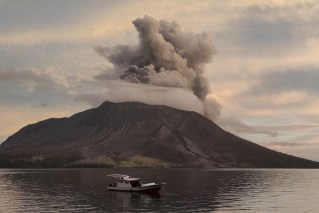
Thousands flee Indonesian volcano


Top videos: Popeye aboard pumpkin, otter in a spin