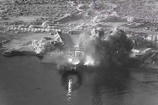
Cyclone Kimi: Category two system barrels south, shifts direction ahead of landfall
The weather bureau expected Cyclone Kimi to make landfall between Port Douglas and Innisfail. Photo: ABC
Cyclone Kimi has churned into a category two system and shifted course again as North Queensland residents batten down the hatches head of its landfall within hours.
The Bureau of Meteorology says Cyclone Kimi was barrelling south, shifting direction for a second time about 195km north of Townsville at 1pm AEST on Monday.
Kimi is set to slow and stall between Hinchinbrook Island and Townsville and potentially weaken before crossing the coast on Tuesday.
However, forecasters warn it could still make landfall as a category two storm, packing winds up to 150km/h, on Monday night or on Tuesday.
“Considerable uncertainty remains with the future movement of the system, and a category two coastal crossing between Hinchinbrook Island and Townsville tonight or on Tuesday remains possible,” the bureau said in an alert.
Tweet from @BOM_Qld
Residents from Innisfail to Bowen, including Townsville, are being told to prepare for gales up to 120km/h, heavy rains and abnormally high tides.
Premier Annastacia Palaszczuk is urging people to listen carefully to media reports and updates on where the cyclone moves.
“Everybody in the north … should be listening to the media reports very, very closely because the bureau will be giving those reports every three hours, and we’ll be giving a further update from the state government this afternoon,” she told reporters on Monday.

Queensland Premier Annastacia Palaszczuk and Police Commissioner Katarina Carroll at a briefing on Tropical Cyclone Kimi. Photo: Twitter
People between Innisfail and Ayr are being urged to get ready and secure their boats and homes in particular.
“I know we’re Queenslanders, I know we go through cyclones every single year but please do not be complacent,” Police Minister Mark Ryan said.
The bureau also warns that heavy rainfall could bring flash flooding and major river flooding to coastal and hinterland areas between Port Douglas and Ayr on Monday and Tuesday.
Mr Ryan said a flood watch was issued for waterways including the Jeannie, Endeavour, Daintree, Mossman, Barron, Mulgrave, Russell, Johnstone, Tully, Murray and Herbert rivers.
“So if you’re in those areas you need to prepare … if it’s flooded forget it, have a plan about where you’ll be travelling, bear in mind where those river catchments are, be aware that during this event you could have flash flooding,” he said.
Tweet from @7NewsCairns
Parts of the Wooroonooran, Girramay and Paluma Range national parks, and the Abergowrie State Forest, have been closed.
With the cyclone set to dump rain on large parts of Queensland’s interior, flood warnings have also been issued for a number of inland rivers.
The Norman and Gilbert rivers in the Gulf Country and most of the Queensland tributaries of Lake Eyre could break their banks.
Worried residents evacuated, islanders caught by surprise
Fitzroy Island CEO Glen Macdonald said everything had been removed from the island that could be considered a projectile as more than 200 were evacuated as a precaution.
“Only core staff remain so we can get back to business when it is safe to do so,” Mr Macdonald told the ABC.
He said the cyclone caught many people by surprise.
“It was difficult because the first cyclone advice from the BOM wasn’t until 12.20pm and then there was another one at 2pm, at which time we decided to remove guests.”
On Sunday night, the regional harbour master issued a red cyclone alert for vessel operators at ports in Cairns, Port Douglas, Innisfail, Half Moon Bay Marina and Cooktown, meaning the ports are now only open for emergency movements.
Locals and tourists banding together
Douglas Shire Council Mayor Michael Kerr told the ABC residents and tourists were more than prepared.
“Locals who live here know what they need to do … we’ve gone through it many times before,” he said
“Even with the people that are staying in hotels, all of these buildings are designed to cope with up to category three.”
Meanwhile, Ingham Mayor Raymon Jayo said he expected heavy rainfall to result in rapid river rises and reminded residents to be prepared.
“Rivers at present have receded from last week from the effects of ex-tropical Cyclone Imogen,” Mr Jayo told the ABC.
“But the country is that saturated and that sodden everywhere in both our upper and lower catchments that it’s not going to take a great deal of rain to get those river levels straight back up.”
-with AAP
Want to see more stories from The New Daily in your Google search results?
- Click here to set The New Daily as a preferred source.
- Tick the box next to "The New Daily". That's it.


Taxpayers may stump up for historic brewery