Eastern states brace for more wild weather before Christmas
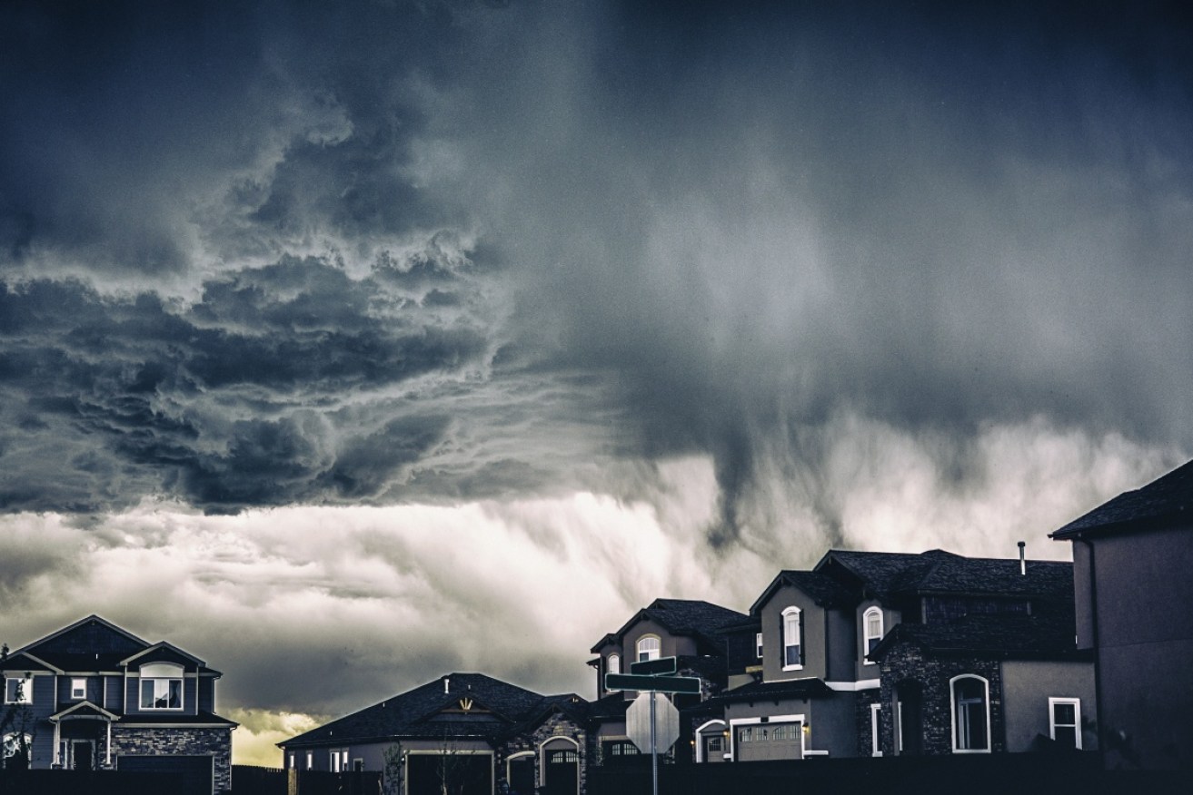
An ominous storm is set to develop in the northern and central parts of NSW. Photo: Getty
More heavy rain and flooding is forecast for parts of northern NSW and Victoria as the east coast continues to be battered by extreme weather.
Up to 80 millimetres of rain is forecast to hit Victoria’s west and south on Tuesday, with the weather bureau warning parts of the state could receive a month’s rain in a matter of hours.
Widespread heavy rain is expected in the next 24 hours, with localised falls of 50-70 millimetres possible in Victoria’s south-west on Monday night, and over the ranges in central parts of the state on Tuesday.
Rain is already falling over the state’s west as a trough deepens before moving east on Monday night.
“We’re expecting a broad area of rain of 20 to 40 millimetres with isolated totals in some locations potentially reaching their December monthly average,” senior meteorologist Claire Yeo said on Monday.
Tweet from @BOM_Vic
Tweet from @Ben_Domensino
For the Melbourne area, the heaviest rainfall is expected from Tuesday morning while isolated thunderstorms are possible late on Monday. Other locations affected include Horsham, Warrnambool, Maryborough, Ballarat, Geelong and Melbourne.
In NSW, there is a severe weather warning throughout Monday for heavy rainfall in the north-west slopes and plains, and parts of the mid-north coast, Hunter, central tablelands, central-west slopes and plains, upper western and northern tablelands districts.
By Monday afternoon, the eastbound lanes of the central coast highway were closed in West Gosford due to flooding, causing significant delays for traffic.
State Emergency Service Assistant Commissioner Sean Kearns said communities in the Hunter area and Tamworth, Narrabri, Coonamble and Coonabarabran, in particular, should be prepared.
“As heavy rain is very likely, flash and riverine flooding is a risk we need our communities to be aware of,” he said.
Tweet from @WingedCharm
Residents in the area are still mopping up after downpours of more than 400 millimetres last week – this summer’s first major sign of La Niña, a complex weather pattern linked to the Pacific Ocean
“La Niña events are associated with more tropical cyclones and tropical low-pressure systems that don’t quite form cyclones, but still bring a lot of damage,” Dr Linden Ashcroft, a climate researcher at the University of Melbourne, told The New Daily last week.
“We are experiencing a La Niña event at the moment, and it does generally lead to increased rainfall along our east coast.”
Weatherzone’s Ben Domensino said a “mass of tropical air will cause heavy rain and potentially severe thunderstorms over parts of southeastern Australia on Monday and Tuesday”.
“A tongue of moisture-laden air from the tropics has drifted south and is now interacting with a much colder pool of air that’s travelled up from the Southern Ocean.
“As these two contrasting air masses clash, it will create a dynamic mix of weather over Australia’s south-eastern states during the next couple of days.
He said Monday’s rain will spread from central Australia across NSW and parts of Victoria, South Australia and Tasmania. Some will continue into Tuesday before the system moves out to the Tasman Sea on Wednesday.
Tweet from @BOM_Vic
NSW braces for more floods, severe weather
More heavy rain and flooding is forecast for parts of northern NSW, as residents continue to mop up from recent downpours.
On Sunday, the Bureau of Meteorology issued a warning for the Gwydir, Peel, Namoi, Hunter, Paterson and Williams river catchments.
A slow-moving low pressure trough is set to deepen later on Monday, bringing heavy rain that is expected to linger over north-east NSW.
The drenching is forecast to begin near Walgett, Coonamble, Coonabarabran and Narrabri before moving southeast towards Tamworth, Armidale and the parts of the Hunter region.
Riverine and flash flooding is likely, the BOM said, but conditions should ease on Tuesday morning.
“Having had so much rain just recently, catchments are very wet and the situation is being monitored around the clock,” meteorologist Helen Reid said.
Tweet from @NSWSES
Thunderstorms are also likely to increase rainfall totals in the afternoon.
“We’re expecting them to have heavy rainfall associated with them, not so much damaging winds and large hail this time, it’s just a very moist environment with lots of moisture ready to come down all at once,” she said.
The NSW coast is forecast to have a couple showers on Christmas Day, while areas west of the ranges will remain cool and dry.
“We’re not expecting anything much in the gauges, but it’s not going to be a fine sunny day east of the ranges.”
The Kimberley and northern interior regions of WA are also receiving heavy rain and damaging winds.
“This moisture is actually providing a conveyor belt of moisture that in combination with an upper trough is generating the heavy rainfall that we’re seeing,” Ms Yeo said.
The storms could cause significant damage to homes and property, the BOM warned on Sunday.
Massive rainfall totals have already been recorded, with Lombadina on the Dampier Peninsula receiving 244 millimetres in a day – almost half of it in just one hour.
Locations that may be affected include Broome, Derby, Halls Creek, Kununurra, Wyndham, Kalumburu, Kuri Bay, Lake Argyle, Mitchell Plateau, Mount Barnett, Troughton Island, Warmun, Cockatoo Island and Fitzroy Crossing.
The same system will bring heavy rainfall to the Northern Territory, with flash flooding possible in the Gregory and Tanami Districts.
-with AAP