BOM declares a La Nina, signalling wet spring and summer likely for northern, eastern Australia
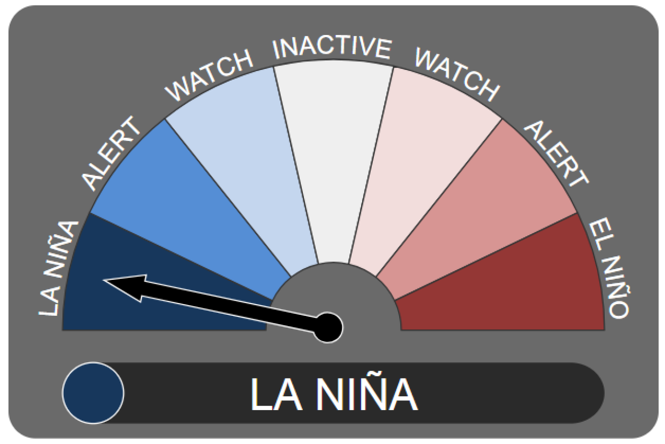
Conditions are now officially at La Nina levels. Photo: BOM
The Bureau of Meteorology has declared a La Nina pattern is officially under way, signalling we could be in for a wet spring and summer.
La Nina is a phase of the El Nino Southern Oscillation (ENSO), which describes ocean and atmospheric circulations over the Pacific Ocean.
During a La Nina phase, Australia’s northern waters are warm with increased convection.
This allows more moisture to be lifted into the air than normal, typically resulting in increased rain for eastern and northern Australia – but, historically, the south-east misses out.
That moisture can lead to cooler daytime temperatures, the BOM’s head of climate operations Andrew Watkins said.
“We tend to have more cloud and a bit more moisture around to evaporate to keep the air a bit cooler,” he said.
“Conversely at night, when you’ve got the cloud acting like a lid trapping in that heat, it can be a bit warmer.”
But every La Nina is different.

When there is a La Nina, the Walker circulation intensifies, bringing warm oceans and wet conditions to eastern Australia. Photo: BOM
Will we get a repeat of 2011?
The last major La Nina events were in the summers of 2010-11 and 2011-12. They resulted in 2010 to 2012 being Australia’s wettest two-year period on record.
Flooding was widespread and devastating.
In early 2011, large parts of south-east Queensland were under water; the Lockyer Valley was hit by a cascade of water coming off the Toowoomba range and Brisbane saw its worst flooding since 1974.
But Dr Watkins said this year’s event was looking weaker than 2010-11 based on the current forecast.
“Also the fact that by this time in 2010, we were already well into a La Nina event and had been pretty much since mid-July.”
So 2010-11 was well ahead of where we are now. In fact, it was one of the four strongest La Nina ever observed, according to Dr Watkins.

Many roads in low-lying Brisbane suburbs like Rocklea were cut off by flooding in 2011.
Criteria for La Nina declaration
- Sea surface temperatures in regions of the eastern Pacific are 0.8 degrees cooler than average
- Trade winds have been stronger than average in the western or central Pacific during any three of the past four months
- Southern Oscillation Index, a measure of the difference in pressure between Tahiti and Darwin, is +7 or higher
- Majority of climate models show sustained cooling of at least 0.8 degrees below average in the eastern Pacific until the end of the year.
What does this mean for cyclone season?
The warm waters and increased convection also lead to La Nina being associated with increased numbers of cyclones.
In a normal year we see between nine and 11 tropical cyclones in Australian waters.
But Dr Watkins believes we could be in the upper end or even above that range this year.
“That also increases the risk of tropical cyclones crossing the coast, so lots of impacts of La Nina, particularly as we get into summer.”
Will farmers be able to get crops out?
After the past few years of drought on the east coast, recent months of good rains for the south-east have been welcome.
The forecast of more rain will be welcome for those who have so far missed out in 2020.
But during late spring and summer, farmers generally need dry conditions to get a crop out – too much rain in late spring and early summer can be a disaster.

During previous La Nina years, northern and eastern Australia have experienced wetter-than-normal conditions. Photo: BOM
Dr Watkins said the odds were easing on a wet harvest, but it was still on the above-average-rainfall side of things.
“Hopefully nice finishing rains but that it won’t be too wet for the actual harvest,” he said.
Fire outlook better than recent years
Meanwhile, the fire risk is at least looking better than this time last year.
“Last year we went into the spring and summer period with a really strong positive Indian Ocean Dipole event; that was keeping things very dry, particularly in eastern Australia and it also had been very hot.”
Dr Watkins said he hoped the La Nina would mean there was more rain before summer that would help to keep the bushfire risk lower than the past couple of years.
“But we can never forget southern Australia will always get dry and hot over summer,” he said.
“There always will be some bushfires, but hopefully this year we have the conditions in place that we won’t see those widespread, long-campaign fires that we did see unfortunately last year.”